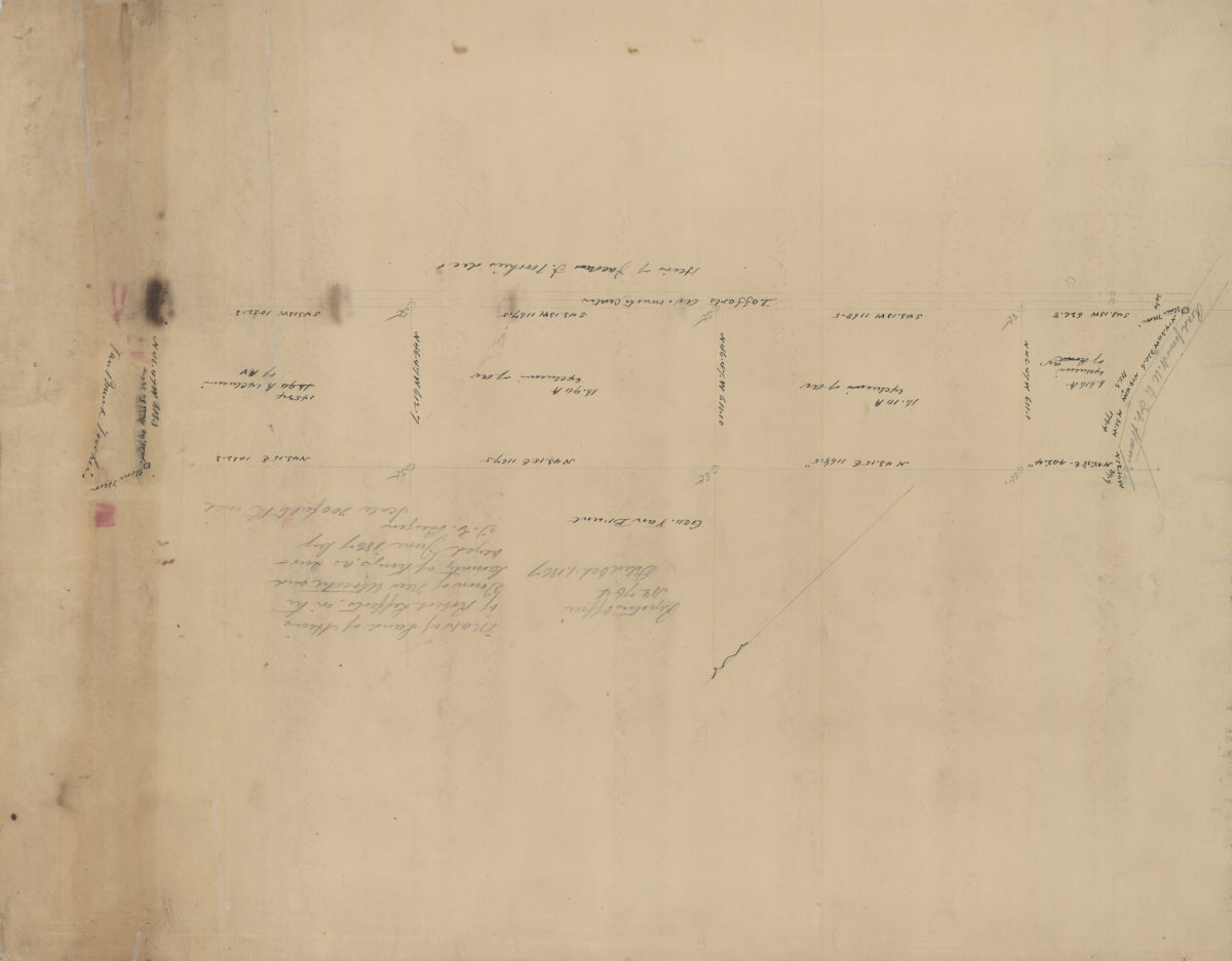
Map of land of heirs of Robert Lefferts, in the town of New Utrecht and county of Kings: as suveyed June 1867 by T.G. Bergen June 1867
Map No. Bergen-1867b.Fl
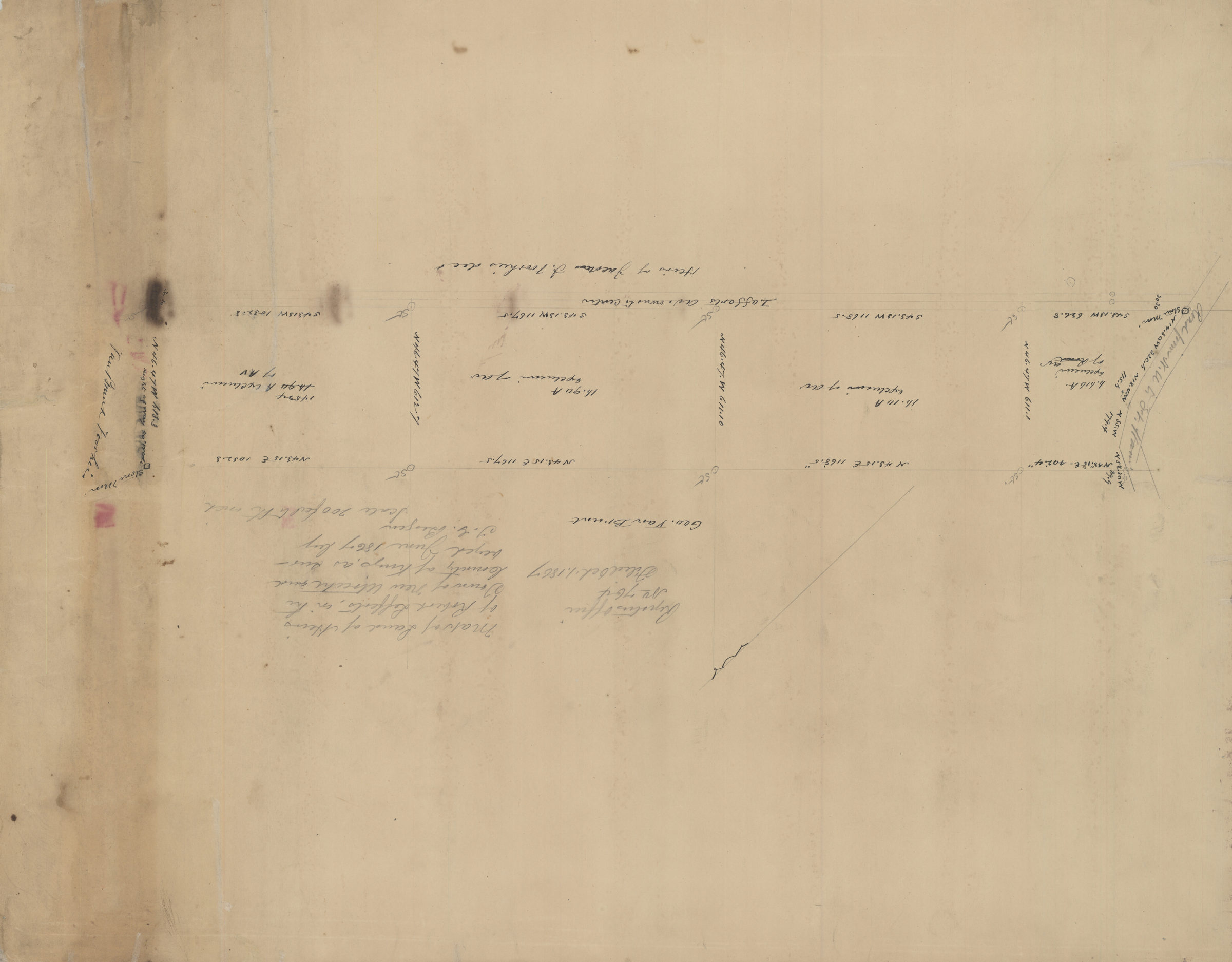
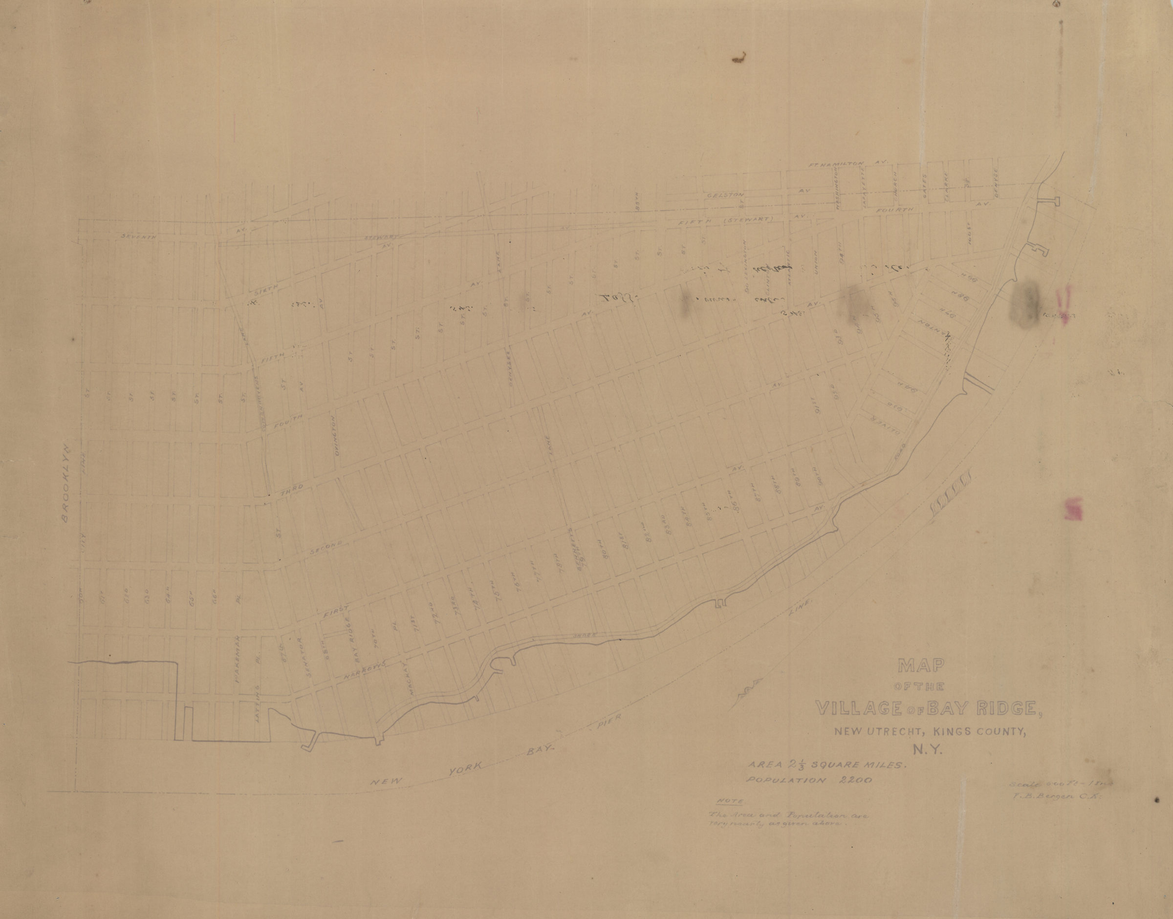
Cadastral map covering Lefferts Avenue. Shows property (including acreages), and names of landowners. Cataloger unable to determine map’s modern-day Brooklyn neighborhood. No cross street names or landmarks on map. Oriented with north to the upper right. Area covered identical to: Map of land of heirs of Robert B. Lefferts in the town of New Utrecht and county of Kings, as surveyed / by T.G. Bergen, also in the Brooklyn Historical Society collection (Bergen-1867.Fl). On verso: Map of the village of Bay Ridge, New Utrecht, Kings County, N.Y. / V.B. Bergen, C.E. (1 map : ms., pencil). Shows streets, blocks, and shoreline.
Map area shown
Relation
Full catalog recordSize
49 × 62 cmDownload
Low Resolution Image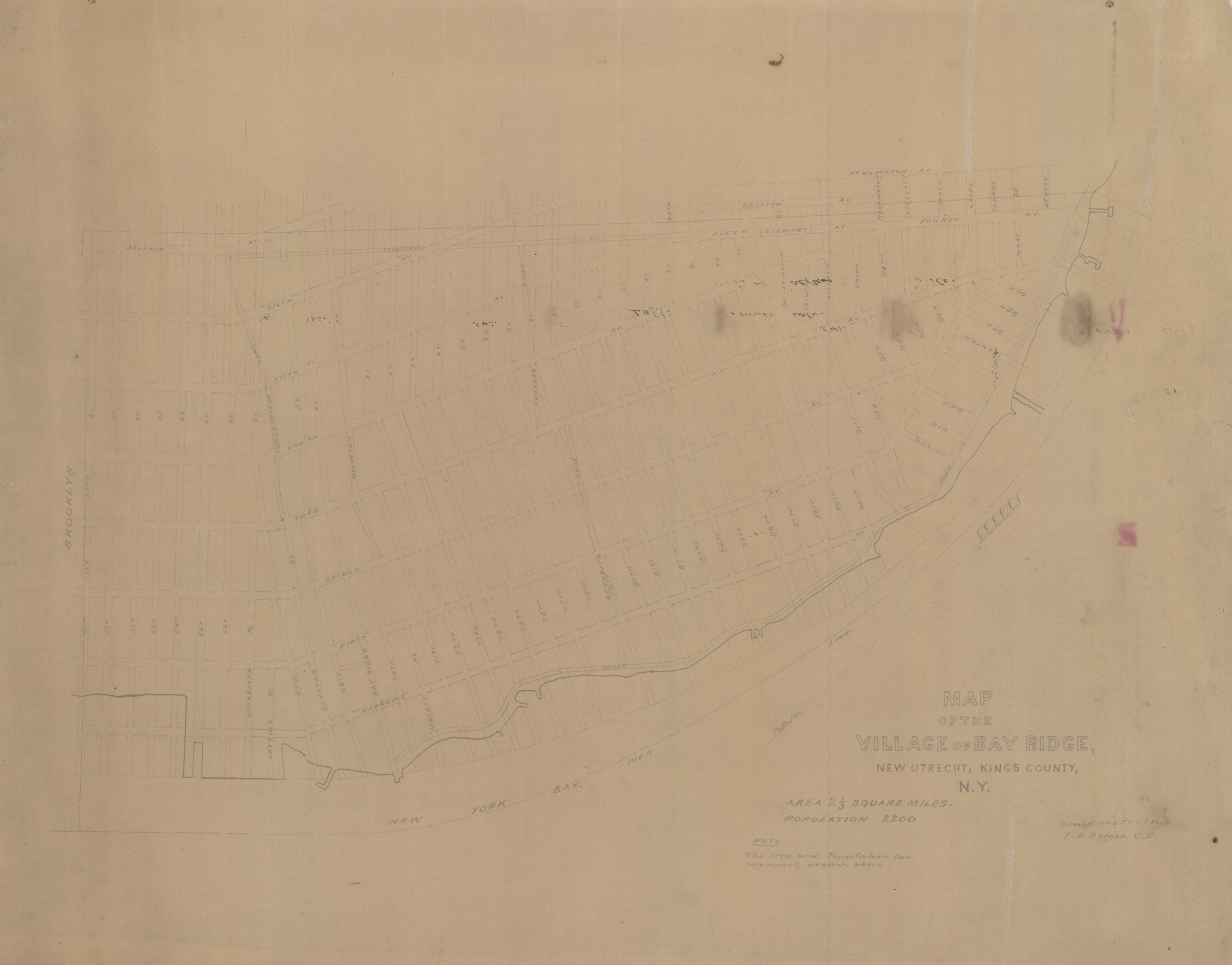
Creator
Bergen, Teunis G.,Publisher
Brooklyn Historical SocietyCitation
Map of land of heirs of Robert Lefferts, in the town of New Utrecht and county of Kings: as suveyed June 1867 by T.G. Bergen; June 1867, Map Collection, Bergen-1867b.Fl; Brooklyn Historical Society.Scale
Scale [1:2400] 1 in to 20Loading zoom image...