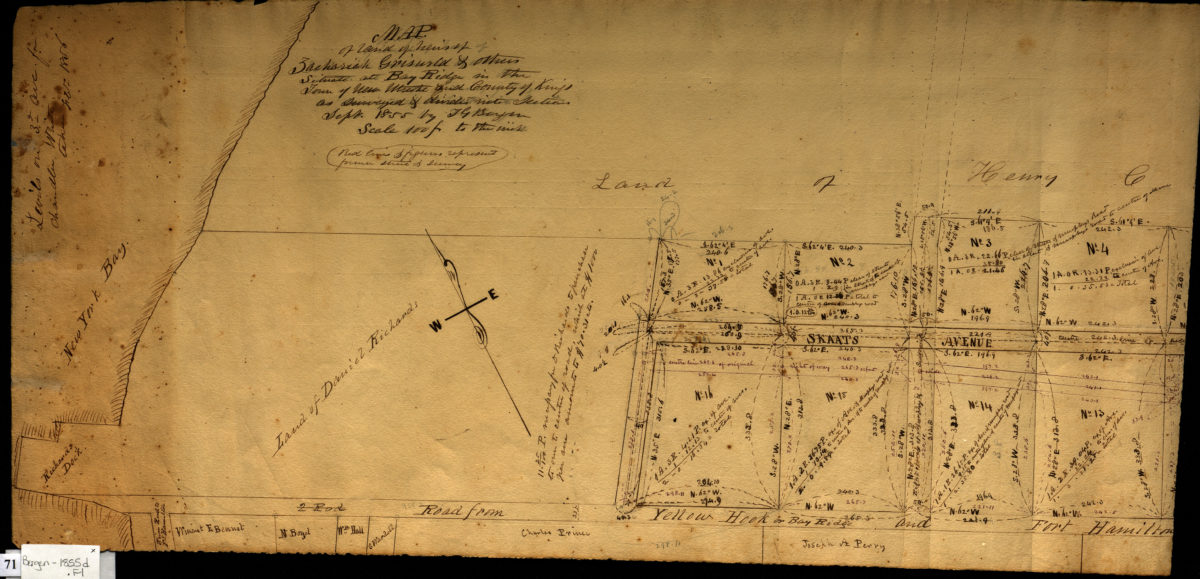
Map of land of heirs of Zachariah Griswold and others, situate[d] at Bay Ridge in the town of New Utrecht and county of Kings, as surveyed & divided into sections, Sept. 1855: by Teunis G. Bergen 1856
Map No. Bergen-1855d.Fl
Cadastral survey map covering area east from New York Bay along the road from Yellow Hook or Bay Ridge and Fort Hamilton [to Brooklyn?] north past Skaats Avenue in modern-day Bay Ridge. Shows property (including lot numbers and dimensions) and names of landowners. Includes notes and calculations. On verso: diagram and calculations for a strip of land to be excavated from the Bullocke property. Oriented with north to the upper left. Incomplete: Cut is evident along the right border, and map covers the western half of the estate depicted in Map of land of heirs of Zachariah Griswold and others, situate[d] at Bay Ridge … Dec. 1855 (Bergen-1855b.Fl), also in the BHS collection.
Map area shown
Relation
Full catalog recordSize
27 × 58 cmDownload
Low Resolution Image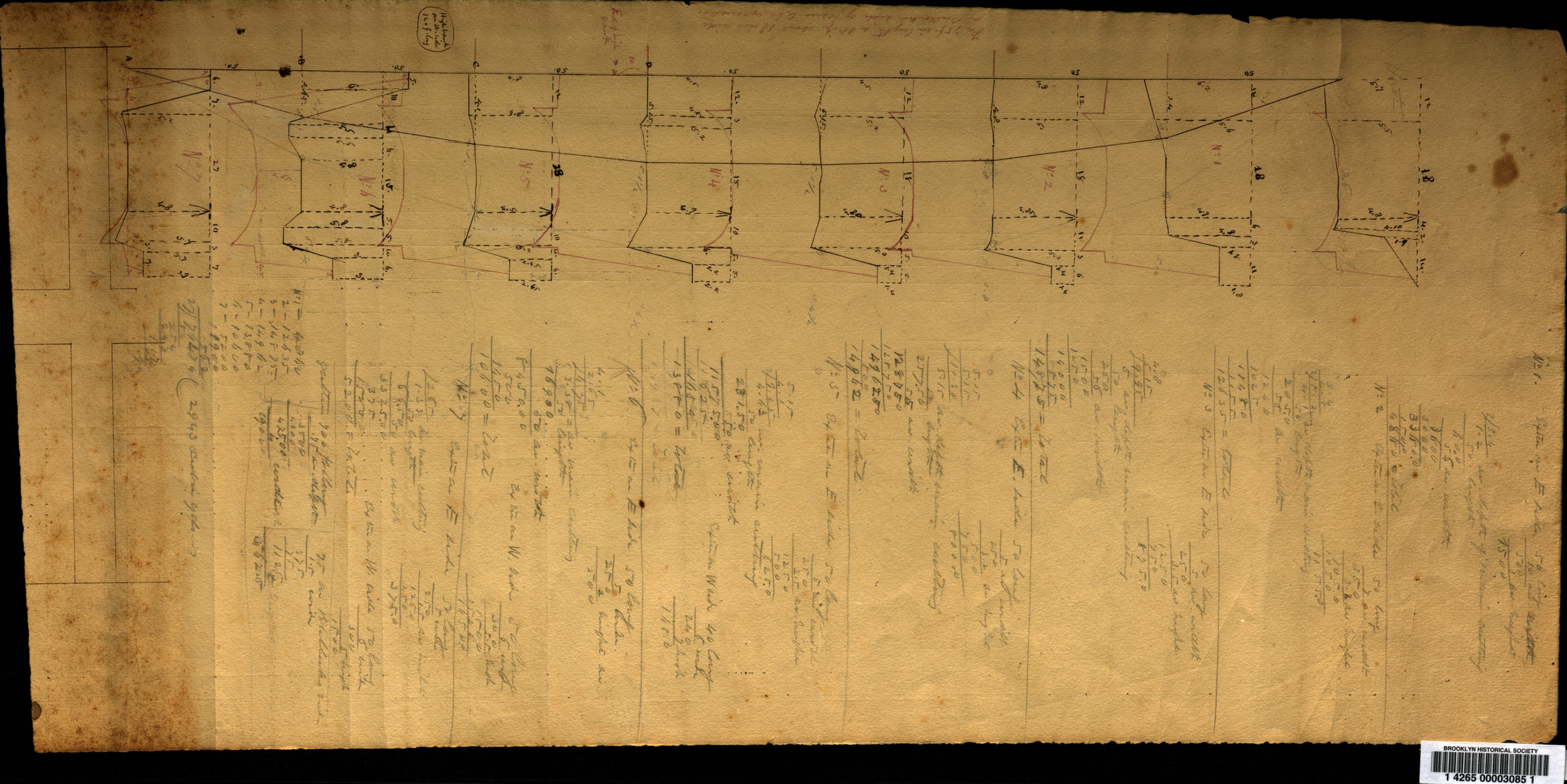
Creator
Bergen, Teunis G.,Publisher
Brooklyn Historical SocietyCitation
Map of land of heirs of Zachariah Griswold and others, situate[d] at Bay Ridge in the town of New Utrecht and county of Kings, as surveyed & divided into sections, Sept. 1855: by Teunis G. Bergen; 1856, Map Collection, Bergen-1855d.Fl; Brooklyn Historical Society.Scale
Scale [1:1,200] 1 in to 1Loading zoom image...