Map of land of J.A. Monsill: as surveyed by T.G. Bergen [1868]
Map No. Bergen-[1868?].Fl
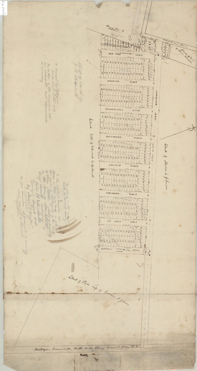
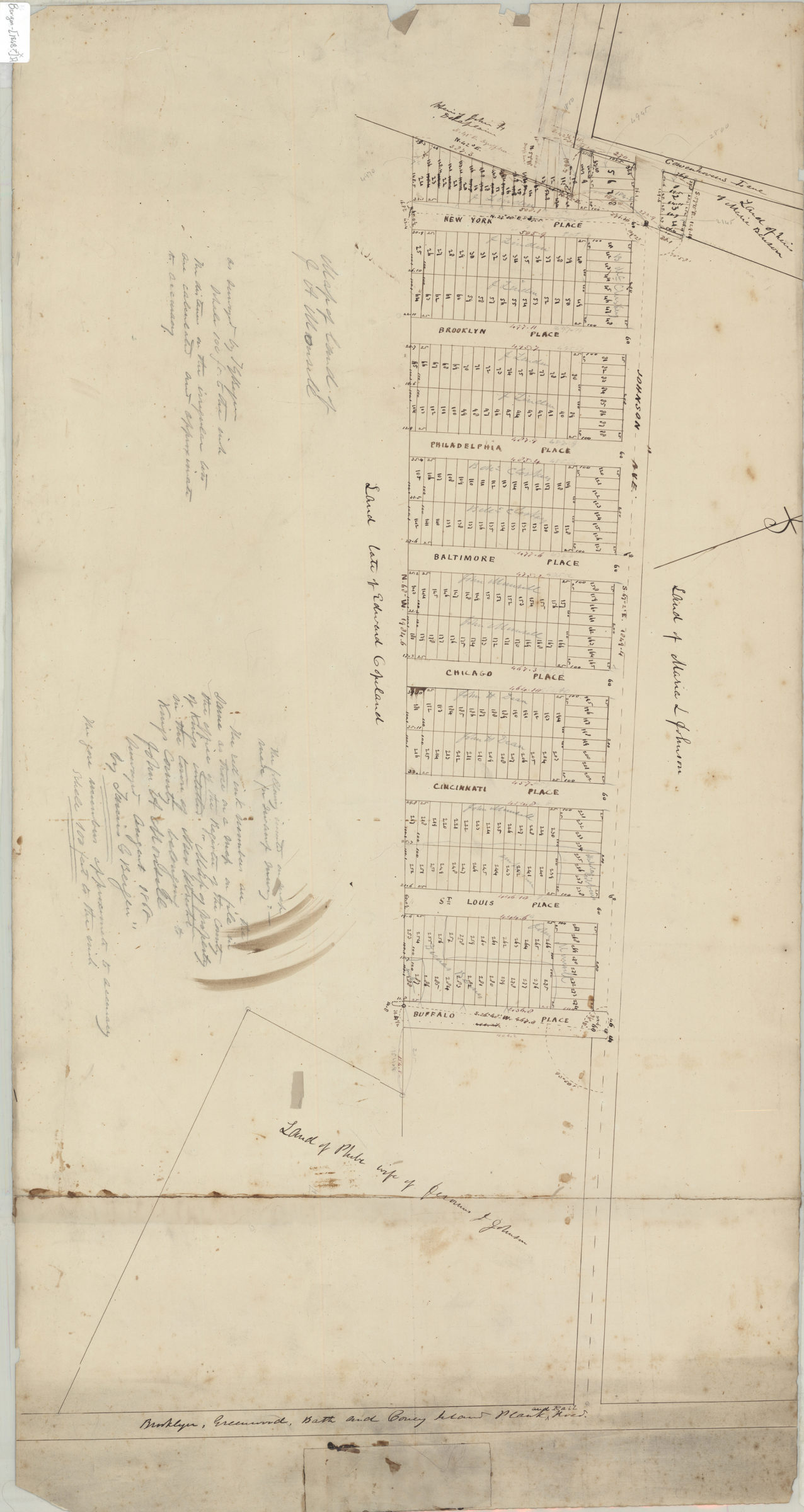
Cadastral map covering Johnson Ave. between Cowenhowven’s Ln. and the Brooklyn and Coney Island Plank Rd. Shows property (inclduing lot numbers and dimensions), and names of landowners. Oriented with north to the upper left. “The red ink numbers are the same as those on a map on file in the office of the Register of the County of Kings entitled Map of property in the town of New Utrecht Kings County belonging to John A. Monsill, surveyed August 1868 by Teunis G. Bergen.” Cataloger unable to determine map’s modern-day Brooklyn neighborhood. Includes annotations on verso unrelated to main map.
Map area shown
Relation
Full catalog recordSize
46 × 88 cmDownload
Low Resolution Image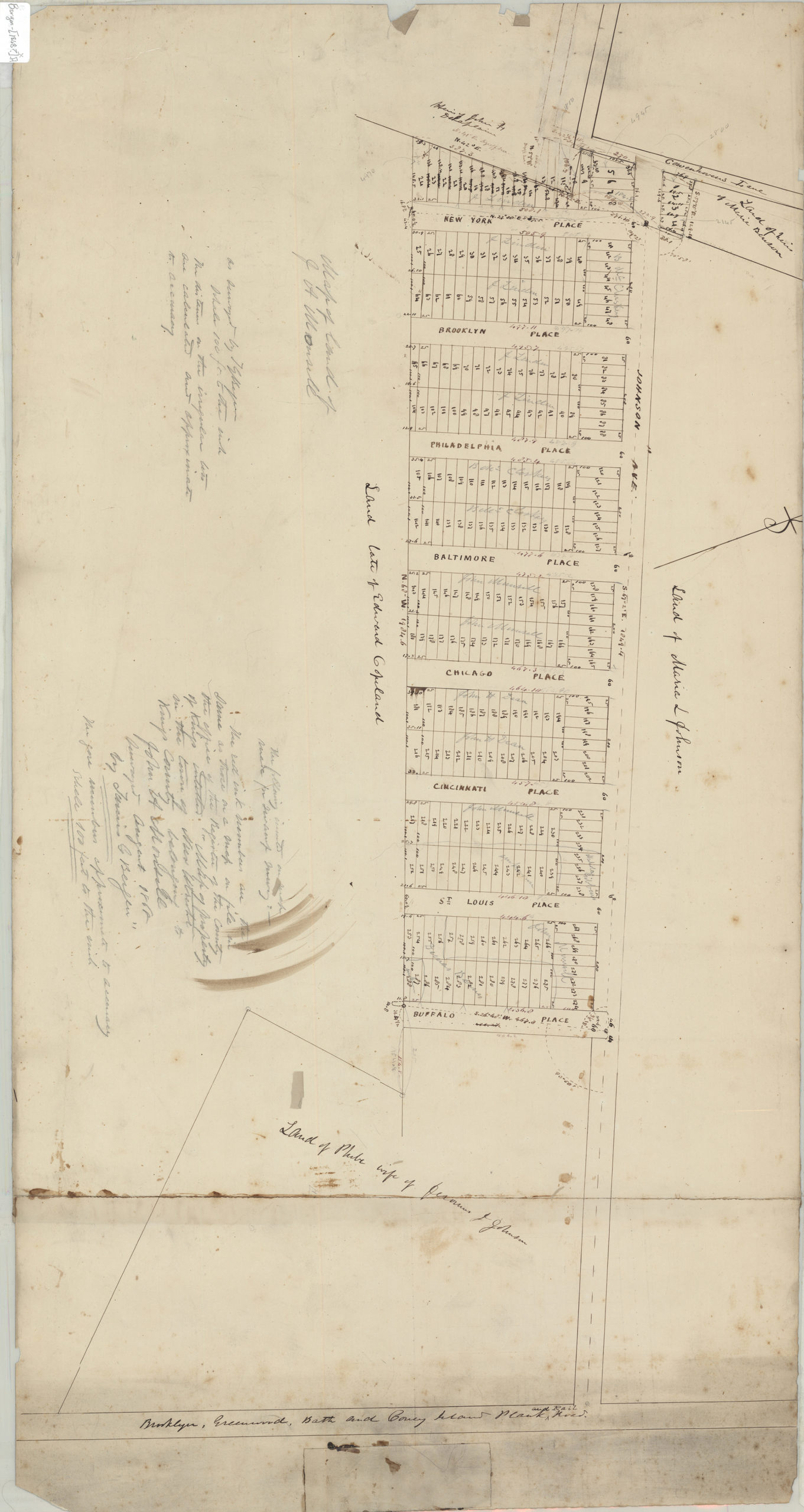
Creator
Bergen, Teunis G.,Publisher
Brooklyn Historical SocietyCitation
Map of land of J.A. Monsill: as surveyed by T.G. Bergen; [1868], Map Collection, Bergen-[1868?].Fl; Brooklyn Historical Society.Scale
Scale [1:1,200] 1 in to 1Loading zoom image...