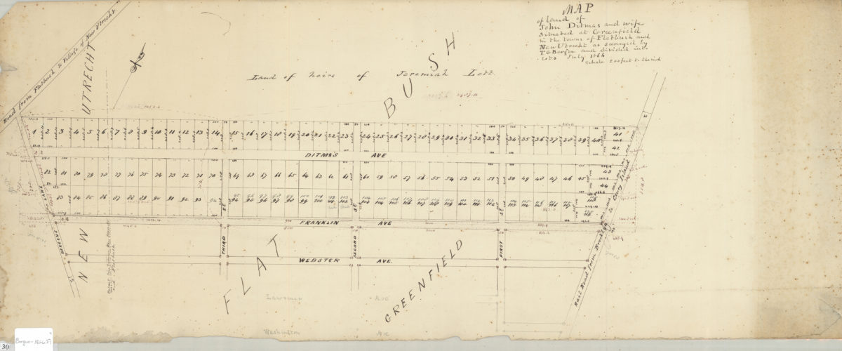
Map of land of John Ditmas and wife, situated at Greenfield in the town of Flatbush and New Utrecht, as surveyed: by T.G. Bergen and divided into lots July 1866
Map No. Bergen-1866.Fl
Cadastral map covering area bounded by Ditmas Ave., Bergens Ln., Webster Ave., and the Railroad from Brooklyn to Coney Island (modern-day Kensington and Parkville). Shows property (including lot numbers and dimensions), and names of landowners. Oriented with north to the upper right.
Subjects
Places
Map area shown
Relation
Full catalog recordSize
31 × 78 cmDownload
Low Resolution Image
Creator
Bergen, Teunis G.,Publisher
Brooklyn Historical SocietyCitation
Map of land of John Ditmas and wife, situated at Greenfield in the town of Flatbush and New Utrecht, as surveyed: by T.G. Bergen and divided into lots; July 1866, Map Collection, Bergen-1866.Fl; Brooklyn Historical Society.Scale
Scale [1:2,400] 1 in to 2Loading zoom image...