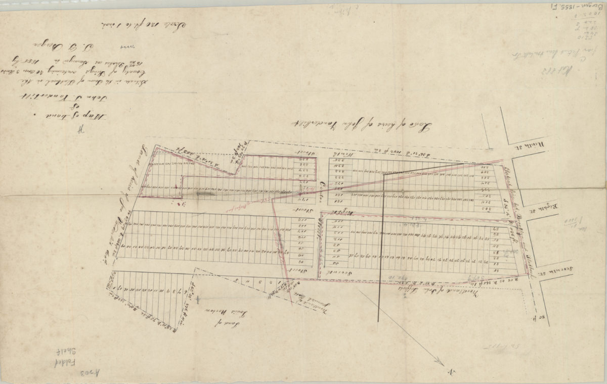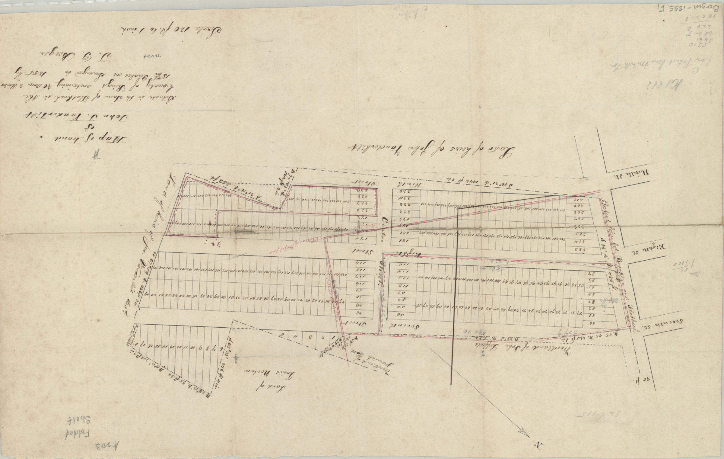
Map of land of John J. Vanderbilt: situate[d] in the town of Flatbush in the county of Kings, containing 40 acres, 3 roods [i.e. rods?], 18 44/100 perches, as surveyed …: by T.G. Bergen 1855
Map No. Bergen-1855.Fl
Cadastral map covering Centre St. at 7th St., 8th St., and 9th St. Shows property (including lot numbers and dimensions), and names of landowners. Oriented with north to the upper left. Cataloger unable to determine map’s modern-day Brooklyn neighborhood.
Map area shown
Relation
Full catalog recordSize
34 × 54 cmDownload
Low Resolution Image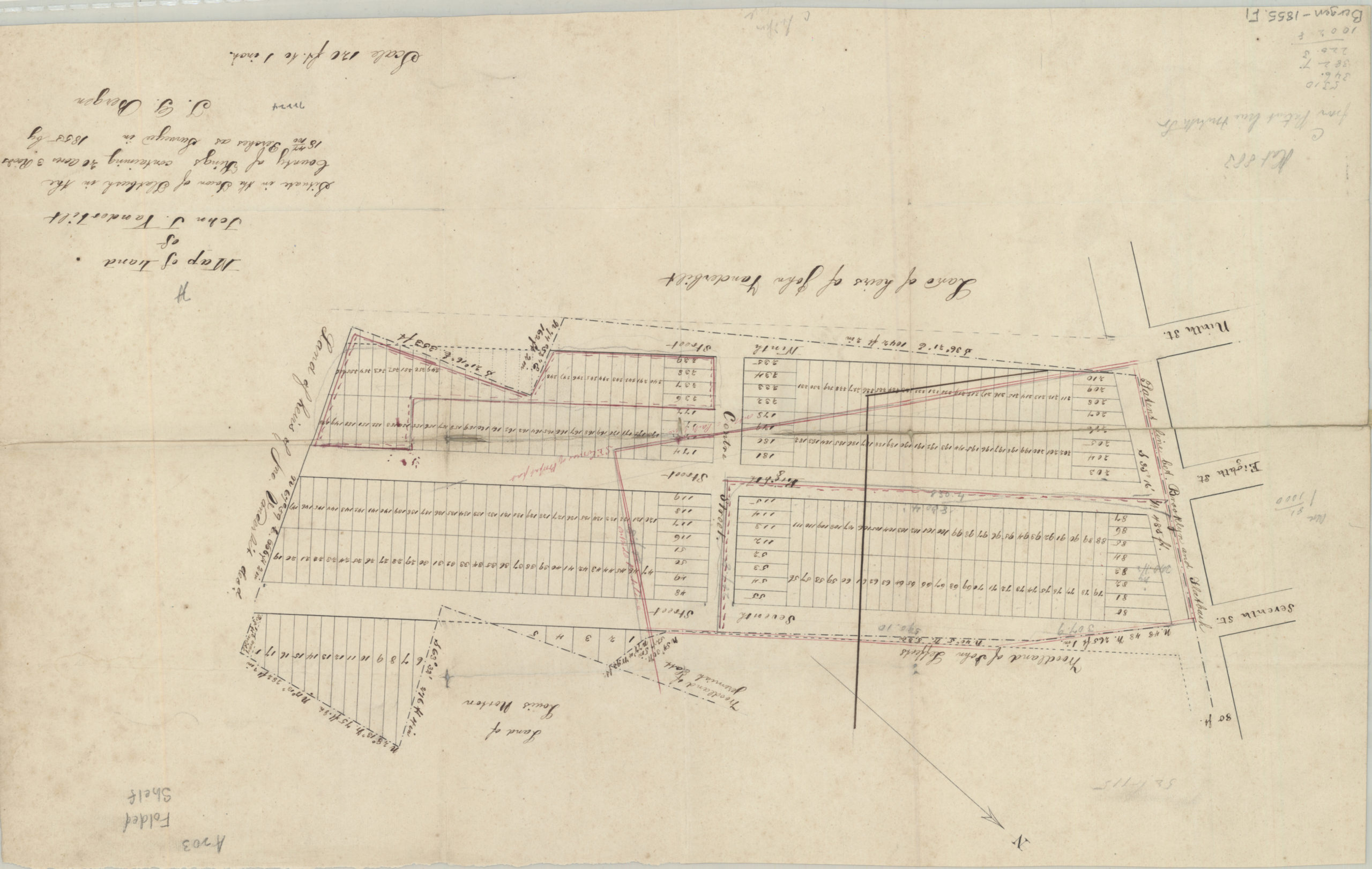
Creator
Bergen, Teunis G.,Publisher
Brooklyn Historical SocietyCitation
Map of land of John J. Vanderbilt: situate[d] in the town of Flatbush in the county of Kings, containing 40 acres, 3 roods [i.e. rods?], 18 44/100 perches, as surveyed …: by T.G. Bergen; 1855, Map Collection, Bergen-1855.Fl; Brooklyn Historical Society.Scale
Scale [1:1,680] 1 in to 1Loading zoom image...