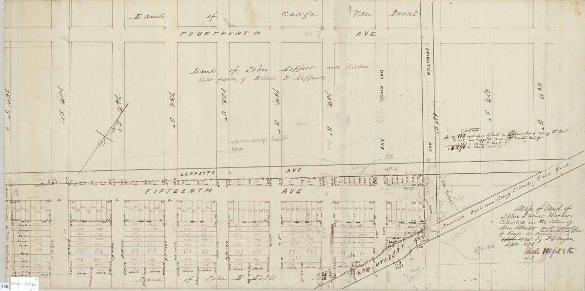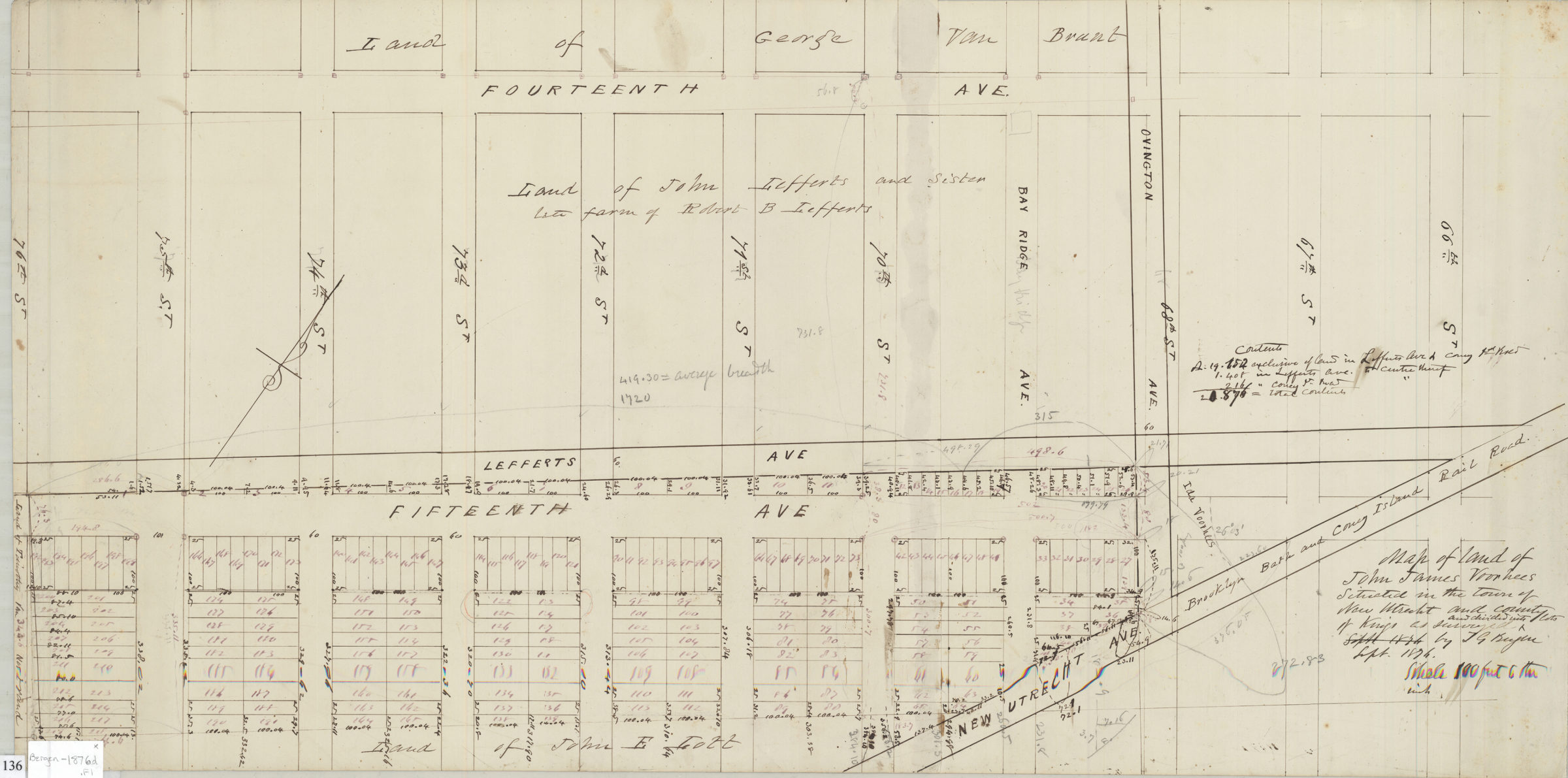
Map of land of John James Voorhees situated in the town of New Utrecht and County of Kings: as surveyed and divided into lots by T.G. Bergen Sept 1876
Map No. Bergen-1876d.Fl
Cadastral map covering area bounded by 76th Street, 14th Avenue, 66th Street and the far side of 15th Street in modern-day Bensonhurst. Shows property, lots (including numbers and dimensions), and names of landowners. Oriented with north to the upper right. Includes notes.
Map area shown
Relation
Full catalog recordSize
36 × 72 cmDownload
Low Resolution Image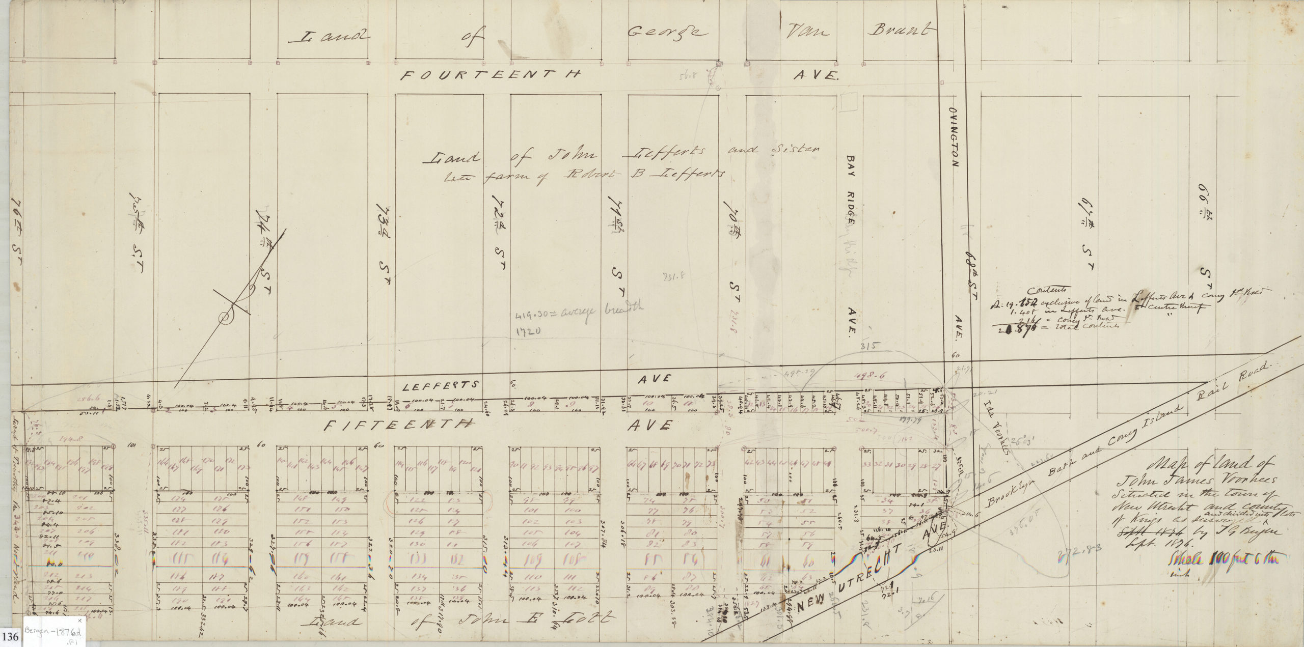
Creator
Bergen, Teunis G.,Publisher
Brooklyn Historical SocietyCitation
Map of land of John James Voorhees situated in the town of New Utrecht and County of Kings: as surveyed and divided into lots by T.G. Bergen; Sept 1876, Map Collection, Bergen-1876d.Fl; Brooklyn Historical Society.Scale
Scale [1:1200] 1 in to 10Loading zoom image...