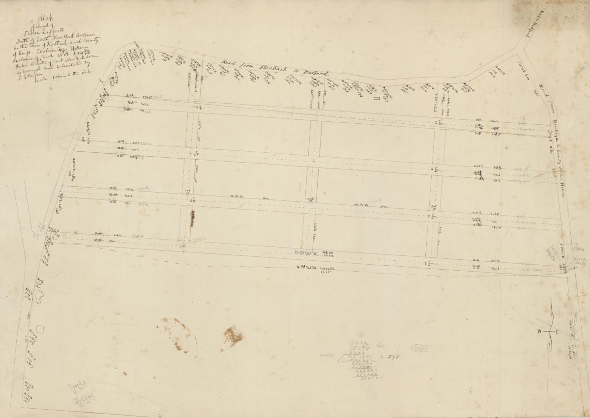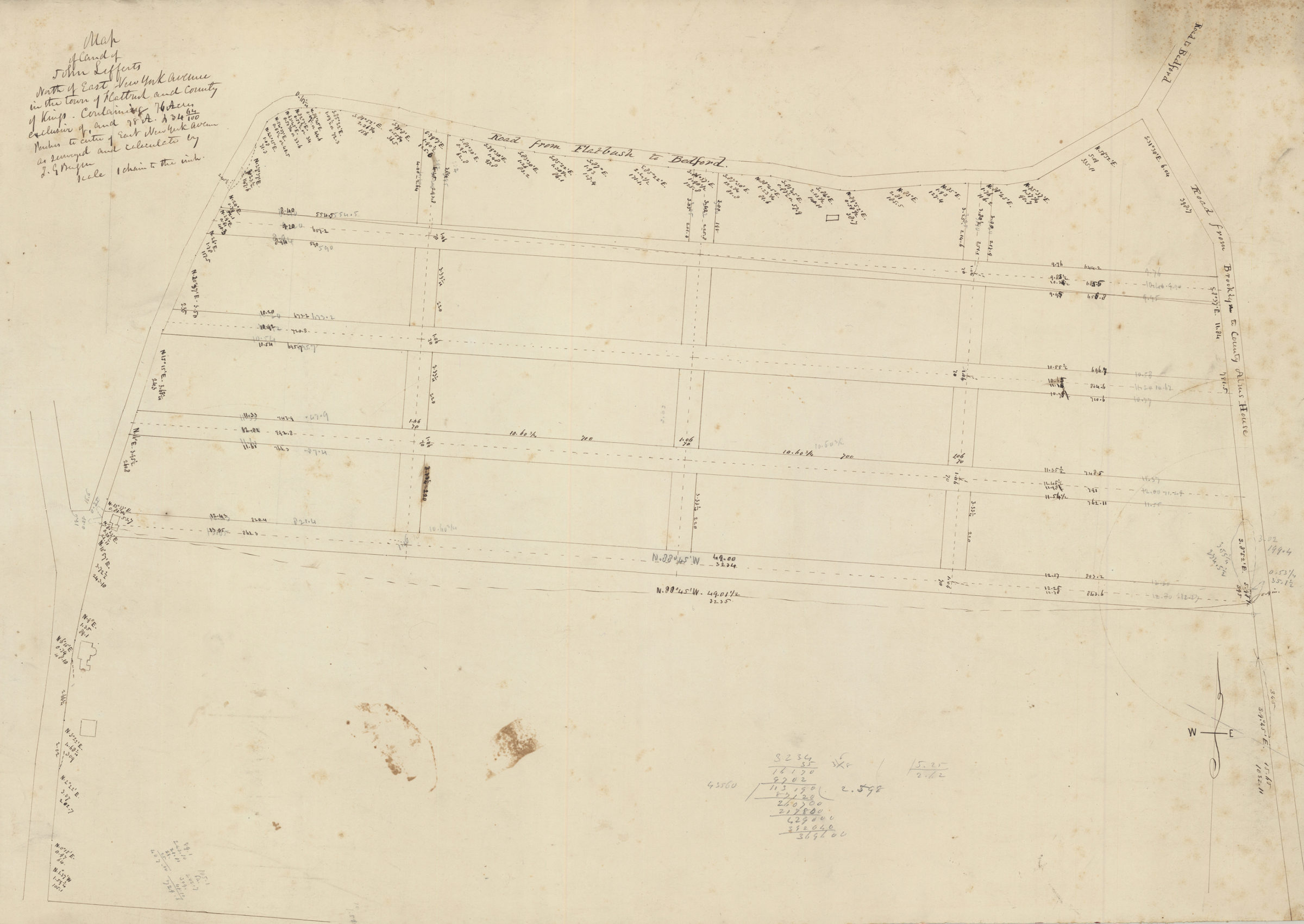
Map of land of John Lefferts, north of East New York Avenue in the town of Flatbush and county of Kings: containing 76 acres exclusive of, and 78 A. 234 64/100 perches to centre of East New York Avenue, as surveyed and calculated: by T.G. Bergen [18??]
Map No. Bergen-[18--?]i.Fl
Cadastral map covering area in modern-day Crown Heights. Does not cover modern-day Flatbush. Includes measurements.
Map area shown
Genre
Manuscript mapsRelation
Full catalog recordSize
51 × 62 cmDownload
Low Resolution Image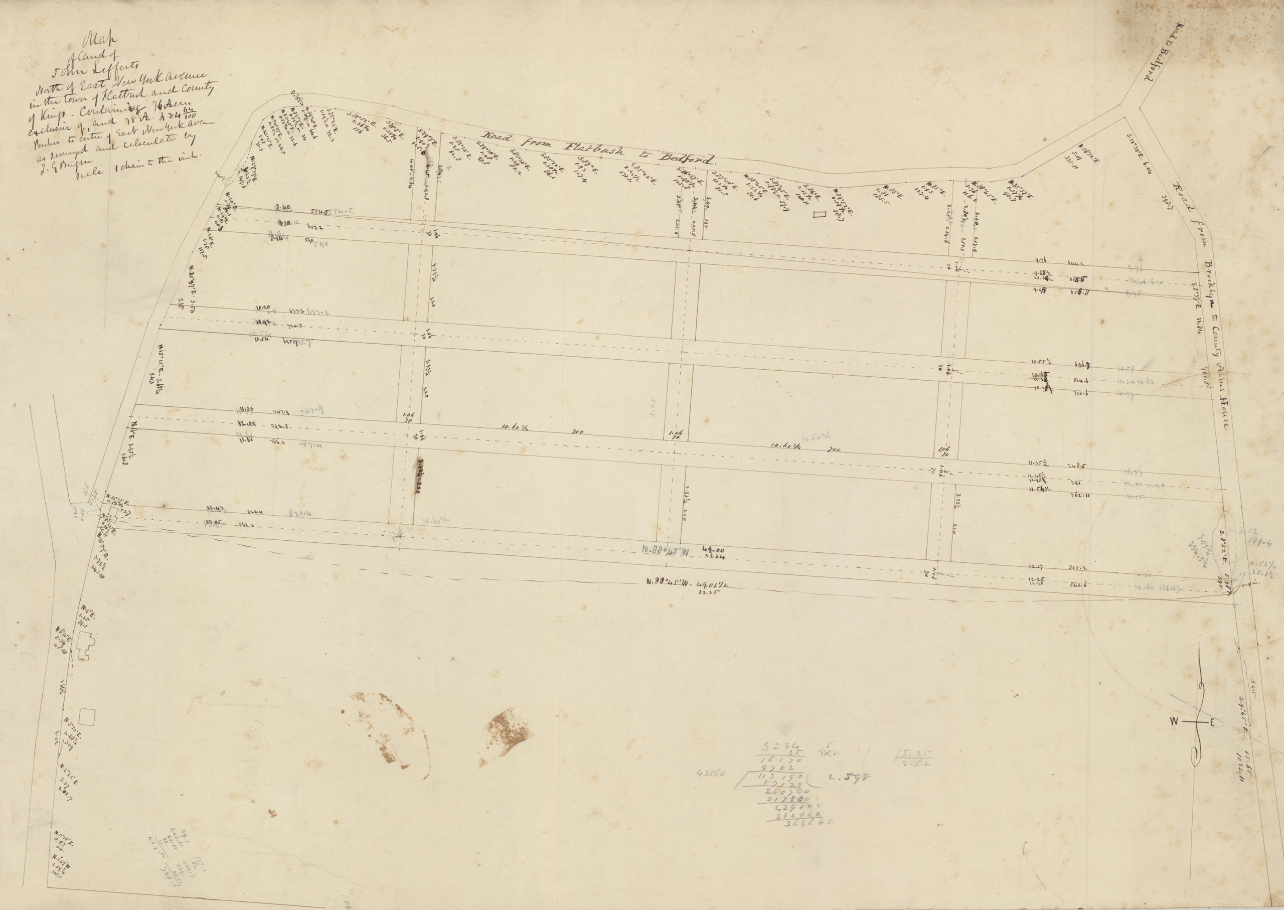
Creator
Bergen, Teunis G.,Publisher
Brooklyn Historical SocietyCitation
Map of land of John Lefferts, north of East New York Avenue in the town of Flatbush and county of Kings: containing 76 acres exclusive of, and 78 A. 234 64/100 perches to centre of East New York Avenue, as surveyed and calculated: by T.G. Bergen; [18??], Map Collection, Bergen-[18--?]i.Fl; Brooklyn Historical Society.Scale
Scale not givenLoading zoom image...