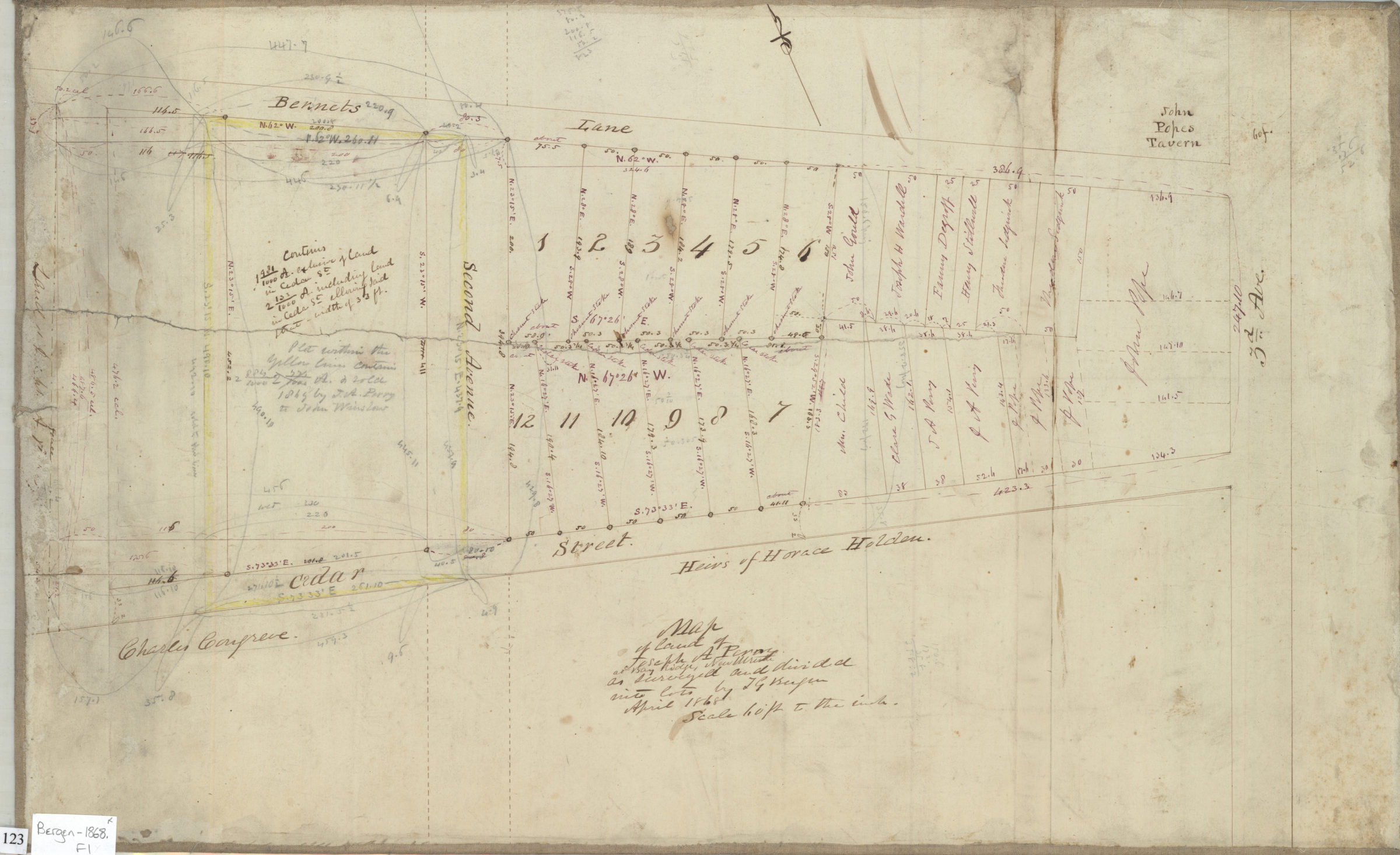
Map of land of Joseph A. Perry: as surveyed and divided into lots by T. G. Bergen April 1868
Map No. Bergen-1868.Fl
Cadastral survey map showing property, lots (including dimensions), and names of landowners in area between Bennets Lane and Cedar Street west of 3rd Avenue in likely modern-day Bay Ridge. Oriented with north to the upper left. Includes notes.
Map area shown
Relation
Full catalog recordSize
36 × 58 cmDownload
Low Resolution Image
Creator
Bergen, Teunis G.,Publisher
Brooklyn Historical SocietyCitation
Map of land of Joseph A. Perry: as surveyed and divided into lots by T. G. Bergen; April 1868, Map Collection, Bergen-1868.Fl; Brooklyn Historical Society.Scale
Scale [1:720] 1 in to 60Loading zoom image... 