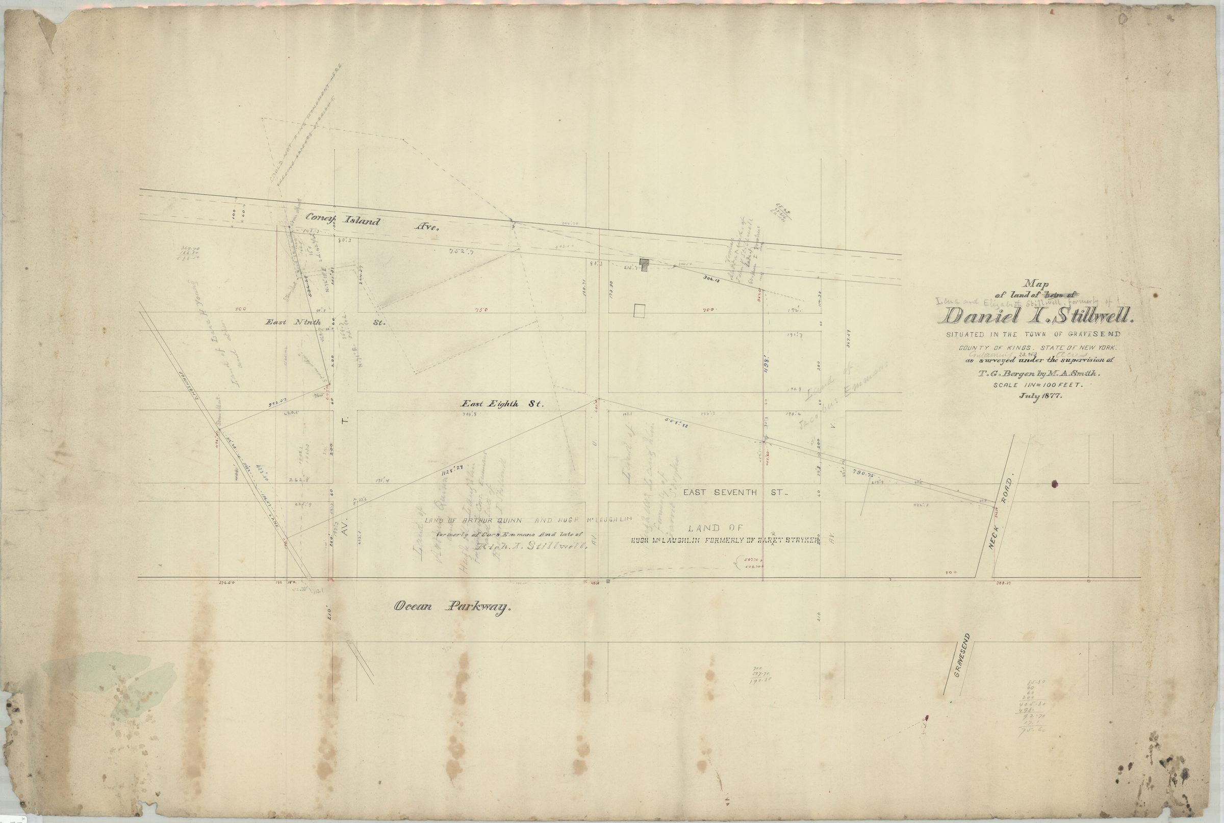
Map of land of Lena and Elizabeth Stillwell, formerly of Daniel I. Stillwell: situated in the town of Gravesend, county of Kings, state of New York, containing 23.953 acres ; as surveyed under the supervision of T.G. Bergen: by M.A. Smith July 1877
Map No. B P-1877a.Fl.Folio
Cadastral map covering area north from Ave. Y. to Gravesend Neck Rd. and east from W. 1st St. to Coney Island Ave. (modern-day Gravesend and Sheepshead Bay). Shows property (including buildings and acreages), names of landowners, and salt meadows. Oriented with north to the upper right. Map title corrected in gray pencil. Original title: Map of land of heirs of Daniel I. Stillwell, situated in the town of Gravesend, county of Kings, state of New York, as surveyed … Includes notes and calculations.
Subjects
Places
Map area shown
Relation
Full catalog recordSize
69 × 102 cmDownload
Low Resolution Image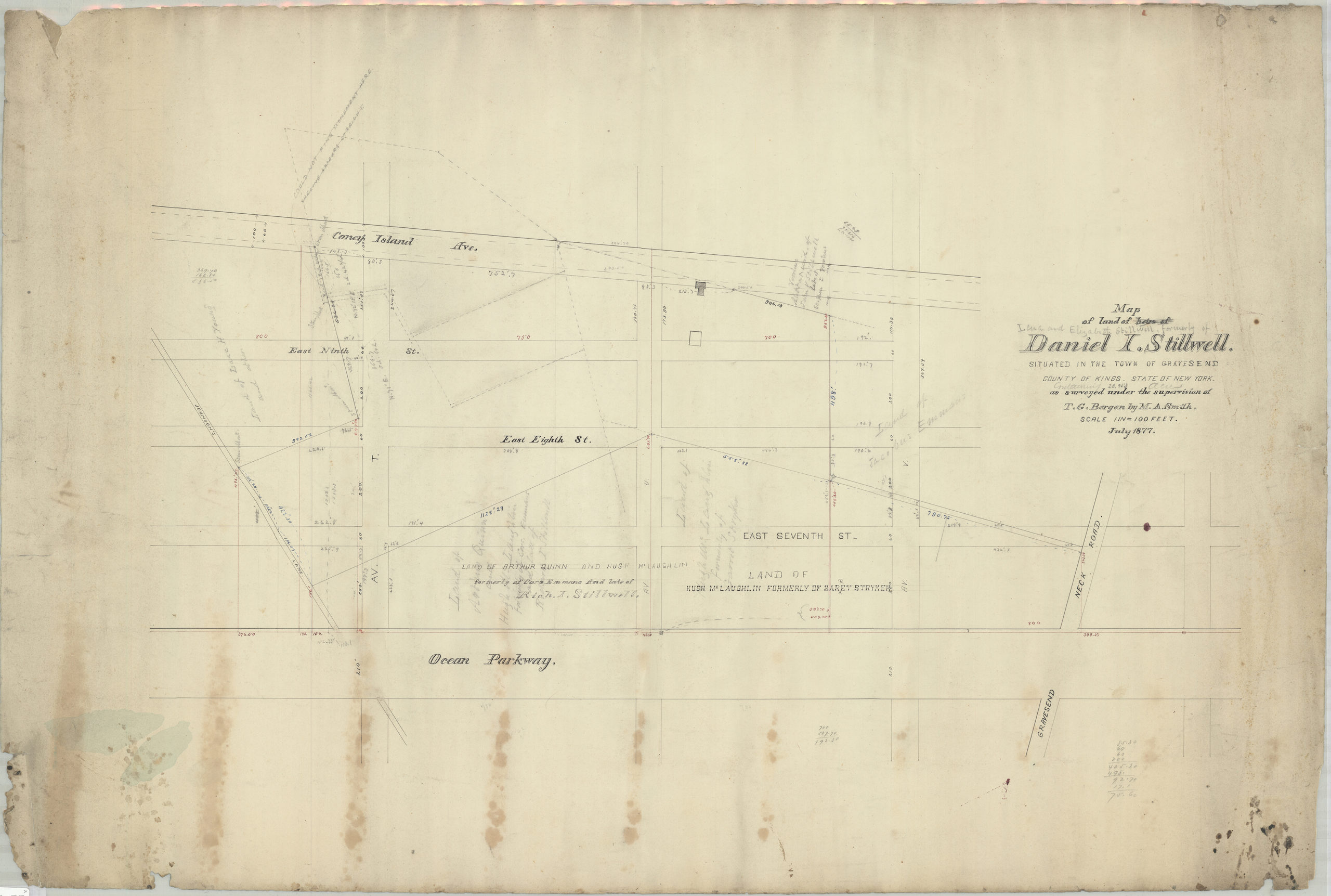
Creator
Smith, M. A.,Publisher
Brooklyn Historical SocietyCitation
Map of land of Lena and Elizabeth Stillwell, formerly of Daniel I. Stillwell: situated in the town of Gravesend, county of Kings, state of New York, containing 23.953 acres ; as surveyed under the supervision of T.G. Bergen: by M.A. Smith; July 1877, Map Collection, B P-1877a.Fl.Folio; Brooklyn Historical Society.Scale
Scale [1:1,200] 1 in to 1Loading zoom image... 