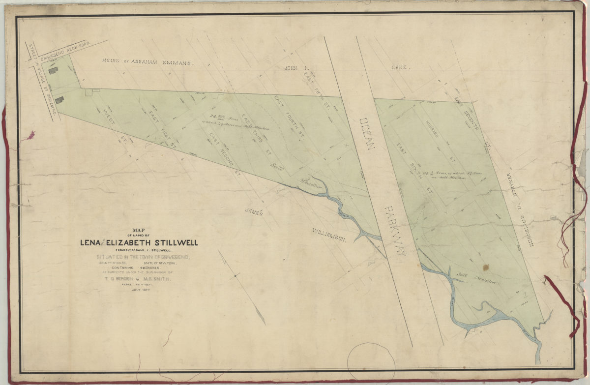
Map of land of Lena [and] Elizabeth Stillwell, formerly of Daniel I. Stillwell, situated in the town of Gravesend, county of Kings, state of New York, containing 48 693/1000 acres: as surveyed under the supervision of T.G Bergen: by M.A. Smith July 1877
Map No. B P-1877.Fl.Folio
Cadastral map covering area north from Ave. Z to Gravesend Neck Road and east from approximately West St. to E. 7th St. Shows property (including dimensions), and names of landowners. Oriented with north to the upper left.
Map area shown
Relation
Full catalog recordSize
62 × 96 cmDownload
Low Resolution Image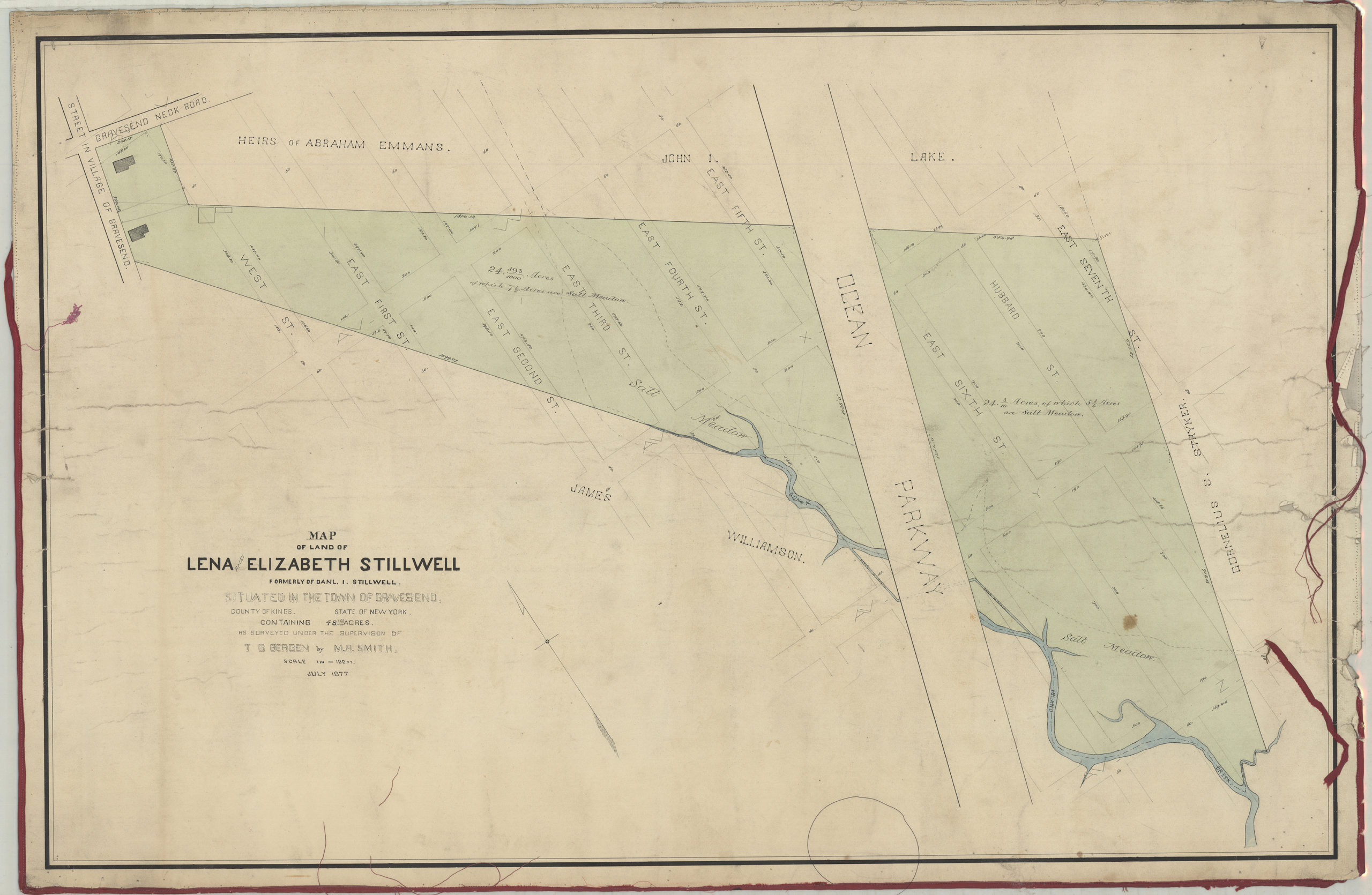
Creator
Smith, M. A.,Publisher
Brooklyn Historical SocietyCitation
Map of land of Lena [and] Elizabeth Stillwell, formerly of Daniel I. Stillwell, situated in the town of Gravesend, county of Kings, state of New York, containing 48 693/1000 acres: as surveyed under the supervision of T.G Bergen: by M.A. Smith; July 1877, Map Collection, B P-1877.Fl.Folio; Brooklyn Historical Society.Scale
Scale [1:1,200] 1 inLoading zoom image...