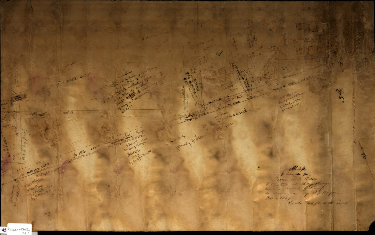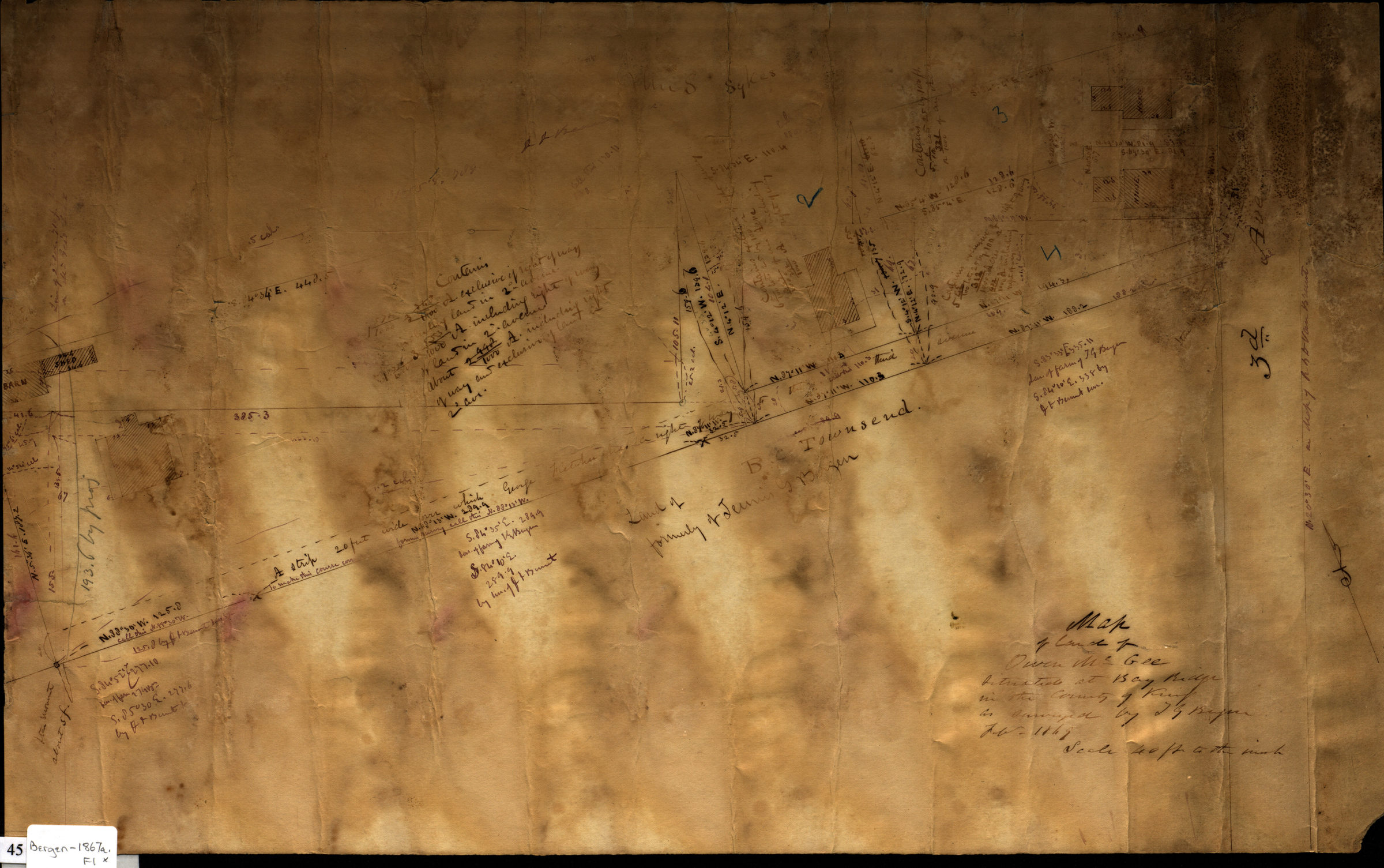
Map of land of Owen McGee situated at Bay Ridge in the county of Kings: as surveyed by T.G. Bergen Feb. 1867 February 1867
Map No. Bergen-1867a.Fl
Cadastral survey map of land west of Third Avenue in Bay Ridge. Shows property (including dimensions) and buildings. Includes text on conveyances and rights of way.
Map area shown
Relation
Full catalog recordSize
34 × 54 cmDownload
Low Resolution Image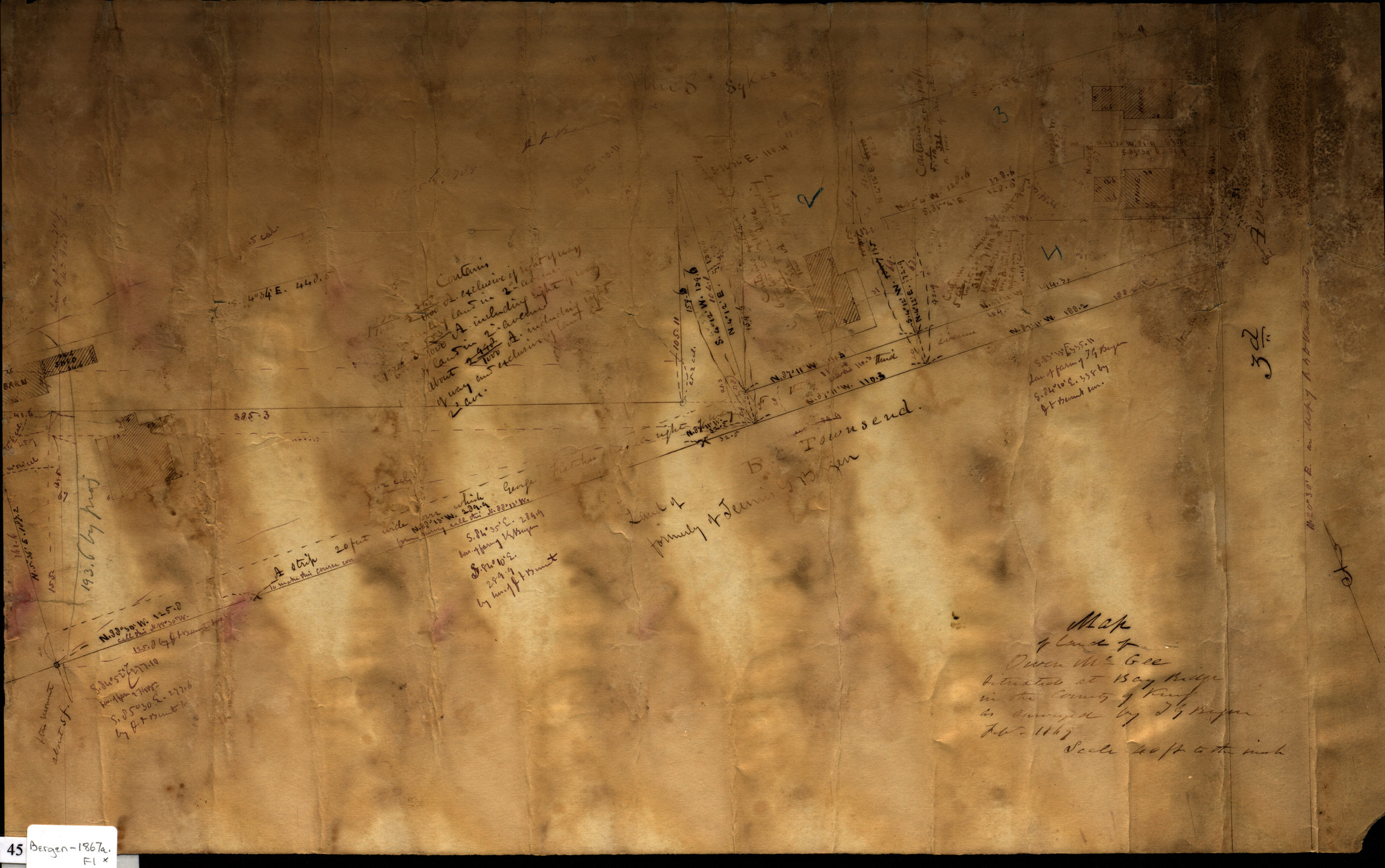
Creator
Bergen, Teunis G.,Publisher
Brooklyn Historical SocietyCitation
Map of land of Owen McGee situated at Bay Ridge in the county of Kings: as surveyed by T.G. Bergen Feb. 1867; February 1867, Map Collection, Bergen-1867a.Fl; Brooklyn Historical Society.Scale
Scale [1:720] 1 in to 60Loading zoom image...