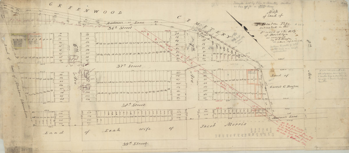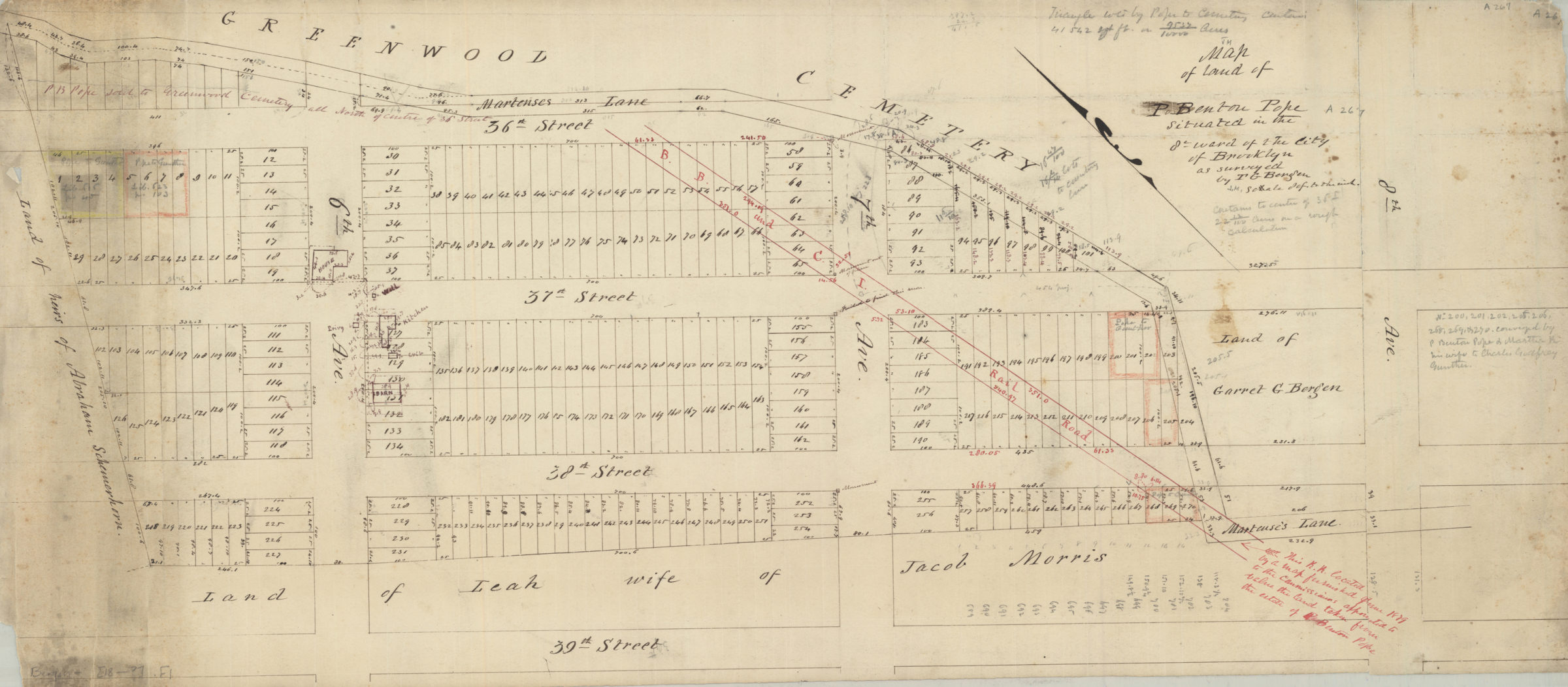
Map of land of P. Benton Pope, situated in the 8th Ward of the city of Brooklyn: as surveyed by T.G. Bergen [188?]
Map No. Bergen-[188-?].Fl
Cadastral map covering area bounded by 39th St., 8th Ave., 36th St., and 6th Ave. (modern-day Sunset Park). Shows property (including lot numbers, dimensions, and buildings), names of landowners, the B.B. and C.I. Railroad, and part of Greenwood Cemetery. Oriented with north to the upper left. Includes notes.
Map area shown
Relation
Full catalog recordSize
32 × 74 cmDownload
Low Resolution Image
Creator
Bergen, Teunis G.,Publisher
Brooklyn Historical SocietyCitation
Map of land of P. Benton Pope, situated in the 8th Ward of the city of Brooklyn: as surveyed by T.G. Bergen; [188?], Map Collection, Bergen-[188-?].Fl; Brooklyn Historical Society.Scale
Scale [1:960] 1 in to 80Loading zoom image...