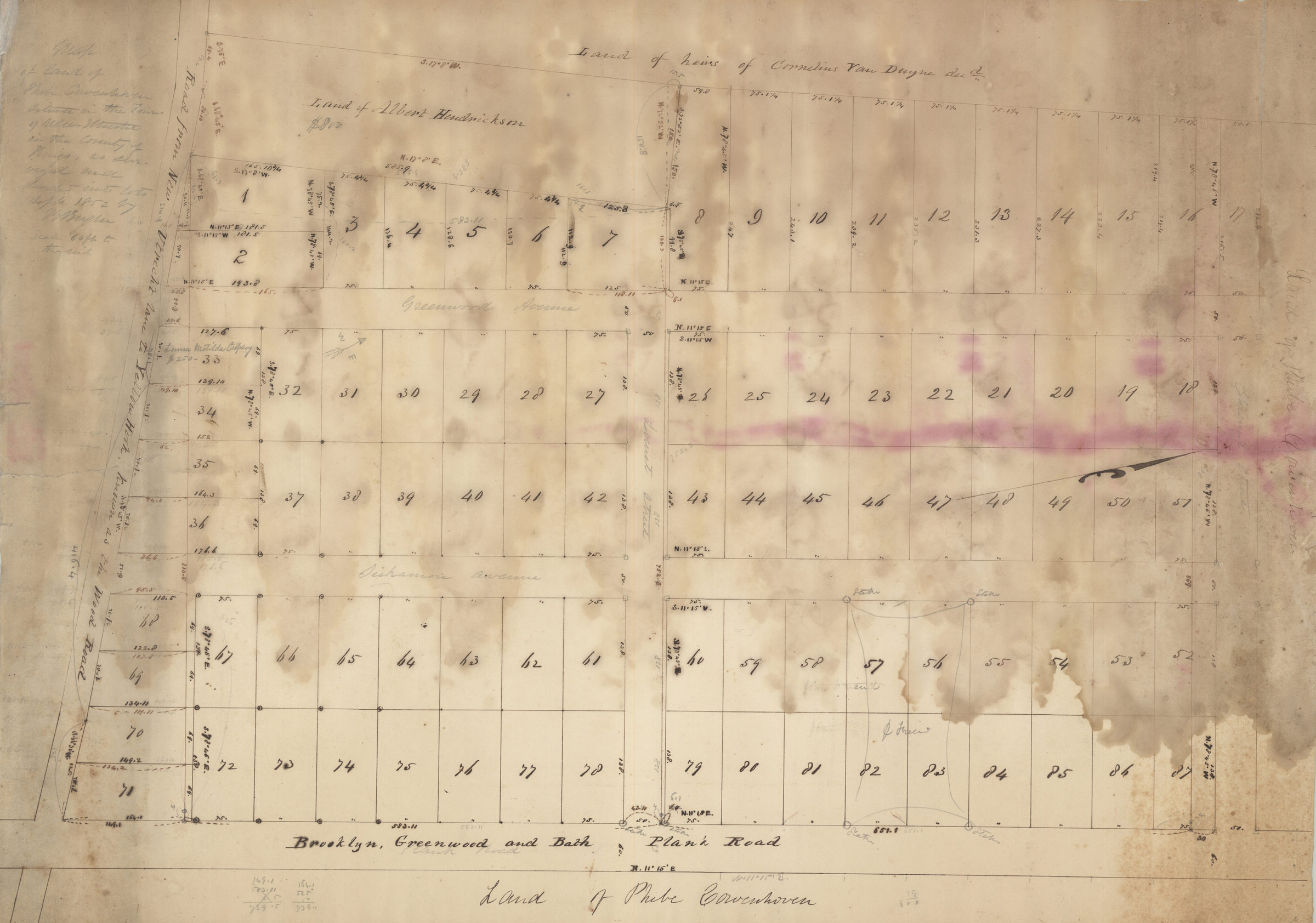
Map of land of Phebe Cowenhoven situated in the Town of New Utrecht in the County of Kings: as surveyed and divided into lots Sept. 1852 by T. G. Bergen 1852
Map No. Bergen-1852a.Fl
Cadastral survey map covering area from Road from New Utrecht Lane to Yellow Hook, known as the Wood Road, to Chisnut Street and Greenwood Avenue to Brooklyn, Greenwood and Bath Plank Road in modern-day Borough Park. Shows property (including lot numbers) and names of landowners. Includes notes and calculations. Accompanied by small sheet with calculations.
Map area shown
Relation
Full catalog recordSize
49 × 69 cmDownload
Low Resolution Image
Creator
Bergen, Teunis G.,Publisher
Brooklyn Historical SocietyCitation
Map of land of Phebe Cowenhoven situated in the Town of New Utrecht in the County of Kings: as surveyed and divided into lots Sept. 1852 by T. G. Bergen; 1852, Map Collection, Bergen-1852a.Fl; Brooklyn Historical Society.Scale
Scale [1:720] 1 in to 60Loading zoom image... 