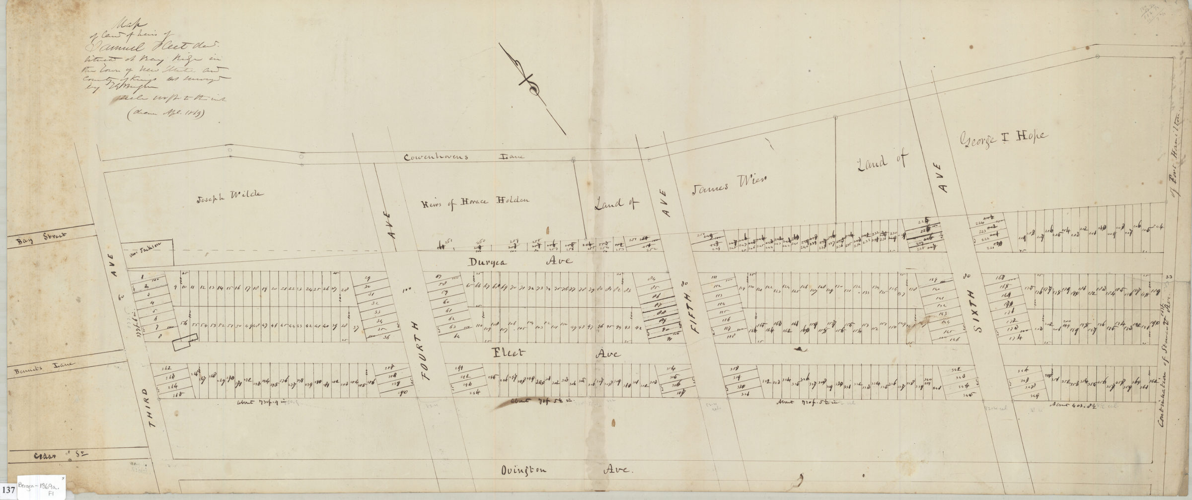
Map of land of Samuel Fleet dec[ease]d situated at Bay Ridge in the town of New Utrecht and County of Kings: as surveyed by T.G. Bergen April 1869
Map No. Bergen-1869a.Fl
Cadastral map covering area bounded by Third Avenue, Cowenhowens Lane, continuation of Stewart Avenue, and Ovington Avenue in modern-day Bay Ridge. Shows property (including lots and dimensions) and names of landowners. Oriented with north to the upper left.
Map area shown
Relation
Full catalog recordSize
36 × 83 cmDownload
Low Resolution Image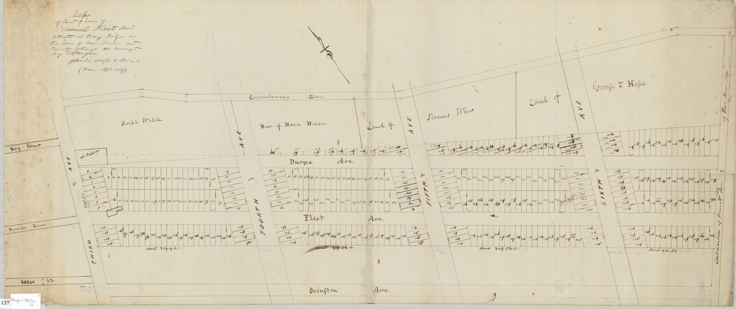
Creator
Bergen, Teunis G.,Publisher
Brooklyn Historical SocietyCitation
Map of land of Samuel Fleet dec[ease]d situated at Bay Ridge in the town of New Utrecht and County of Kings: as surveyed by T.G. Bergen; April 1869, Map Collection, Bergen-1869a.Fl; Brooklyn Historical Society.Scale
Scale [1:1200] 1 in to 10Loading zoom image... 