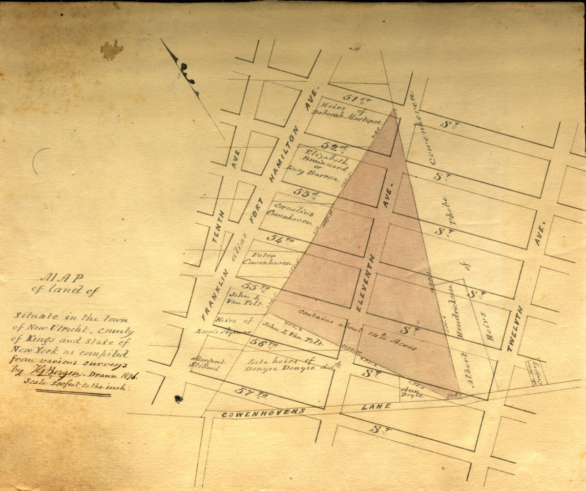
Map of land of … situate[d] in the town of New Utrecht, county of Kings, and state of New York, as compiled from various surveys: by T.G. Bergen 1876
Map No. Bergen-1876a.Fl
Cadastral map covering area bounded by 10th Ave., Cowenhoven’s Ln., 12th Ave., and 51st St. (modern-day Borough Park). Shows property (including acreages), and names of landowners. Title incomplete missing text not due to damage on piece. Oriented with north to the upper left.
Map area shown
Relation
Full catalog recordSize
32 × 38 cmDownload
Low Resolution Image
Creator
Bergen, Teunis G.,Publisher
Brooklyn Historical SocietyCitation
Map of land of … situate[d] in the town of New Utrecht, county of Kings, and state of New York, as compiled from various surveys: by T.G. Bergen; 1876, Map Collection, Bergen-1876a.Fl; Brooklyn Historical Society.Scale
Scale [1:2,400] 1 in to 2Loading zoom image...