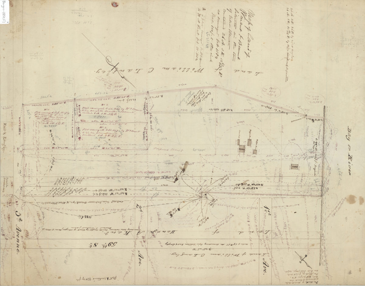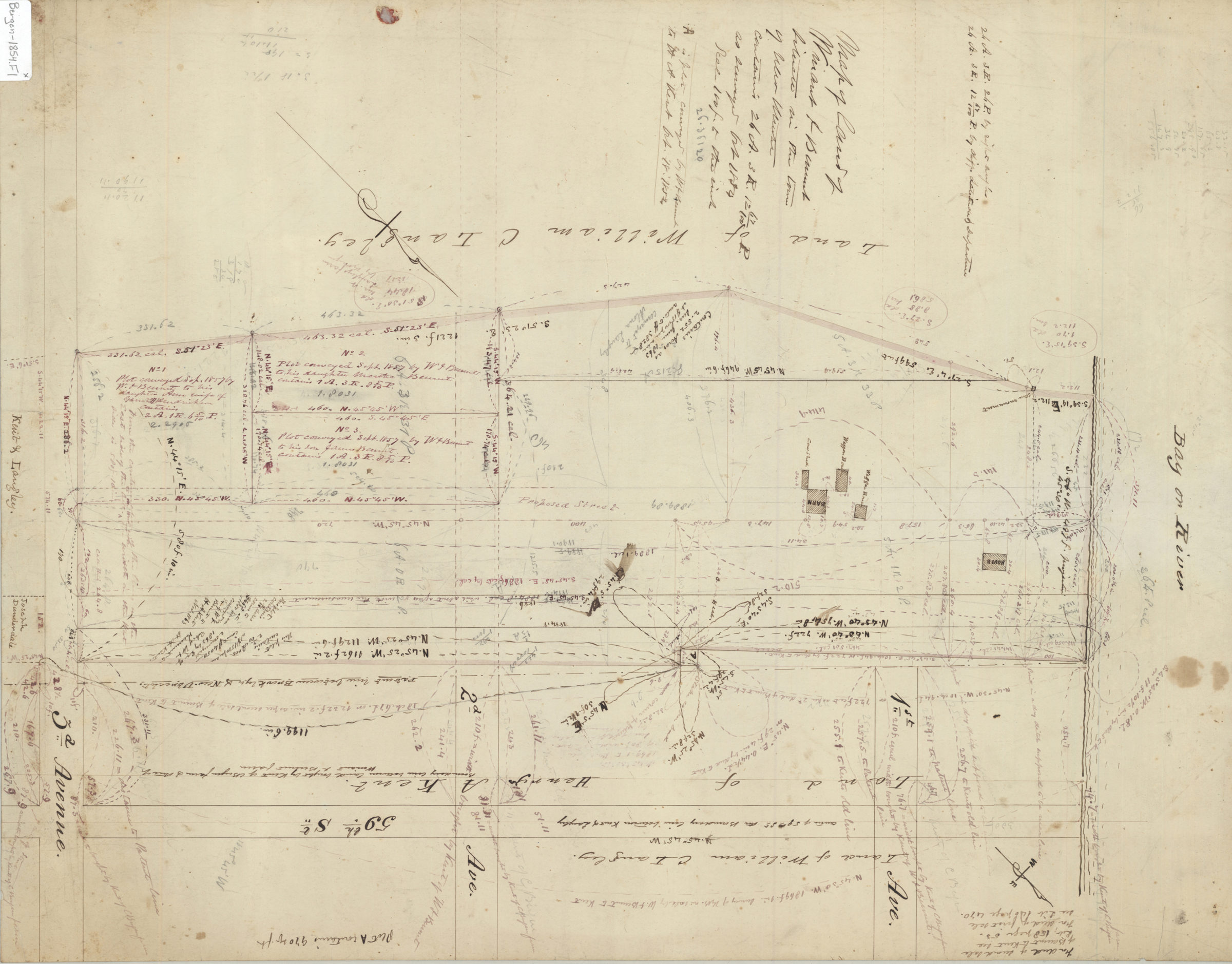
Map of land of Winant J. Bennet, situate[d] in the town of New Utrecht, contains 26 A., 3 R., 12 67/20 P 1854
Map No. Bergen-1854.Fl
Cadastral map covering area north from approximately 61st St. to 59th St. and east from New York Bay to 3rd Ave. (modern-day Sunset Park). Shows property (including buildings and dimensions), and names of landowners. Likely attributed to T.G. Bergen, based on handwriting on piece. Oriented with north to the upper right. Includes notes.
Map area shown
Relation
Full catalog recordSize
59 × 46 cmDownload
Low Resolution Image
Creator
Bergen, Teunis G.,Publisher
Brooklyn Historical SocietyCitation
Map of land of Winant J. Bennet, situate[d] in the town of New Utrecht, contains 26 A., 3 R., 12 67/20 P; 1854, Map Collection, Bergen-1854.Fl; Brooklyn Historical Society.Scale
Scale [1:1,200] 1 in to 1Loading zoom image...