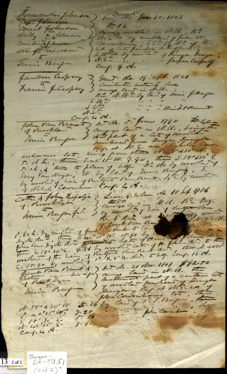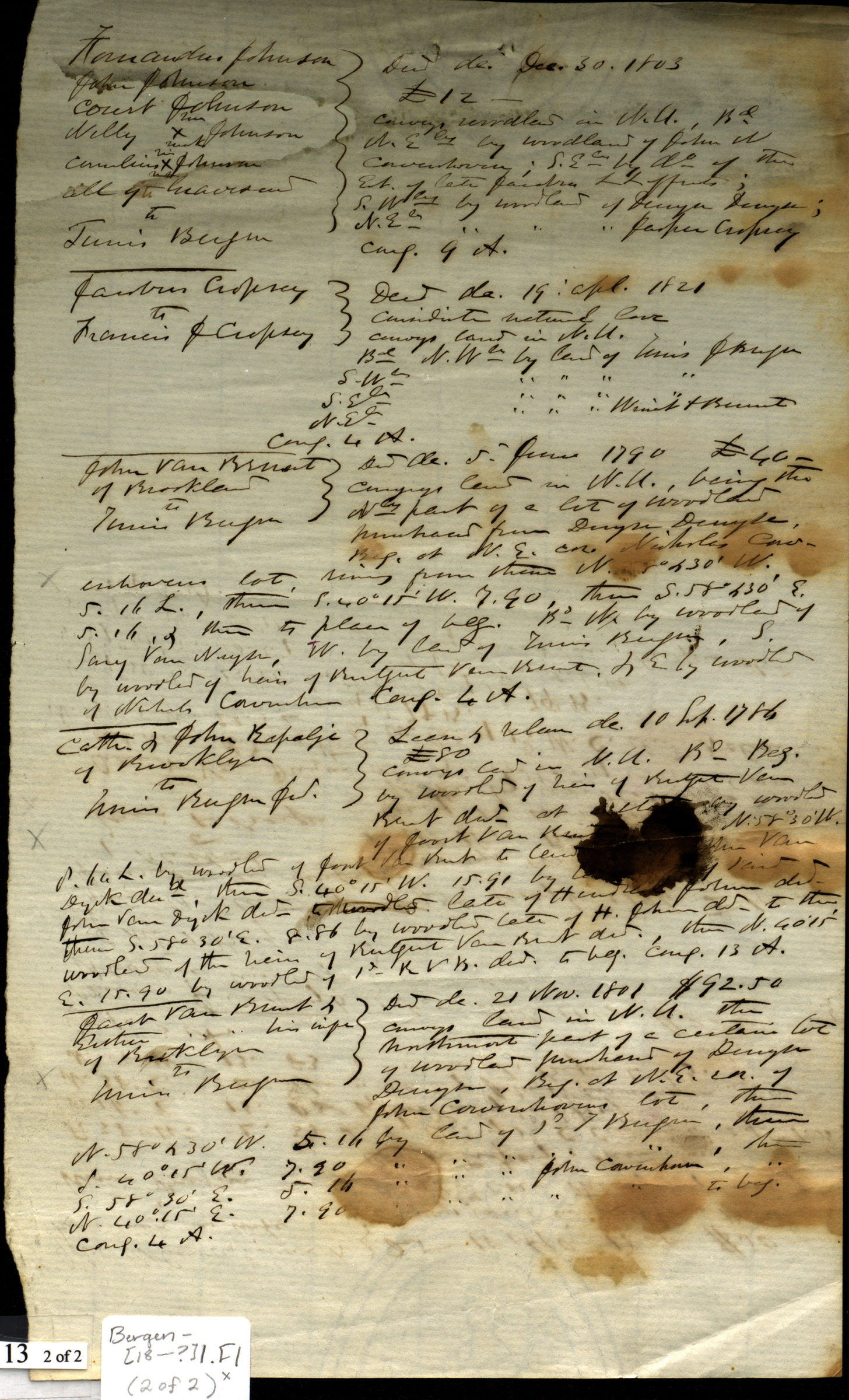
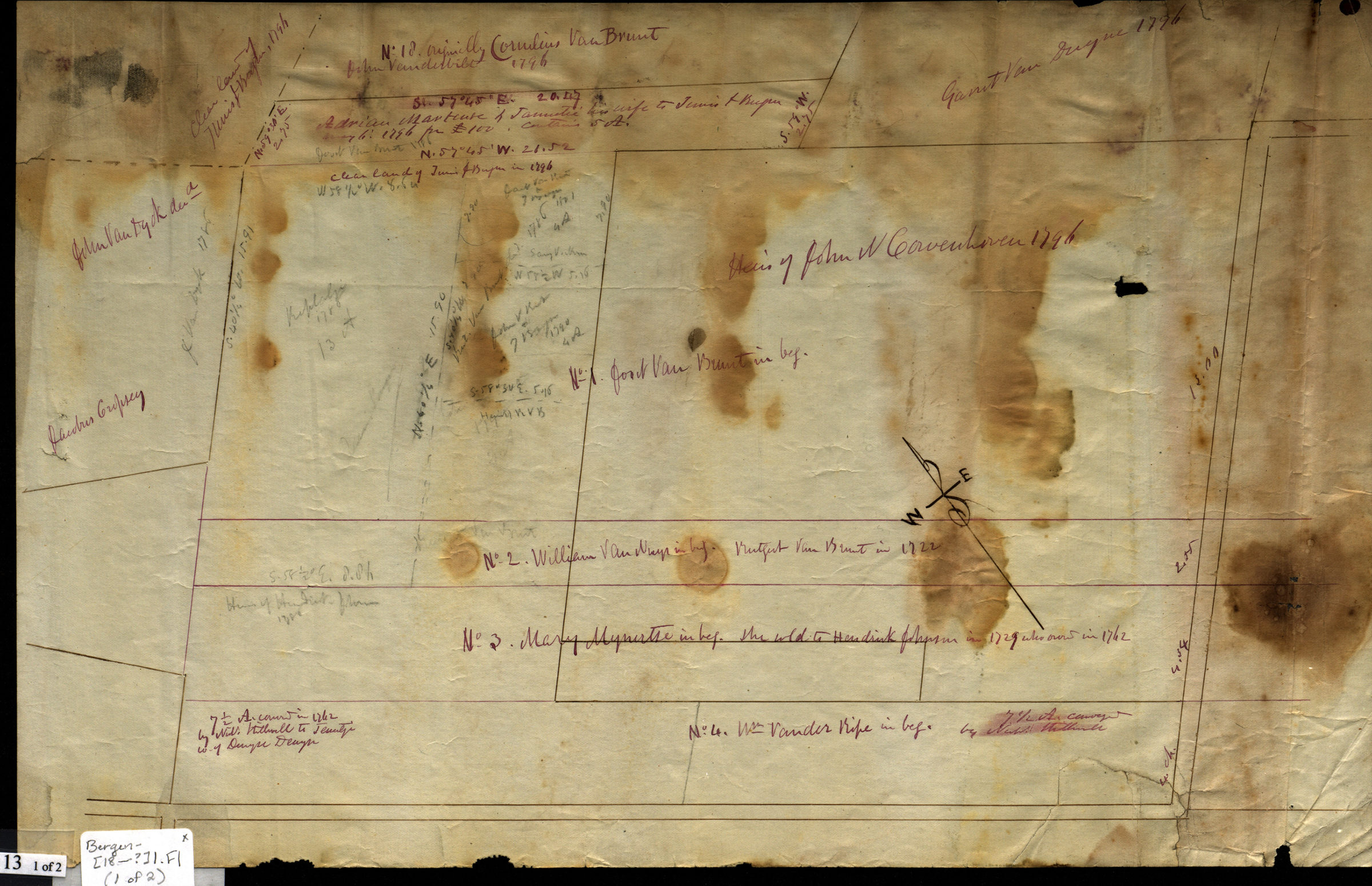

[Map of land ownership in 18th century Brooklyn] [18??]
Map No. Bergen-[18--?]l.Fl
Cadastral map. Shows property and names of landowners. Title devised by cataloger. Likely attributed to T.G. Bergen, based on handwriting on piece. Oriented with north to the upper left. Cataloger unable to determine map’s modern-day Brooklyn neighborhood. No street names or landmarks given on map. Includes notes and calculations.
Map area shown
Relation
Full catalog recordSize
27 × 42 cmDownload
Low Resolution Image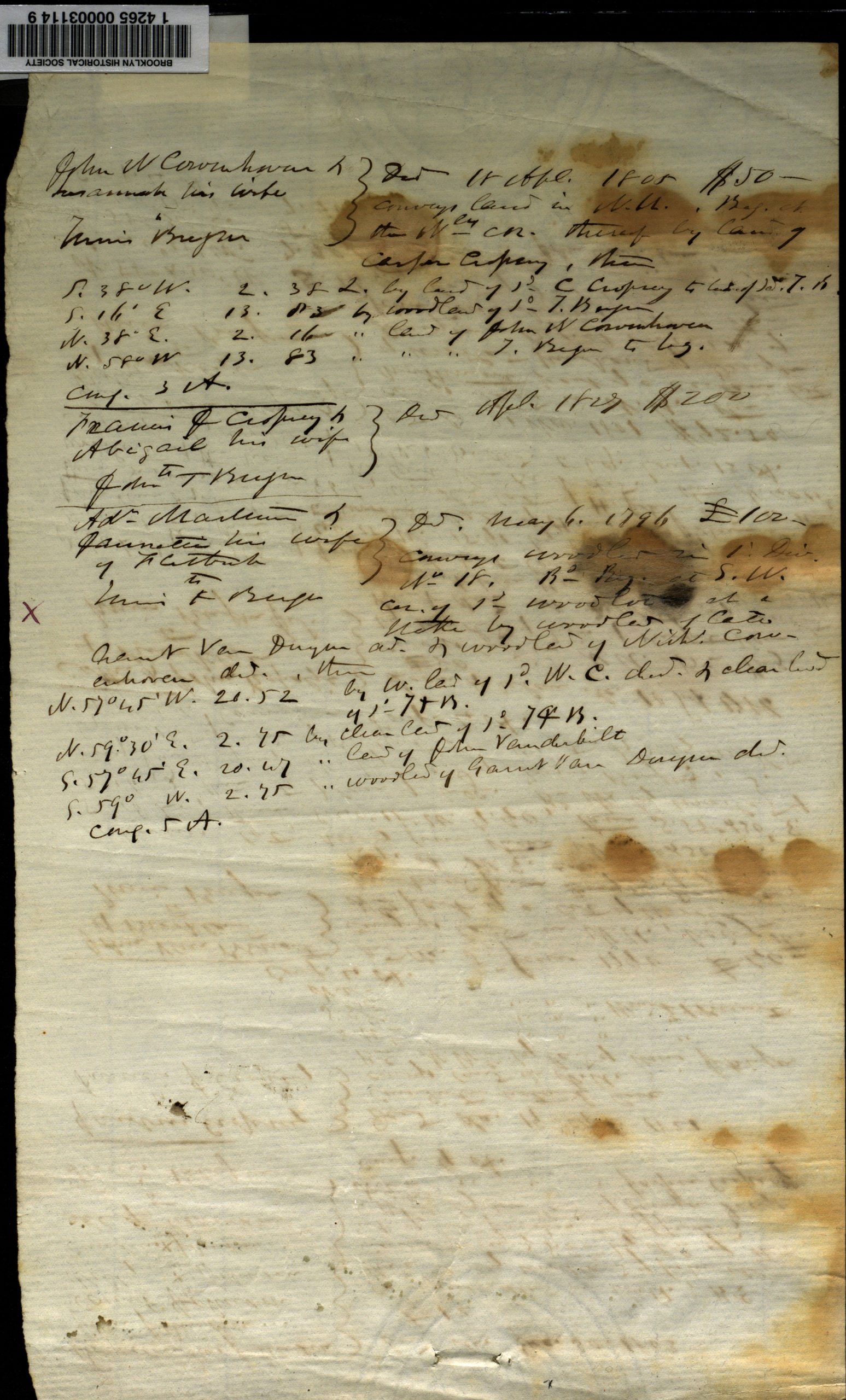
Creator
Bergen, Teunis G.,Publisher
Brooklyn Historical SocietyCitation
[Map of land ownership in 18th century Brooklyn]; [18??], Map Collection, Bergen-[18--?]l.Fl; Brooklyn Historical Society.Scale
Scale not givenLoading zoom image...