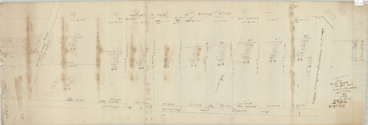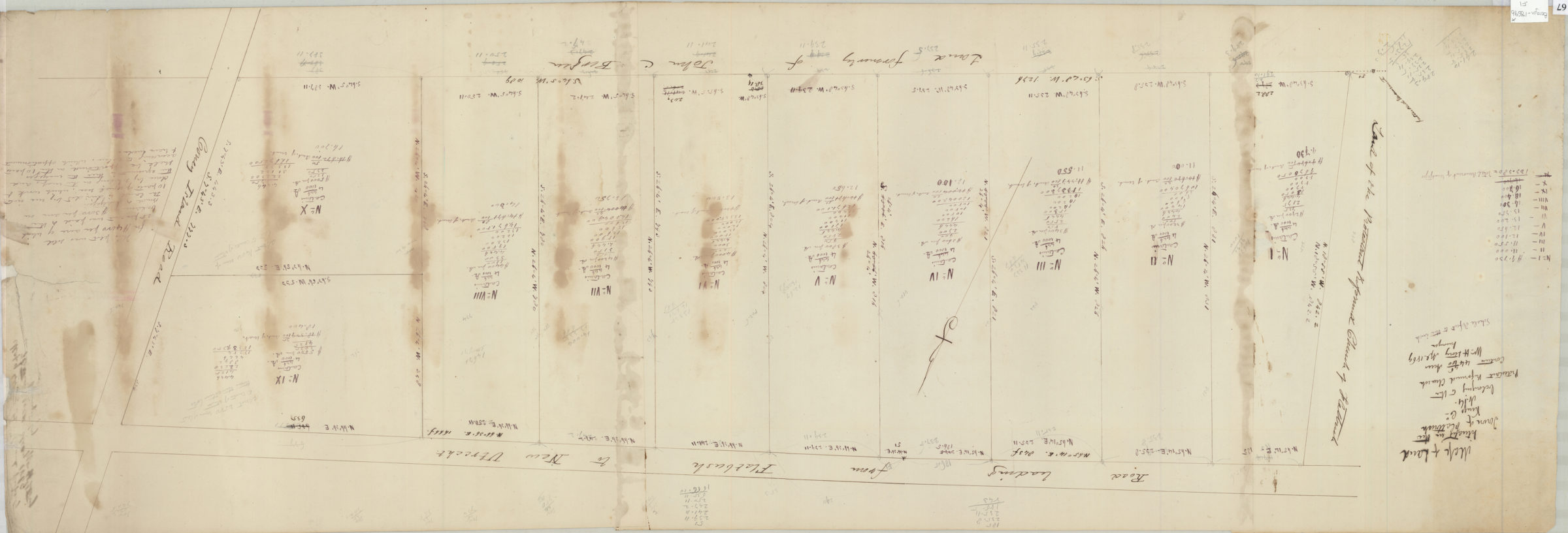
Map of land situated in the town of Flatbush, Kings Co. belonging to the Protestant Reformed Church contains 44 46/100 acres: Wm. H. Story, Apl. 1869, surveyor [drawn by T.G. Bergen] 1869
Map No. Bergen-1869b.Fl
Cadastral map of property on the southern side of the road leading from Flatbush to New Utrecht near Coney Island Road. Shows property, lots (including dimensions) and names of landowners in modern-day Flatbush and Prospect Park South. Copying attributed to Teunis G. Bergen based on handwriting on piece. Includes notes and calculations.
Subjects
Places
Map area shown
Relation
Full catalog recordSize
36 × 105 cmDownload
Low Resolution Image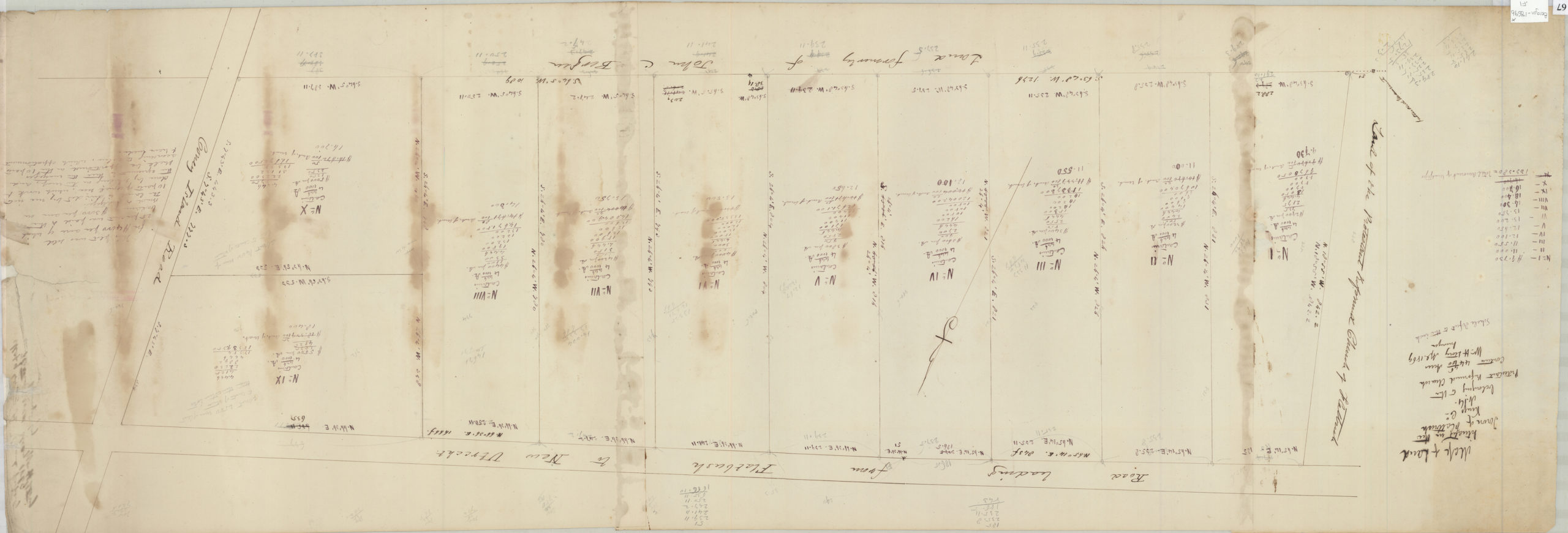
Creator
Story, William H.,Publisher
Brooklyn Historical SocietyCitation
Map of land situated in the town of Flatbush, Kings Co. belonging to the Protestant Reformed Church contains 44 46/100 acres: Wm. H. Story, Apl. 1869, surveyor [drawn by T.G. Bergen]; 1869, Map Collection, Bergen-1869b.Fl; Brooklyn Historical Society.Scale
Scale [1:600] 1 in to 50Loading zoom image...