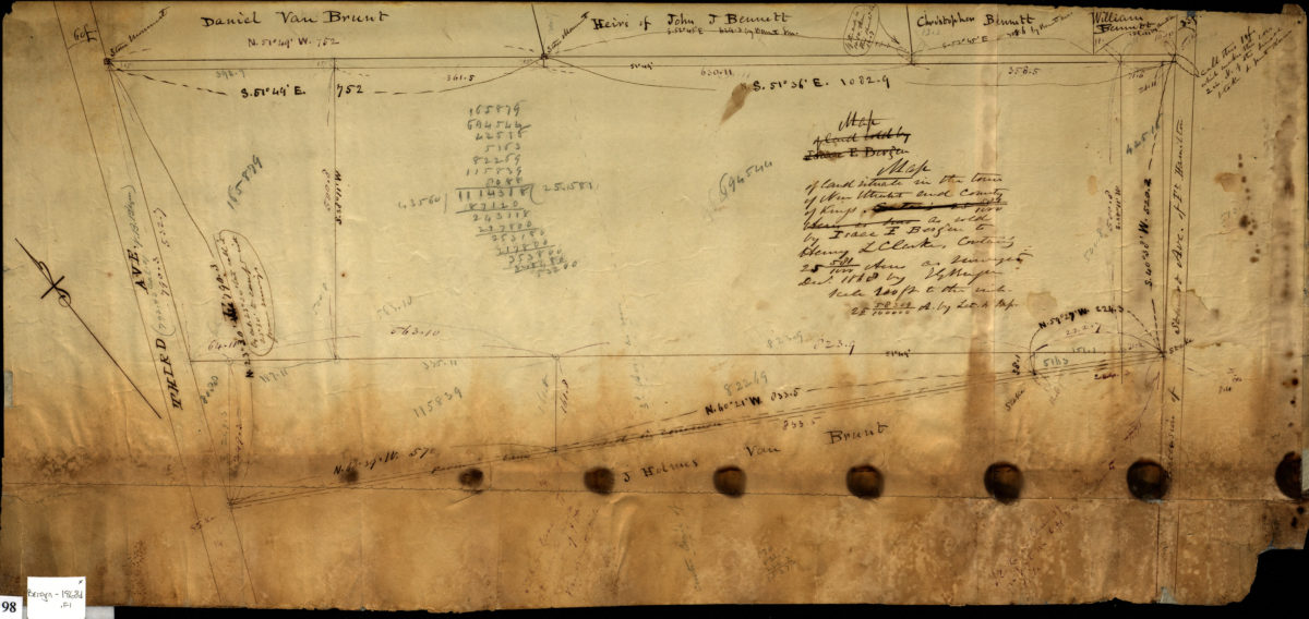
Map of land situate[d] in the town of New Utrecht and County of Kings as sold by Isaac I. Bergen to Henry L. Clarke, containing 25 581/1000 acres: as surveyed by T.G. Bergen December 1868
Map No. Bergen-1868d.Fl
Cadastral map covering area between 3rd Avenue and extension of Stewart Avenue in modern-day Bay Ridge. Area covered identical to: [Map of area between 3rd Avenue and Stewart Avenue continuation] (Bergen-[1868]e.Fl), also held by BHS.
Map area shown
Relation
Full catalog recordSize
26 × 57 cmDownload
Low Resolution Image
Creator
Bergen, Teunis G.,Publisher
Brooklyn Historical SocietyCitation
Map of land situate[d] in the town of New Utrecht and County of Kings as sold by Isaac I. Bergen to Henry L. Clarke, containing 25 581/1000 acres: as surveyed by T.G. Bergen; December 1868, Map Collection, Bergen-1868d.Fl; Brooklyn Historical Society.Scale
Scale [1:1200] 1 in to 10Loading zoom image...