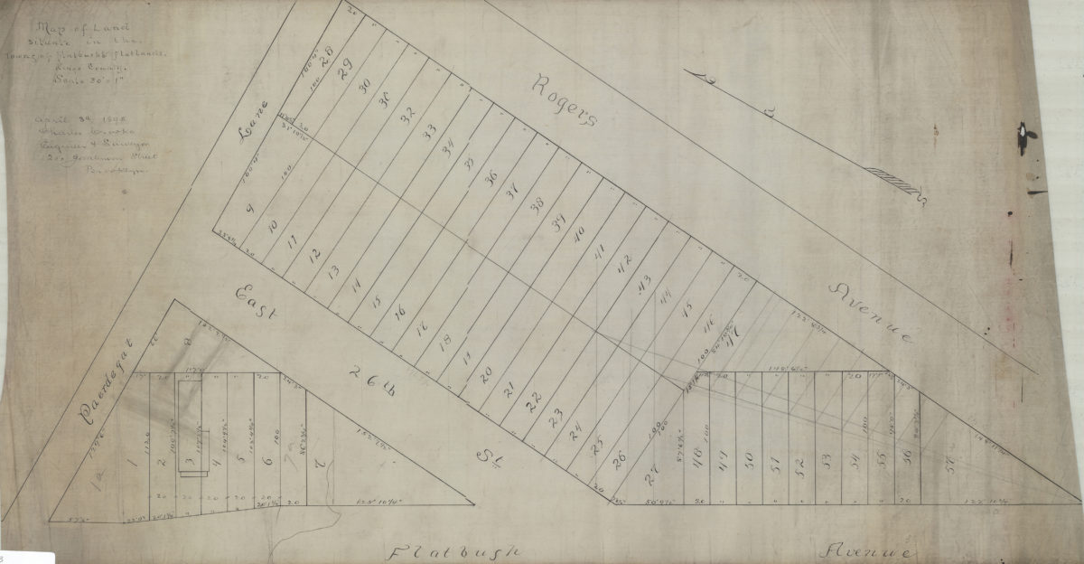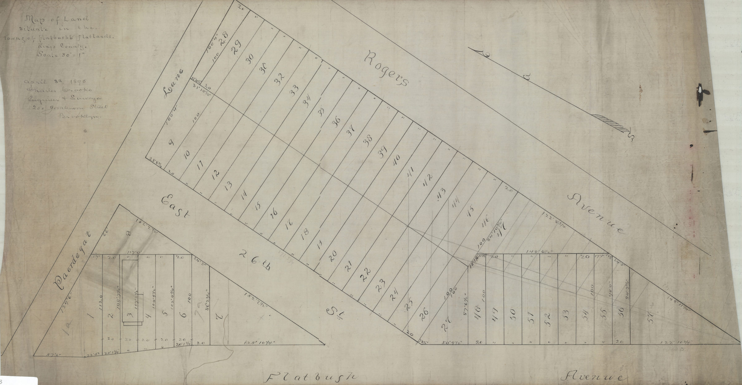
Map of land situate[d] in the towns of Flatbush & Flatlands, Kings County: Charles Crooke, engineer & surveyor April 8, 1895
Map No. B P-1895.Fl
Cadastral map covering area bounded by Flatbush Ave., Rogers Ave., and Paerdegat Ln. Shows property (including lot numbers and dimensions). Oriented with north to the bottom.
Subjects
Places
Map area shown
Relation
Full catalog recordSize
37 × 70 cmDownload
Low Resolution Image
Creator
Crooke, Charles,Publisher
Brooklyn Historical SocietyCitation
Map of land situate[d] in the towns of Flatbush & Flatlands, Kings County: Charles Crooke, engineer & surveyor; April 8, 1895, Map Collection, B P-1895.Fl; Brooklyn Historical Society.Scale
Scale [1:360] 1 in to 30Loading zoom image...