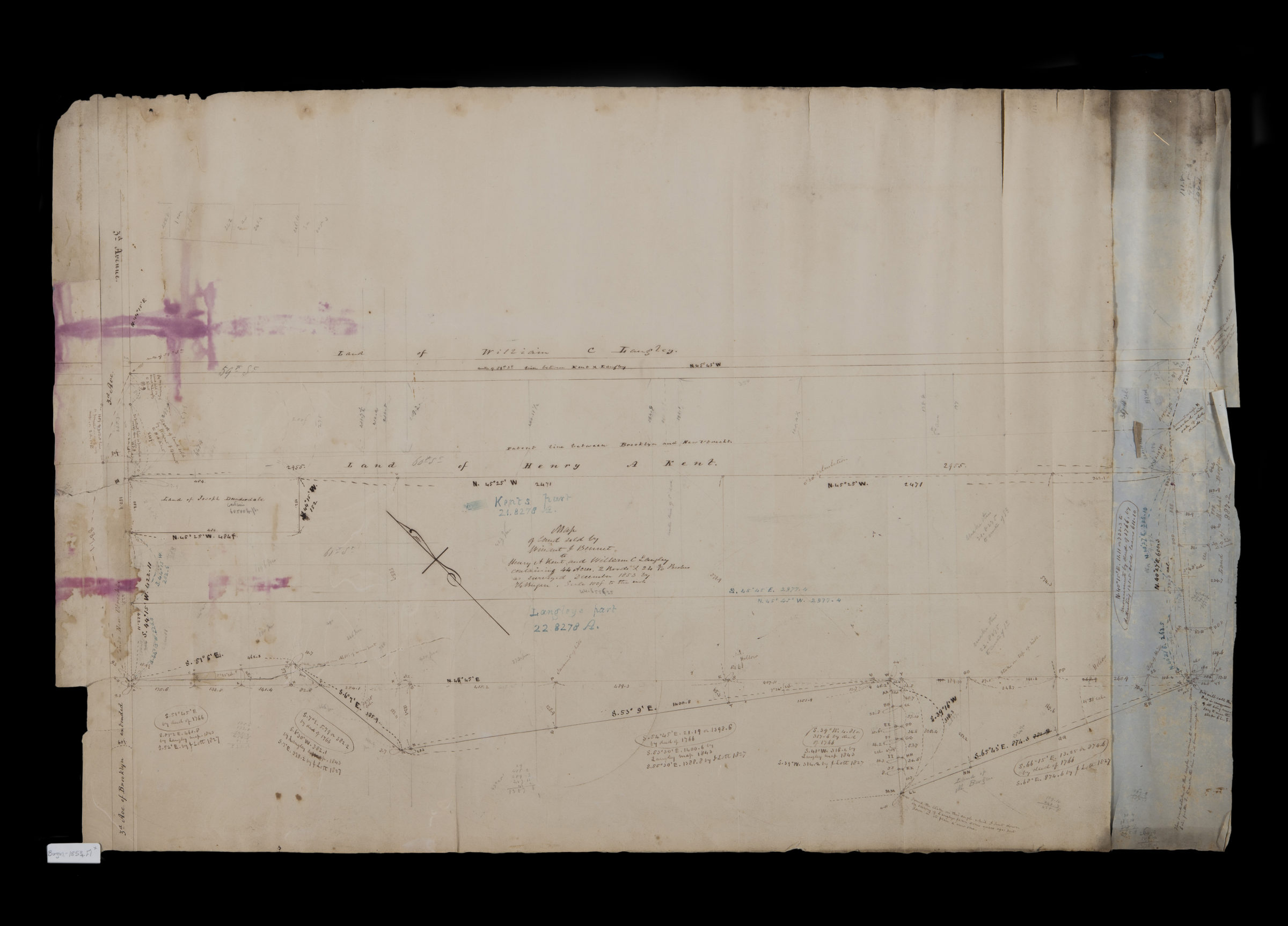
Map of land sold by Winant J. Bennet to Henry A. Kent and William C. Langley, containing 44 acres, 2 roods [i.e. rods?] and 24 9/10 perches: as surveyed December 1853: by T.G. Bergen 1853
Map No. Bergen-1853.Fl
Cadastral map covering area bounded roughly by 3rd Ave., 61st St., 6th Ave., and 59th St. (modern-day Sunset Park). Shows property (including dimensions), and names of landowners. Oriented with north to the upper left. Includes notes and calculations. Watermark: J. Whatman. Turkey Mill. 1850.
Map area shown
Relation
Full catalog recordSize
55 × 85 cmDownload
Low Resolution Image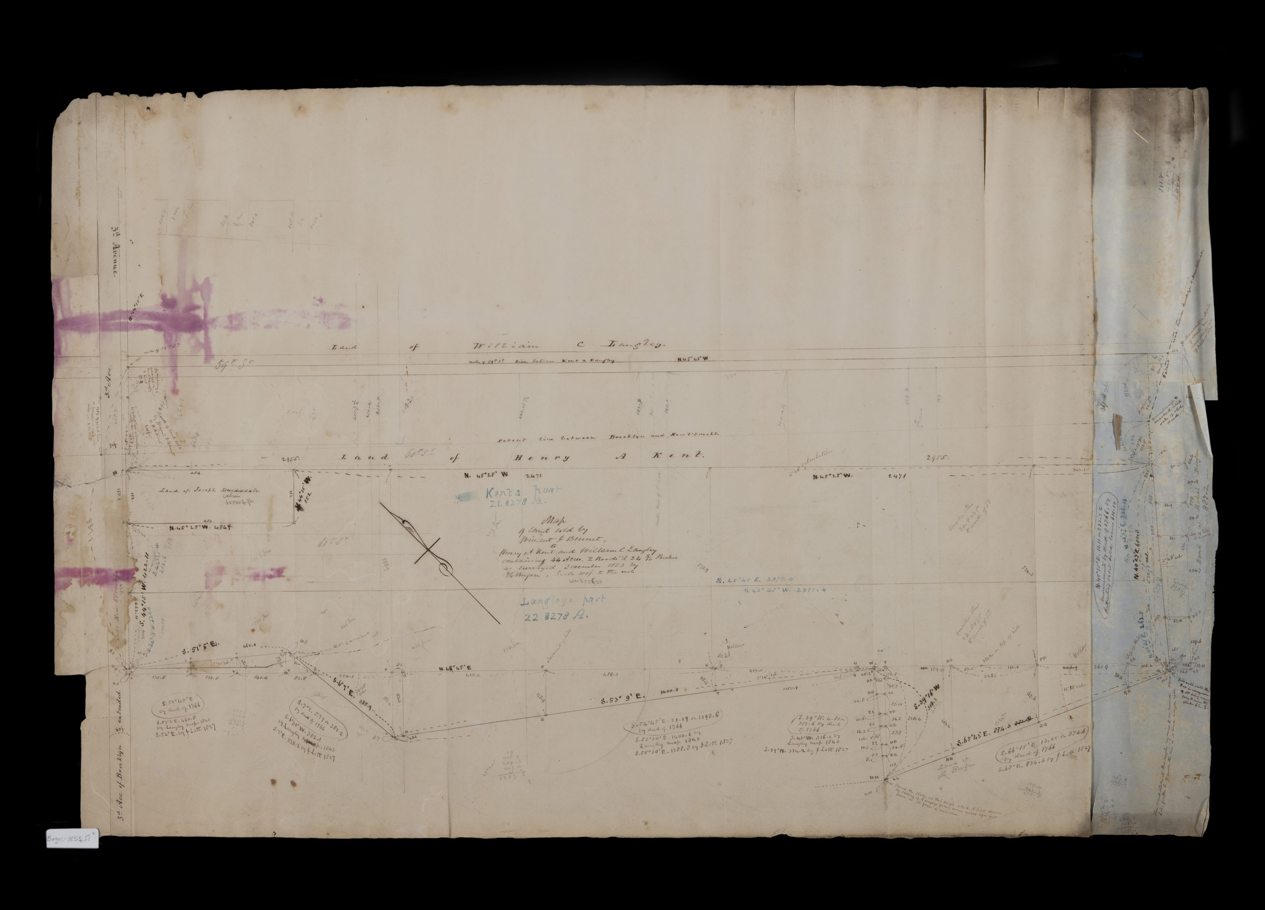
Creator
Bergen, Teunis G.,Publisher
Brooklyn Historical SocietyCitation
Map of land sold by Winant J. Bennet to Henry A. Kent and William C. Langley, containing 44 acres, 2 roods [i.e. rods?] and 24 9/10 perches: as surveyed December 1853: by T.G. Bergen; 1853, Map Collection, Bergen-1853.Fl; Brooklyn Historical Society.Scale
Scale [1:1,200] 1 in to 1Loading zoom image... 