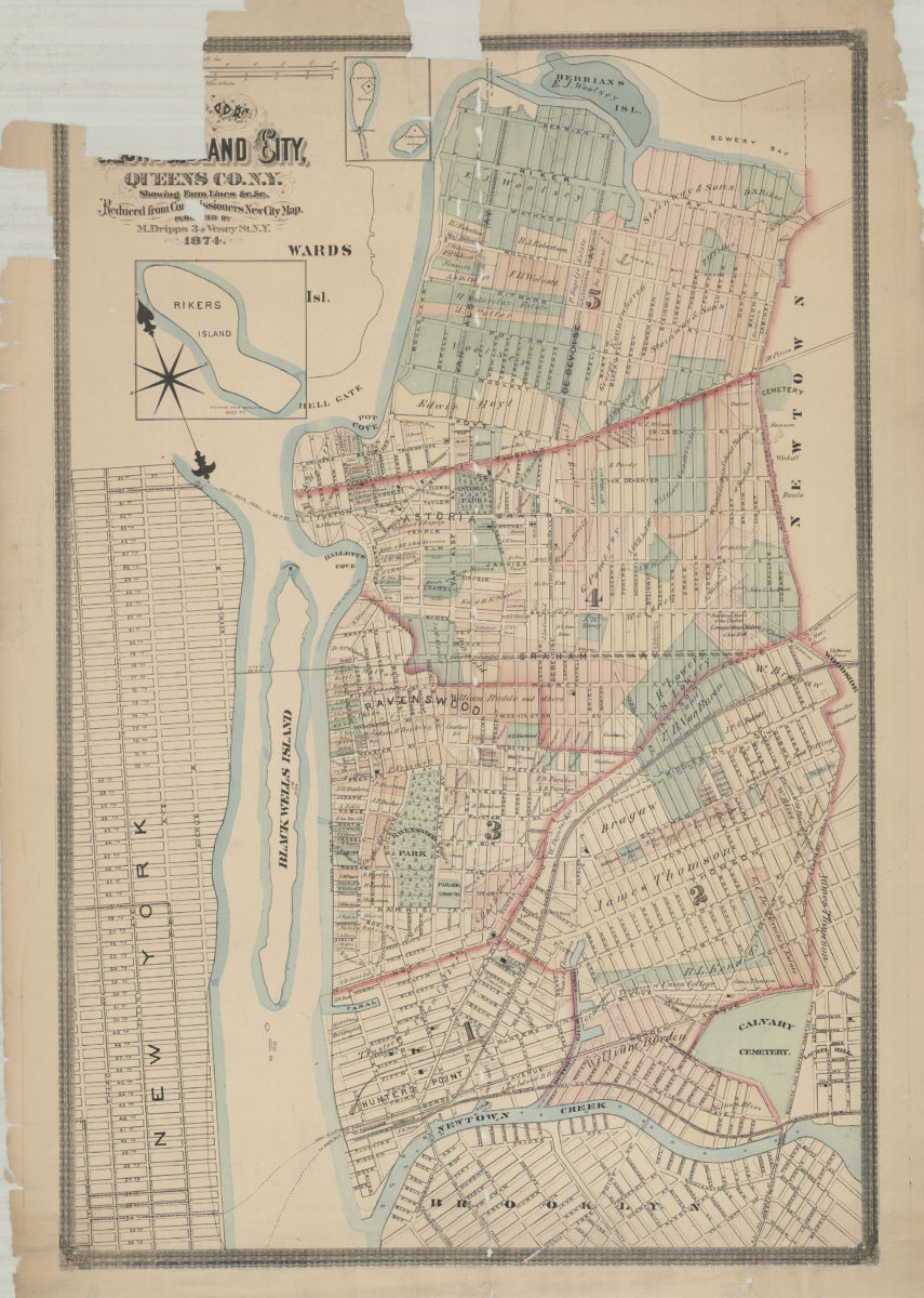
Map of Long Island City, Queens Co. N.Y.: showing farm lines &c. &c.: reduced from Commissioners new city map 1874
Map No. Q-1874.Fl.F;Q-1874.Fl.F c.2
Cadastral map. Shows property lines, a few buildings, owners’ names. Gives some dimensions. Also shows original shoreline, streams, canals and railroads. Includes inset maps of Rikers Island, North and South Brother Islands. NYHS copy lightly soiled. Dissected and mounted on cloth. M009384
Subjects
Places
Map area shown
Genre
Cadastral mapsRelation
Full catalog recordSize
109 × 73 cmDownload
Low Resolution Image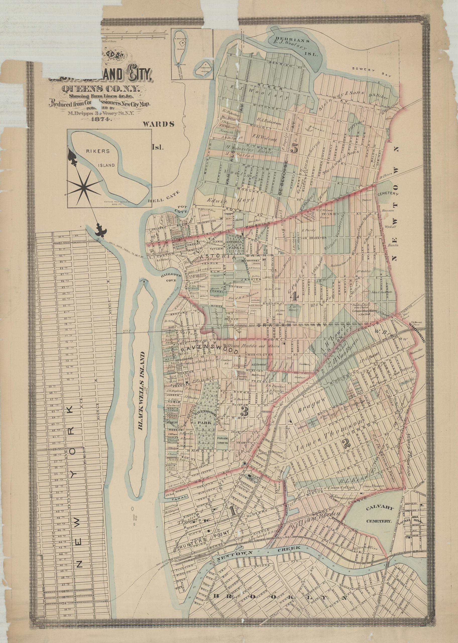
Creator
Dripps, M.,Publisher
Brooklyn Historical SocietyCitation
Map of Long Island City, Queens Co. N.Y.: showing farm lines &c. &c.: reduced from Commissioners new city map; 1874, Map Collection, Q-1874.Fl.F;Q-1874.Fl.F c.2; Brooklyn Historical Society.Scale
Scale 1:7,200Loading zoom image...