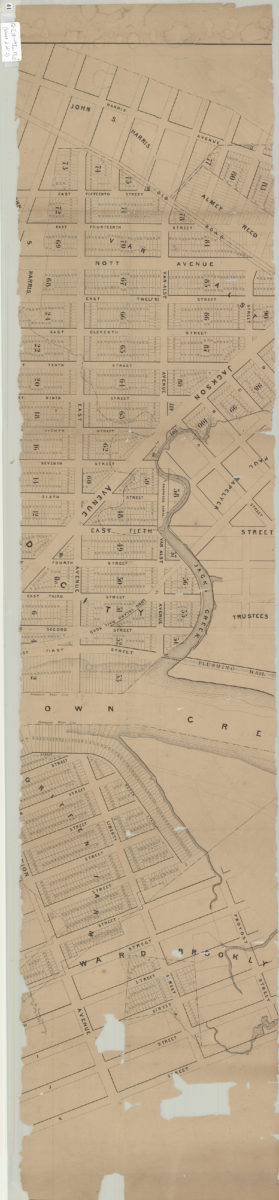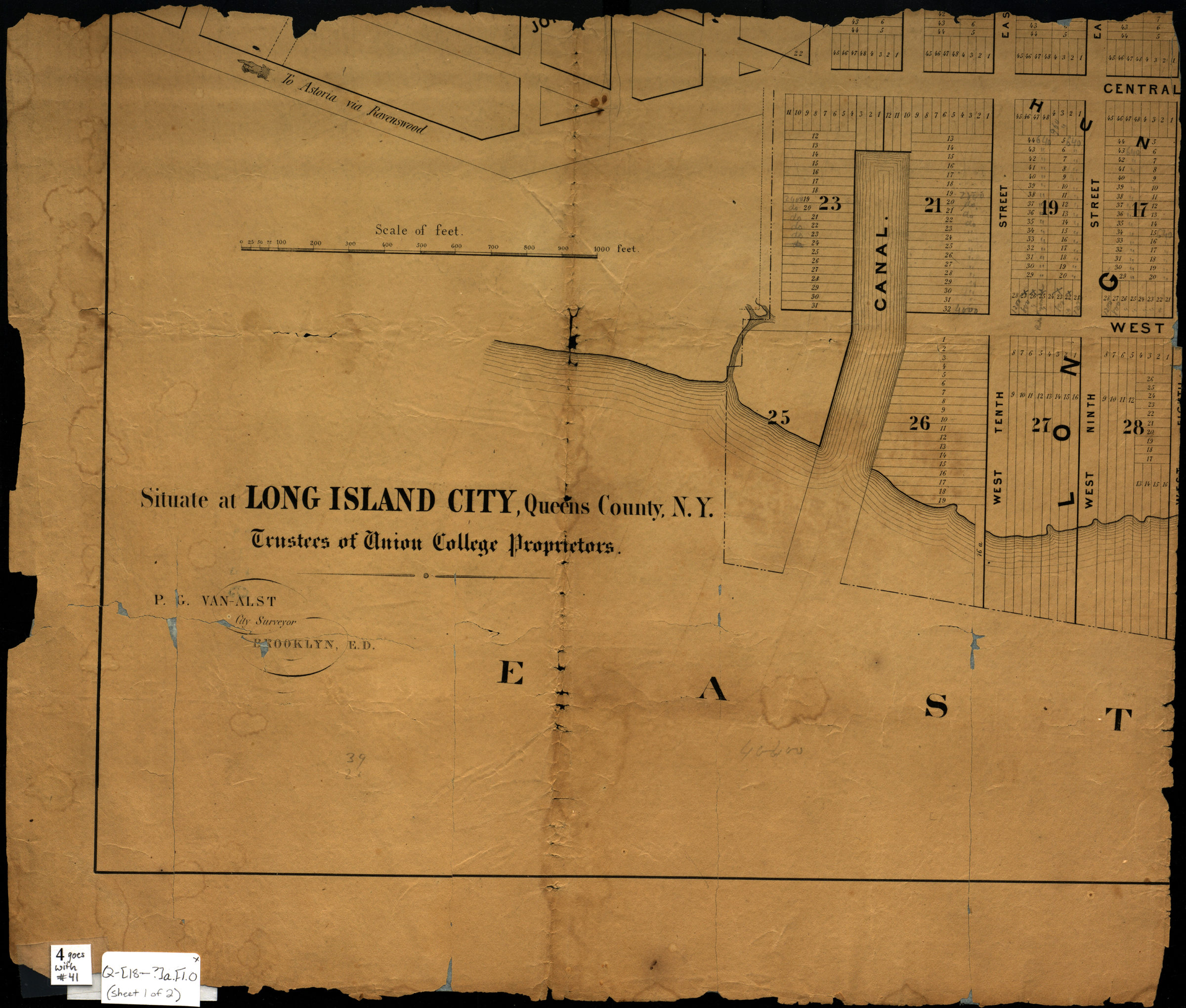

[Map of Long Island Ciy]: P.G. Van-Alst, city surveyor, Brooklyn, E.D. [18??]
Map No. Q-[18--?]a.Fl.O
Cadastral map. Shows property (including block and lot numbers), names of landowners, canals, and railroads. Title devised by cataloger. BHS copy a fragment of complete map cataloger unable to determine what map it came from. BHS copy in 2 pieces: 1st piece is bottom left corner of map, measuring 38 cm. from left neatline, and 31 cm. from bottom neat line 2nd piece is continuation of 1st piece, measuring 26 cm. from top of the 1st piece and across 114 cm. from the left neat line to the right neat line. BHS copy annotated in gray pencil.
Map area shown
Genre
Cadastral mapsRelation
Full catalog recordSize
64 × 114 cmDownload
Low Resolution Image
Creator
Van Alst, P. G.,Publisher
Brooklyn Historical SocietyCitation
[Map of Long Island Ciy]: P.G. Van-Alst, city surveyor, Brooklyn, E.D.; [18??], Map Collection, Q-[18--?]a.Fl.O; Brooklyn Historical Society.Scale
Scale [ca. 1:2,400]Loading zoom image...