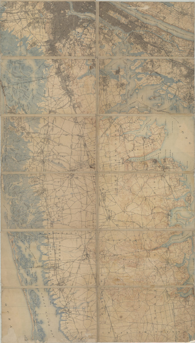
[Map of Long Island, from Greenwood Cemetery to Brentwood] [18??]
Map No. L.I.-[18--?]c.Fl
Also covers portions of eastern New Jersey, Manhattan, the Bronx, and Westchester County. Shows railroads, administrative divisions, cemeteries, ponds, and harbors. Relief shown by contours and spot heights. Title devised by cataloger. Extracted from a larger map? Oriented with north to the upper right.
Places
Map area shown
Genre
Zoning mapsRelation
Full catalog recordSize
60 × 106 cmDownload
Low Resolution Image
Creator
Publisher
Brooklyn Historical SocietyCitation
[Map of Long Island, from Greenwood Cemetery to Brentwood]; [18??], Map Collection, L.I.-[18--?]c.Fl; Brooklyn Historical Society.Scale
Scale not givenLoading zoom image...