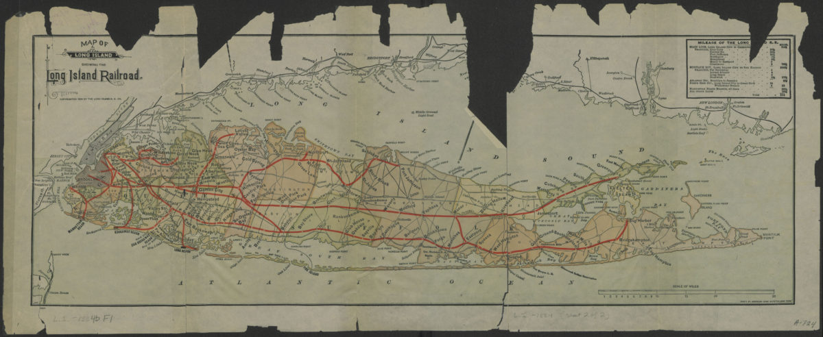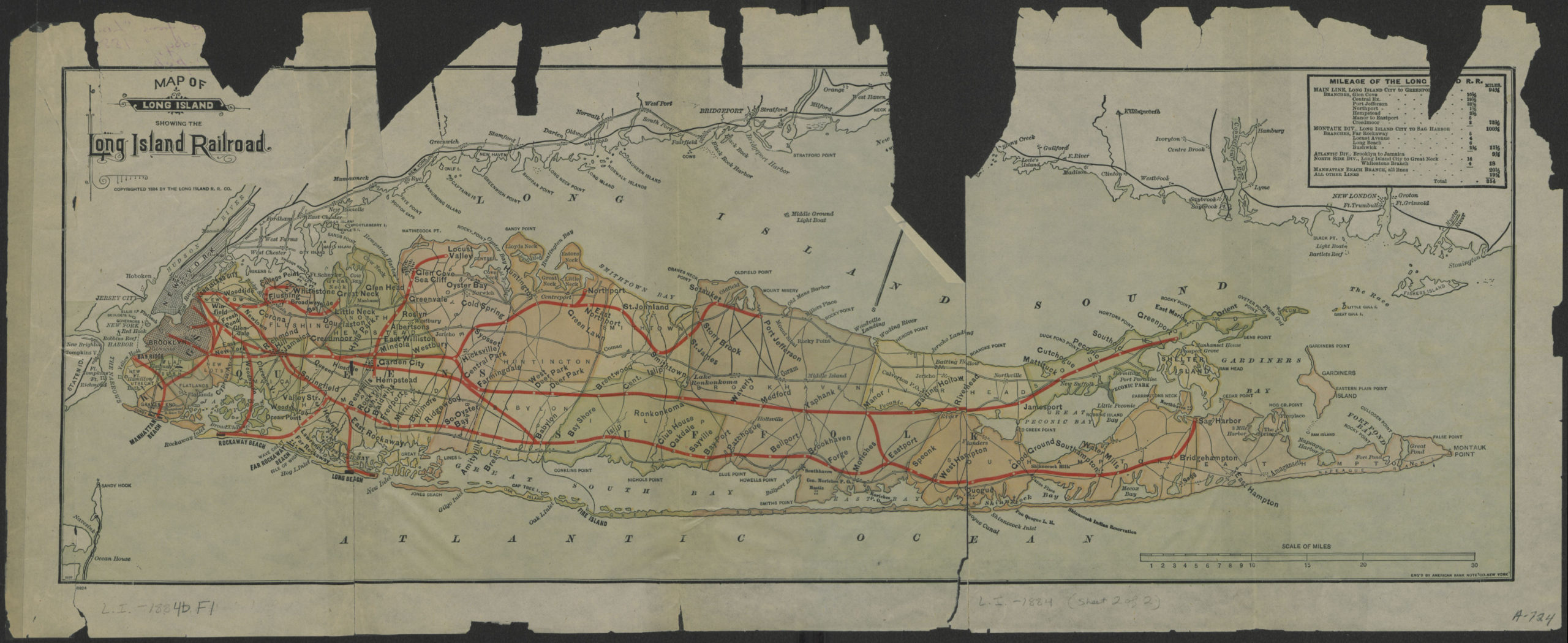
Map of Long Island showing the Long Island Railroad [ca. 1884]
Map No. L.I.-1884b.Fl
Also covers New York City, Long Island Sound, and the southern coast of Connecticut. Shows administrative divisions. Oriented with north to the upper right. “Copyrighted 1884 by the Long Island R.R. Co.” Includes table showing mileage of the Long Island Railroad. “8939”–Lower left corner. “8924”–Lower left margin.
Map area shown
Genre
Transportation mapsRelation
Full catalog recordSize
19 × 53 cmDownload
Low Resolution ImageCreator
Long Island Railroad Company,Publisher
Brooklyn Historical SocietyCitation
Map of Long Island showing the Long Island Railroad; [ca. 1884], Map Collection, L.I.-1884b.Fl; Brooklyn Historical Society.Scale
Scale [ca. 1:394,971]Loading zoom image...