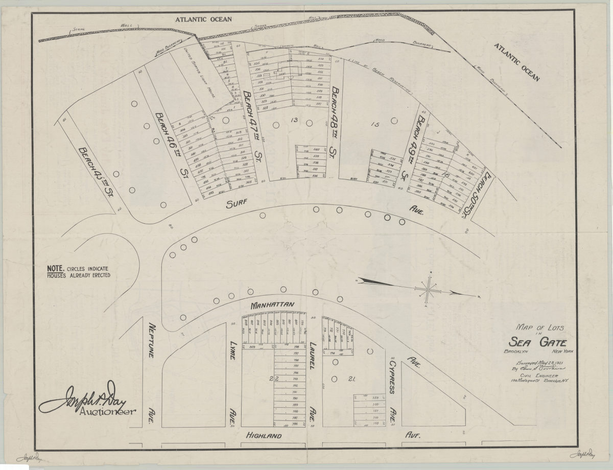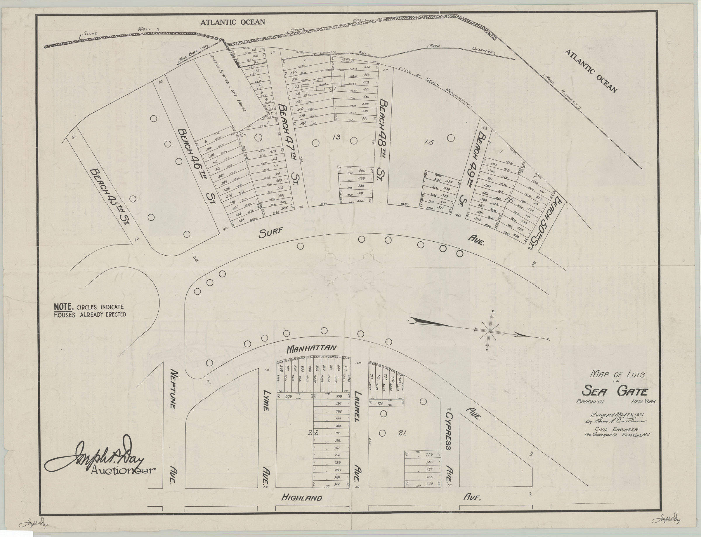
Map of lots in Sea Gate: surveyed May 28, 1921 by Cha[rle]s S. Voorhies 1921
Map No. B P-1921.Fl
Cadastral map covering the area west from Highland Avenue to the shore in the Sea Gate neighborhood. Shows property for sale including block and lot numbers as well as property dimensions. Also shows location of houses already erected. On verso: location map, text, and illustrations. Oriented with north to the right. “Joseph P. Day, auctioneer.”
Map area shown
Genre
Cadastral mapsRelation
Full catalog recordSize
48 × 63 cmDownload
Low Resolution Image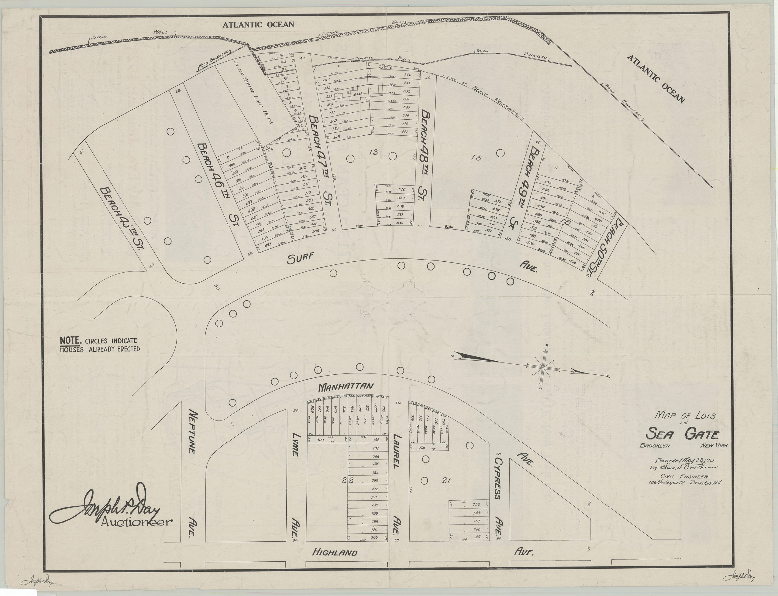
Creator
Voorhies, Charles S.,Publisher
Brooklyn Historical SocietyCitation
Map of lots in Sea Gate: surveyed May 28, 1921 by Cha[rle]s S. Voorhies; 1921, Map Collection, B P-1921.Fl; Brooklyn Historical Society.Scale
Scale not givenLoading zoom image...