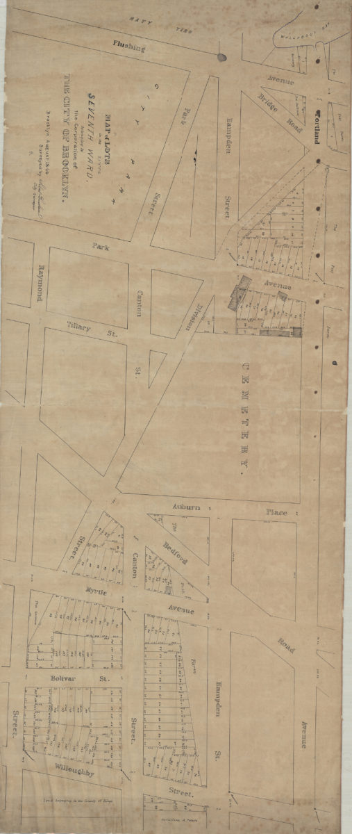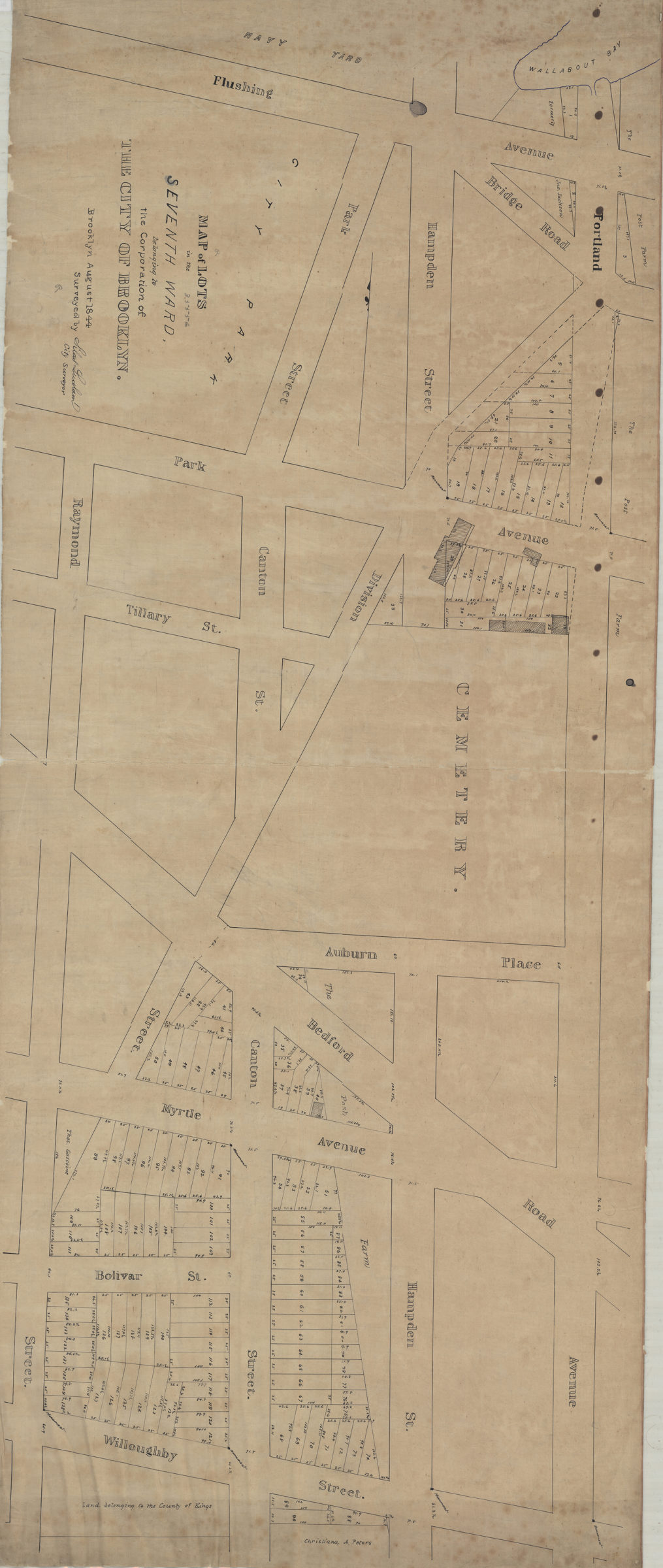
Map of lots in the Seventh Ward belonging to the Corporation of the City of Brooklyn: surveyed by Silas Ludlam, city surveyor August 1844
Map No. B P-1844.Fl
Cadastral map covering area north from Willoughby St. to the Navy Yard and east from Raymond St. to Portland Ave. (modern-day Fort Greene). Shows property (including lot numbers and dimensions), and names of landowners. Oriented with north to the left.
Map area shown
Relation
Full catalog recordSize
56 × 135 cmDownload
Low Resolution Image
Creator
Ludlam, Silas,Publisher
Brooklyn Historical SocietyCitation
Map of lots in the Seventh Ward belonging to the Corporation of the City of Brooklyn: surveyed by Silas Ludlam, city surveyor; August 1844, Map Collection, B P-1844.Fl; Brooklyn Historical Society.Scale
Scale not givenLoading zoom image...