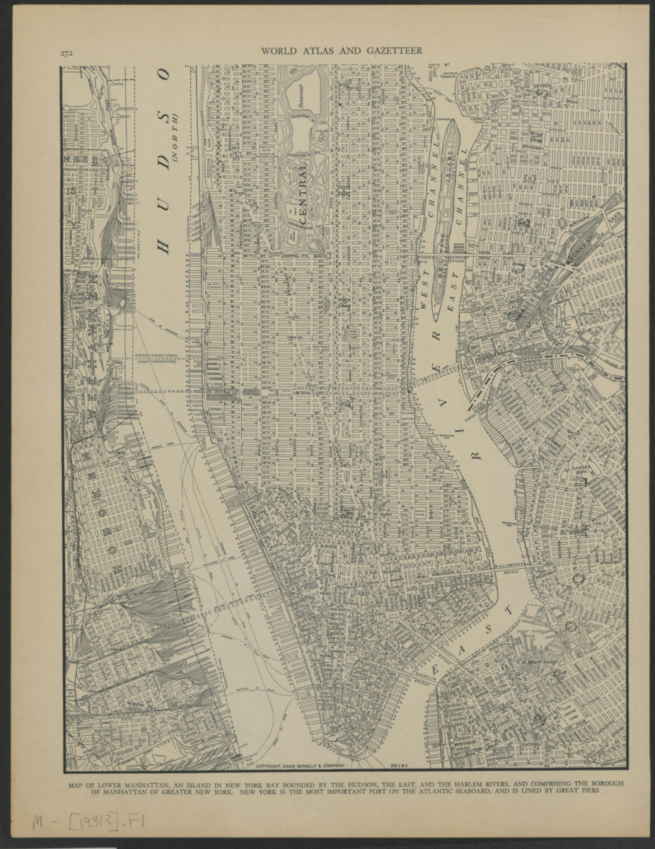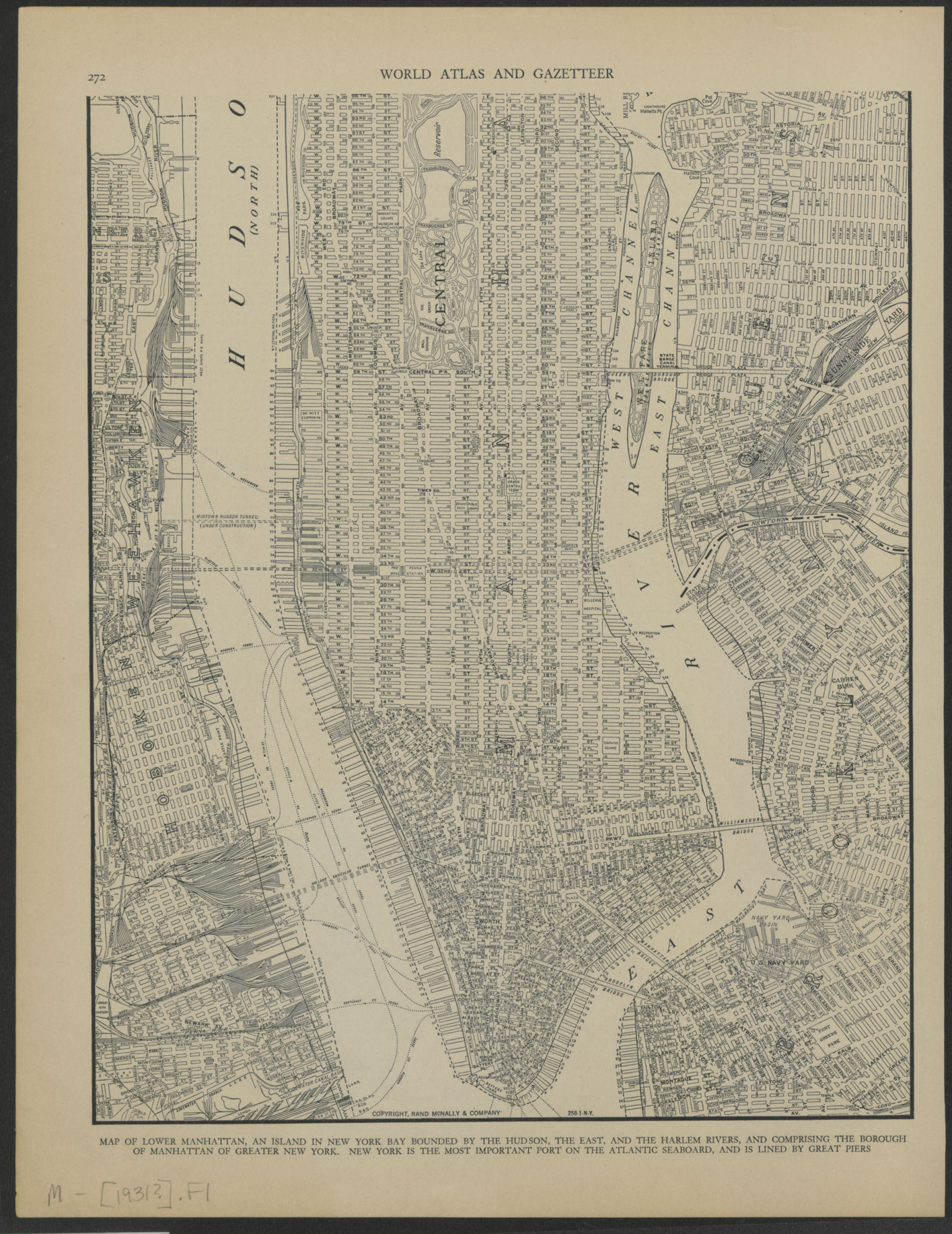
Map of lower Manhattan [ca. 1931]
Map No. M-[1931?].Fl
Street map covers Manhattan south of 96th Street. Also covers a portions of Queens, Brooklyn, and New Jersey. Title from caption. Extracted from an unknown atlas. On verso: text. “258-1-N-Y.”
Map area shown
Genre
MapRelation
Full catalog recordSize
30 × 24 cmDownload
Low Resolution Image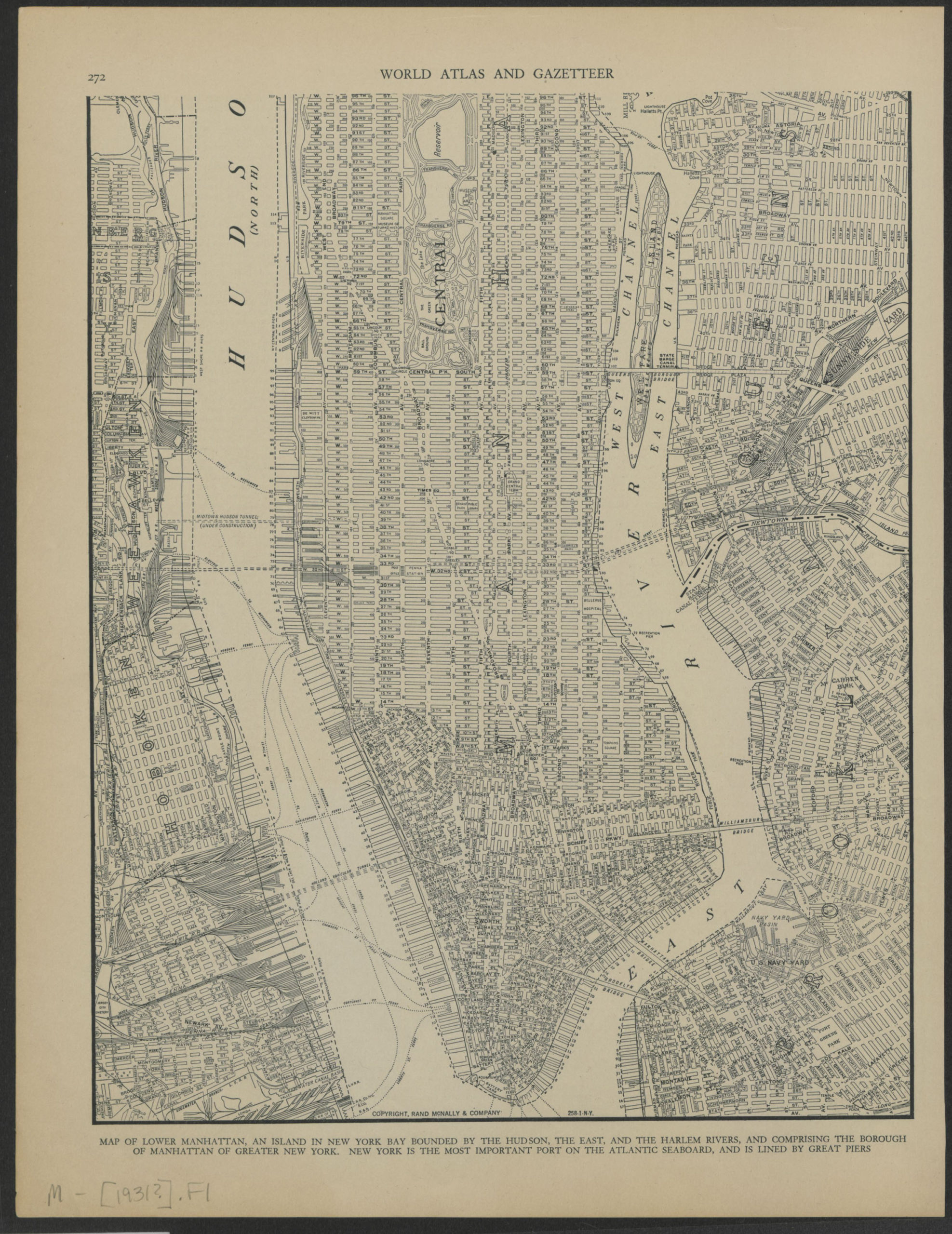
Creator
Rand McNally and Company,Publisher
Brooklyn Historical SocietyCitation
Map of lower Manhattan; [ca. 1931], Map Collection, M-[1931?].Fl; Brooklyn Historical Society.Scale
Scale not givenLoading zoom image...