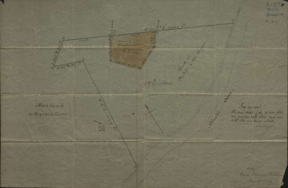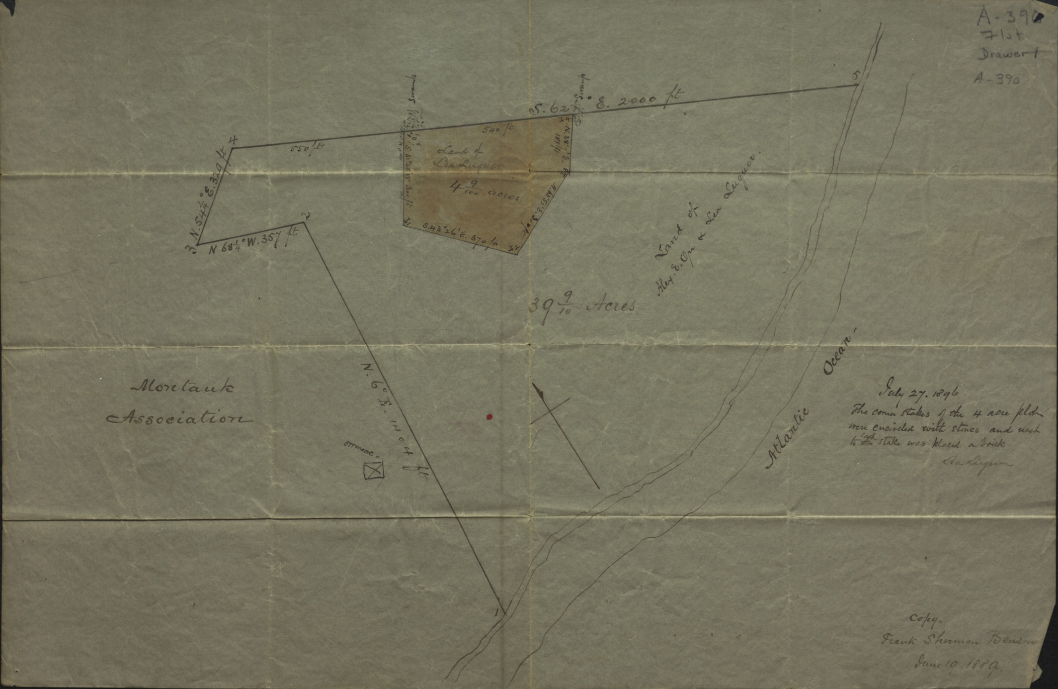
[Map of Luquer property at Montauk]: copy [by] Frank Sherman Benson, June 10, 1889 January 10, 1889
Map No. Luquer-1889.Fl
Cadastral map. Shows property (including dimensions), and names of landowners. Title devised by cataloger. Oriented with north to the upper left. Includes annotation by Lea Luquer, dated July 27, 1896.
Map area shown
Relation
Full catalog recordSize
28 × 43 cmDownload
Low Resolution ImageCreator
Benson, Frank Sherman,Publisher
Brooklyn Historical SocietyCitation
[Map of Luquer property at Montauk]: copy [by] Frank Sherman Benson, June 10, 1889; January 10, 1889, Map Collection, Luquer-1889.Fl; Brooklyn Historical Society.Scale
Scale not givenLoading zoom image...