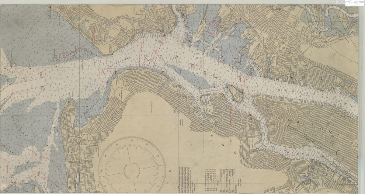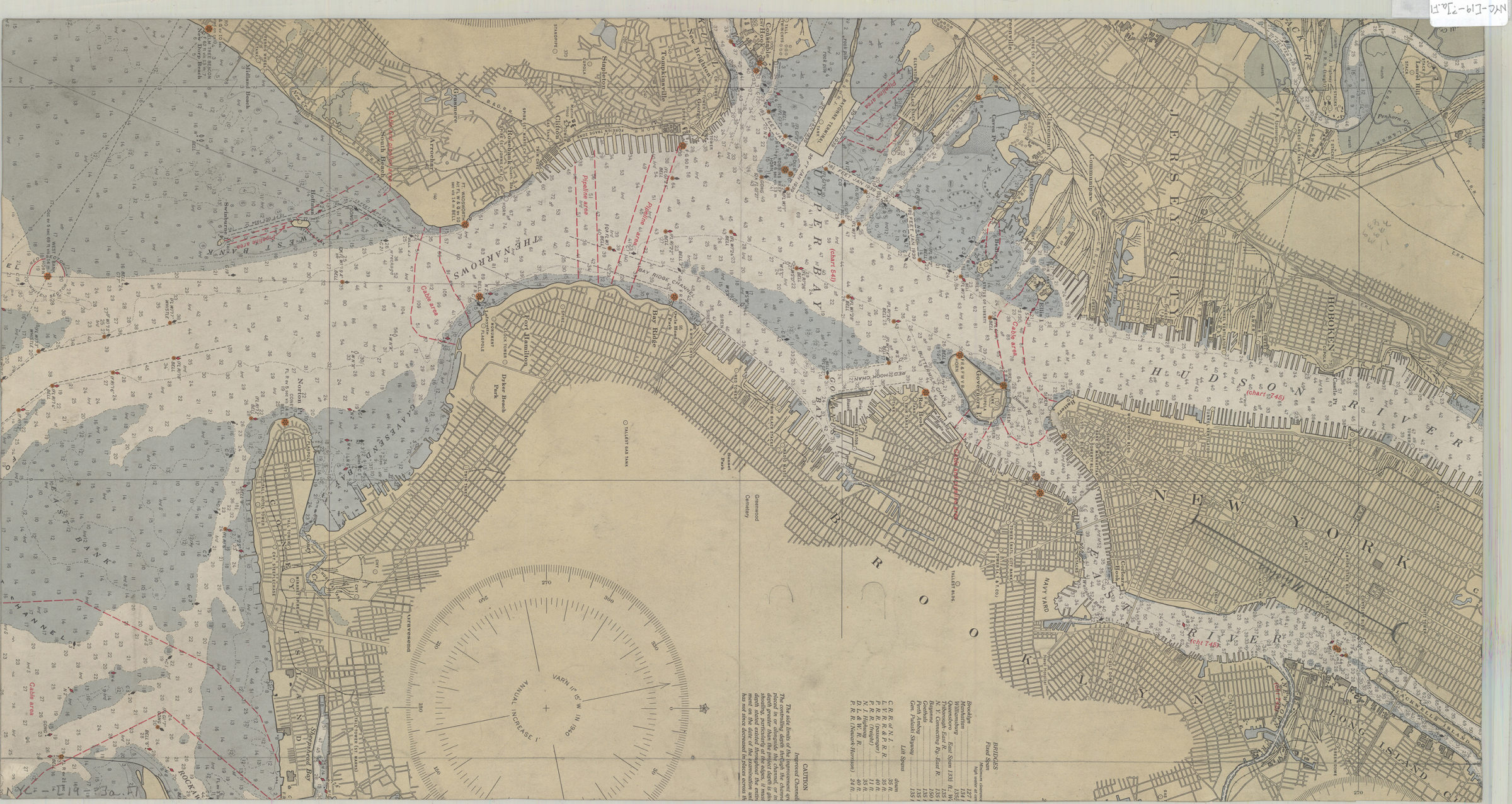

[Map of Mahattan south of Central Park, eastern edge of Brooklyn, southwest edge of New Jersey, and the nothwest edge of Staten Island] [19??]
Map No. NYC-[19-?]a.Fl
Depth shown by soundings. BHS copy is a portion of a larger map.
Map area shown
Genre
Bathymetric mapsRelation
Full catalog recordSize
67 × 35 cmDownload
Low Resolution Image
Creator
Publisher
Brooklyn Historical Society, Brooklyn Historical SocietyCitation
[Map of Mahattan south of Central Park, eastern edge of Brooklyn, southwest edge of New Jersey, and the nothwest edge of Staten Island]; [19??], Map Collection, NYC-[19-?]a.Fl; Brooklyn Historical Society.Scale
Scale not givenLoading zoom image...