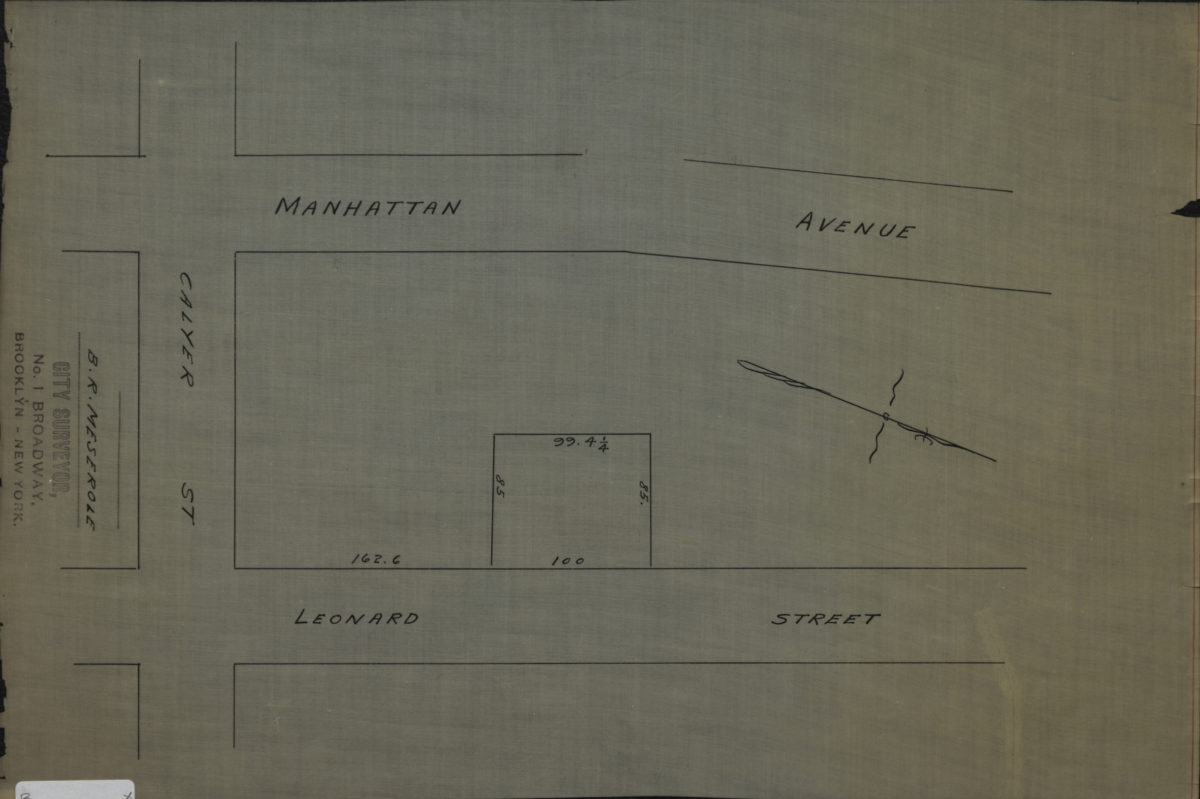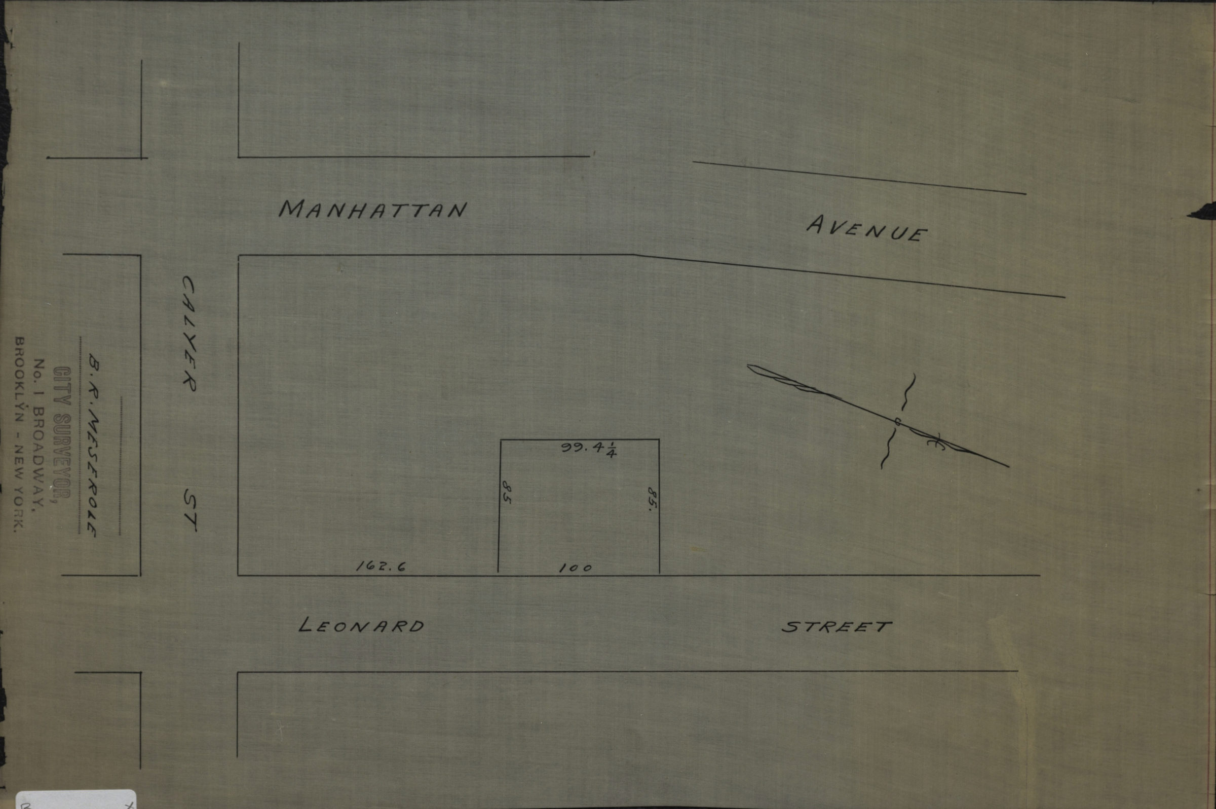
[Map of Manhattan Ave. and Leonard St. at Calyer St.]: B.R. Meserole, city surveyor [189?]
Map No. B P-[189-?]g.Fl
Cadastral map covering modern-day Greenpoint. Shows property (including dimensions). Title devised by cataloger. Oriented with north to the lower right.
Map area shown
Relation
Full catalog recordSize
26 × 39 cmDownload
Low Resolution Image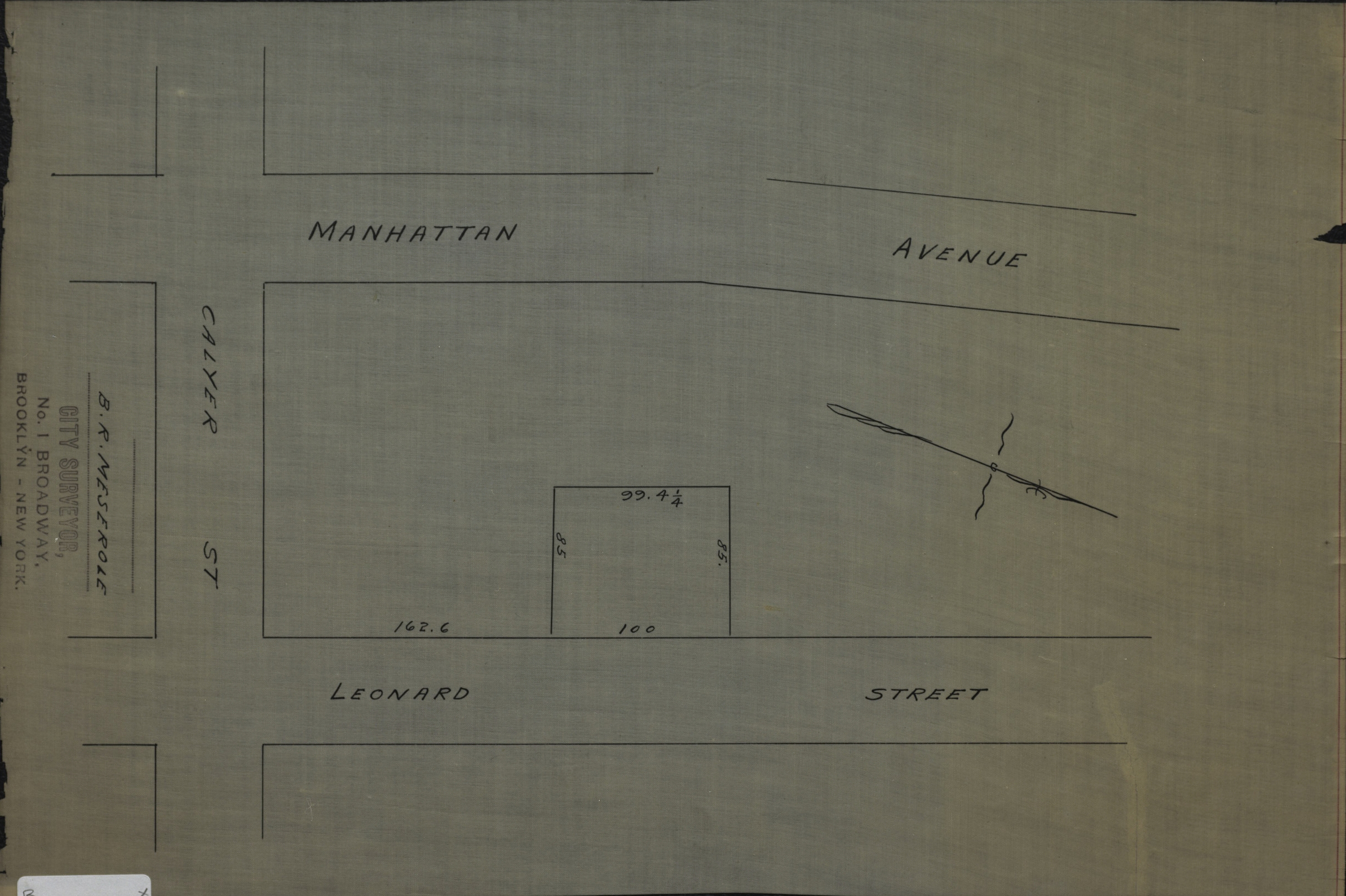
Creator
Publisher
Brooklyn Historical Society, Brooklyn Historical SocietyCitation
[Map of Manhattan Ave. and Leonard St. at Calyer St.]: B.R. Meserole, city surveyor; [189?], Map Collection, B P-[189-?]g.Fl; Brooklyn Historical Society.Scale
Scale not givenLoading zoom image...