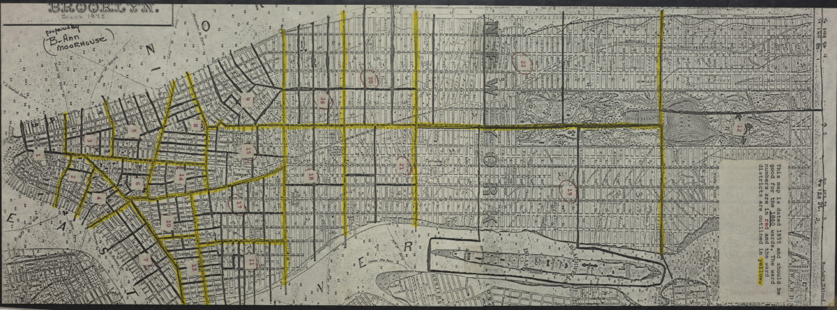
[Map of Manhattan, from the Battery to 114th St.]. [19??]
Map No. M-[1873?] (19--?).Fl
Shows wards, names of landowners, bulkhead lines, and pier lines. Depths shown by soundings. Title devised by cataloger. Extracted from an unknown map. BHS copy annotated in red and yellow ink.
Map area shown
Genre
MapRelation
Full catalog recordSize
60 × 22 cmDownload
Low Resolution Image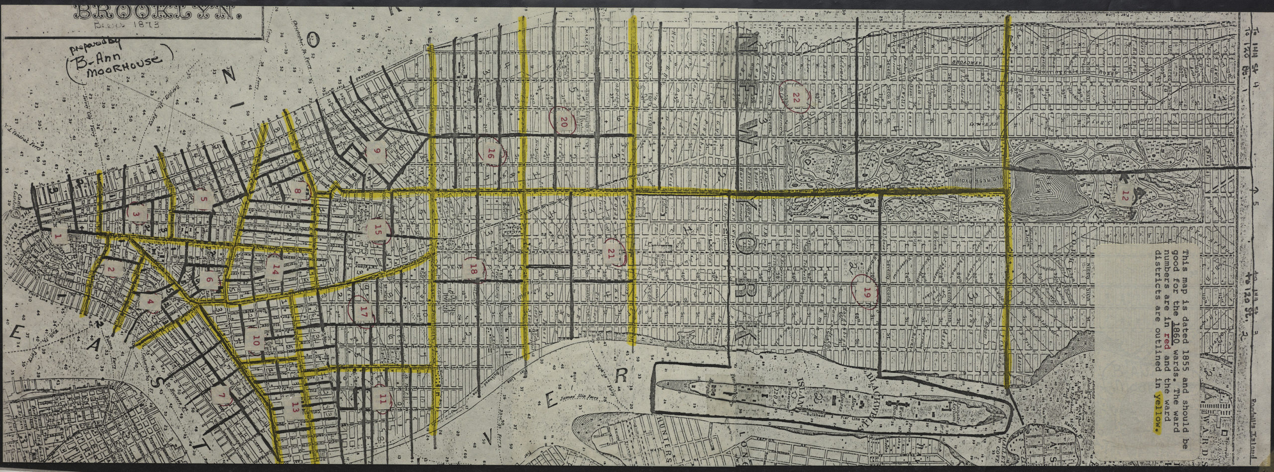
Creator
Publisher
Brooklyn Historical SocietyCitation
[Map of Manhattan, from the Battery to 114th St.].; [19??], Map Collection, M-[1873?] (19--?).Fl; Brooklyn Historical Society.Scale
Scale not givenLoading zoom image...