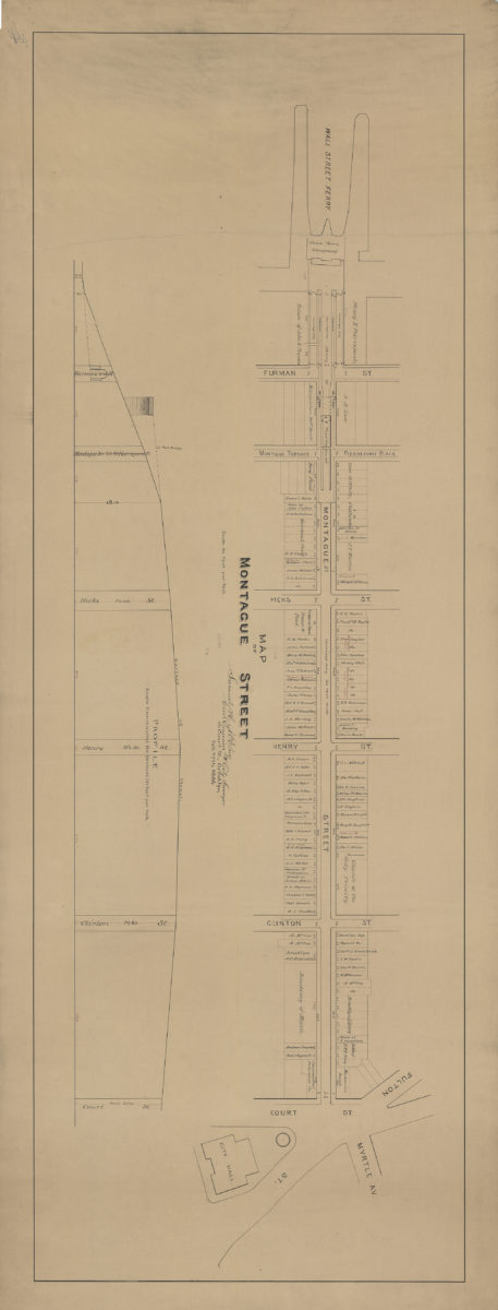
Map of Montague Street: [by] Samuel H. McElroy, civil engineer & city surveyor February 27, 1886
Map No. B P-1886.Fl.O
Cadastral map covering area in modern-day Brooklyn Heights. Shows property (including lots and dimensions), and names of landowners. Includes profile (Vertical scale [1:240]. 20 ft. per in.).
Subjects
Places
Map area shown
Relation
Full catalog recordSize
44 × 124 cmDownload
Low Resolution Image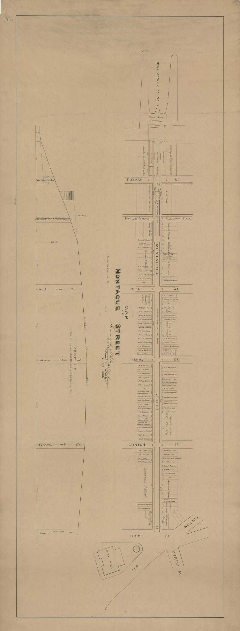
Creator
McElroy, Samuel,Publisher
Brooklyn Historical SocietyCitation
Map of Montague Street: [by] Samuel H. McElroy, civil engineer & city surveyor; February 27, 1886, Map Collection, B P-1886.Fl.O; Brooklyn Historical Society.Scale
Scale [1:960] 1 in to 80Loading zoom image...