Map of Montrose in Queen’s County, Long Island [184?]
Map No. L.I.-[184-?]a.Fl;L.I.-[184-?]a.Fl c.2
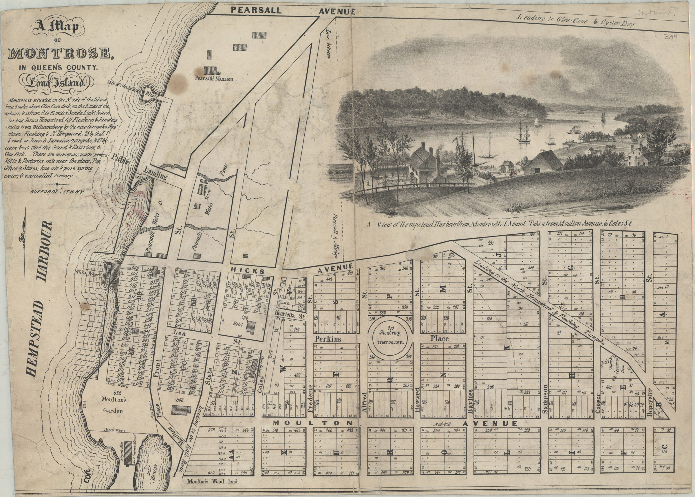
Cadastral map covering the Montrose Estate in modern-day Roslyn Harbor. Shows property (including lots numbers and dimensions), buildings, names of landowners, and wharves. Date of publication conjectured from active dates of Bufford’s Lith. Includes text and titled ill. Titled ill.: A view of Hempstead Harbour (from Montrose) L.I. Sound. Taken from Moulton Avenue & Cotes St. BHS has 2 copies.
Map area shown
Genre
Cadastral mapsRelation
Full catalog recordSize
42 × 57 cmDownload
Low Resolution Image
Creator
Bufford, John Henry,Publisher
Brooklyn Historical SocietyCitation
Map of Montrose in Queen’s County, Long Island; [184?], Map Collection, L.I.-[184-?]a.Fl;L.I.-[184-?]a.Fl c.2; Brooklyn Historical Society.Scale
Scale not givenLoading zoom image... 