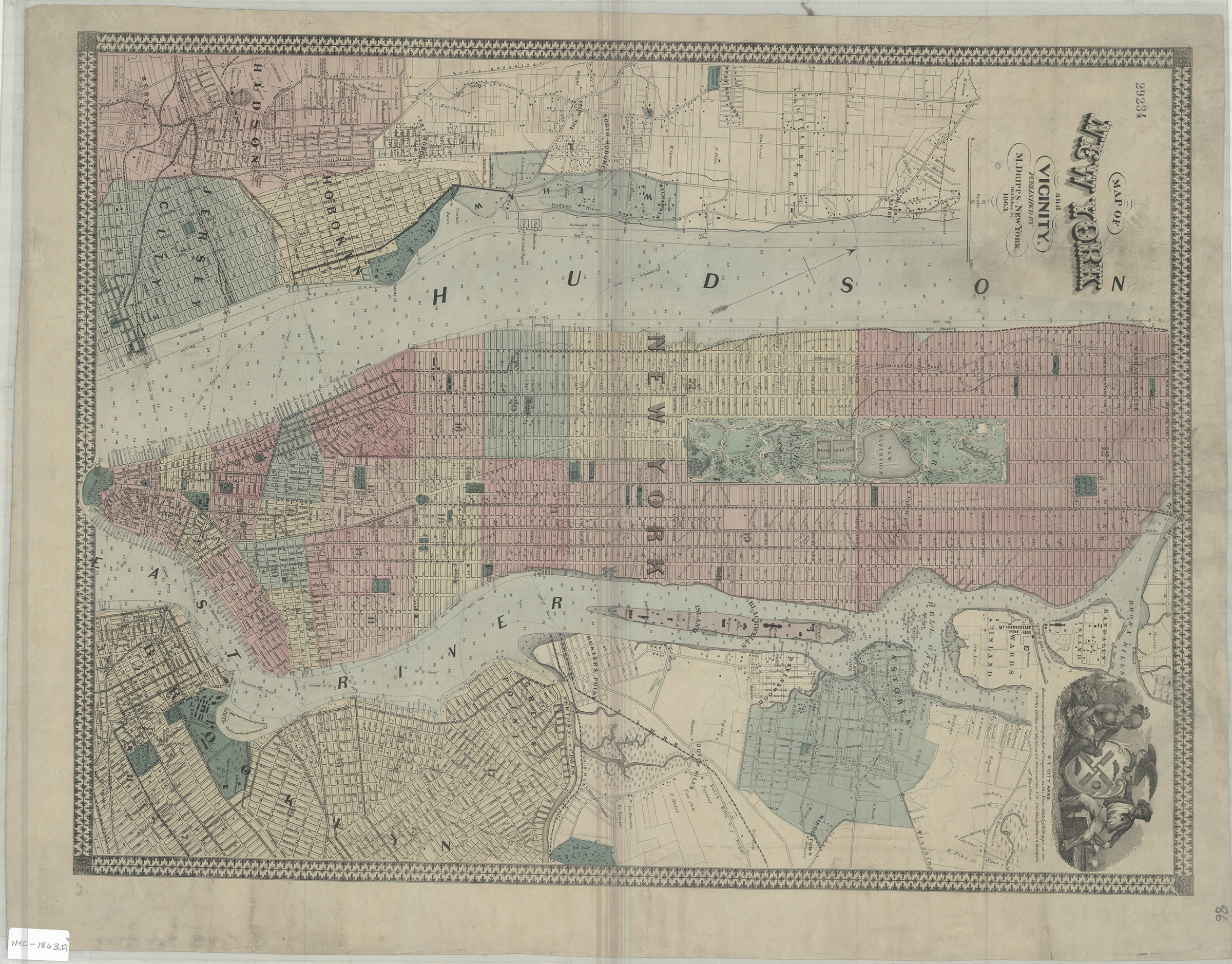
Map of New York and vicinity 1863
Map No. NYC-1863.Fl
Covers New York metropolitan area from Hudson County, New Jersey east to Astoria, Queens and the southern tip of Manhattan north to 135th St. Shows wards, streets, piers and ferry routes. Depths shown by soundings. Includes ill. in upper right corner. In original purple cloth cover. BHS copy missing cover, mounted on linen.
Map area shown
Genre
Bathymetric mapsRelation
Full catalog recordSize
66 × 50 cmDownload
Low Resolution Image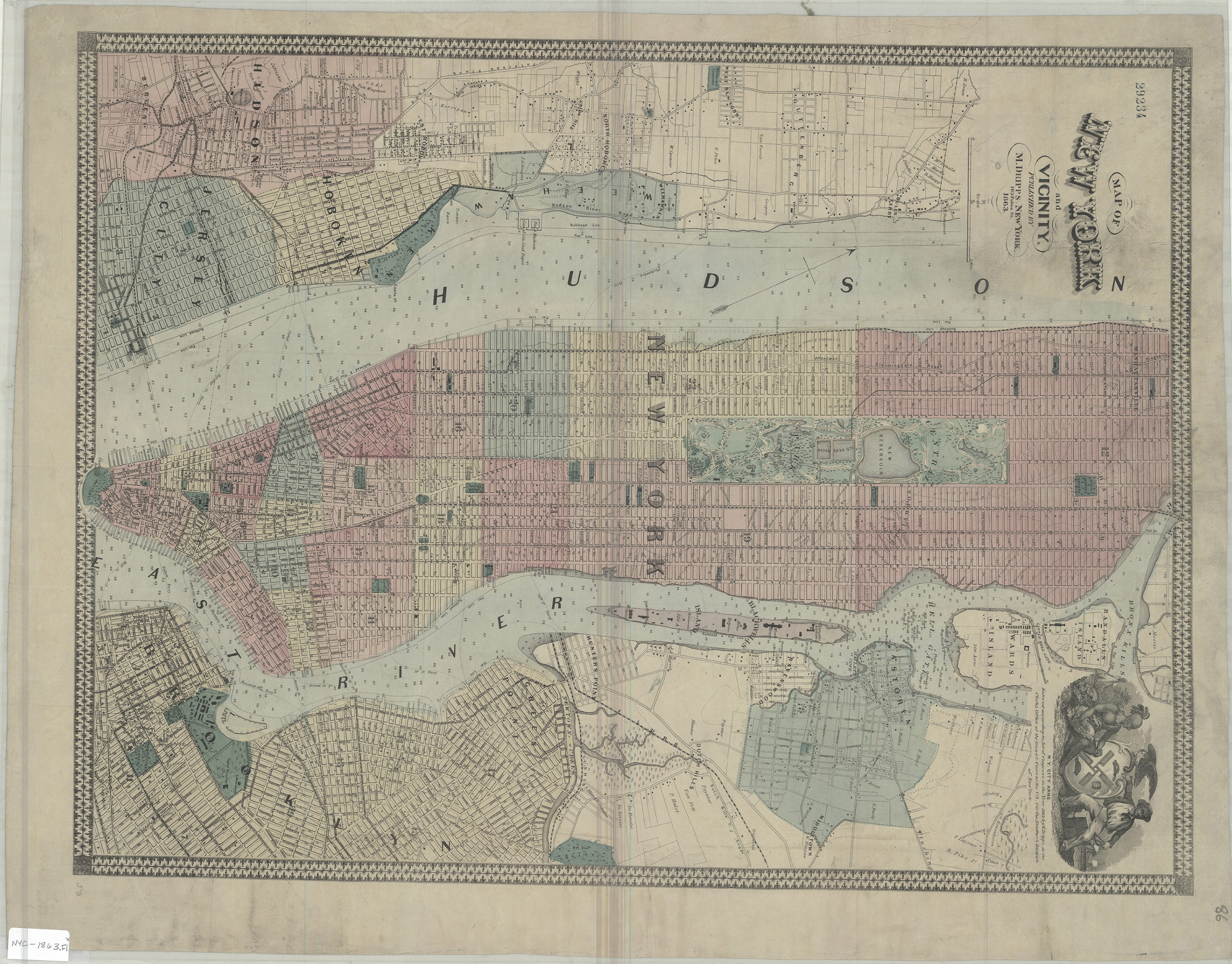
Creator
Dripps, M.,Publisher
Brooklyn Historical SocietyCitation
Map of New York and vicinity; 1863, Map Collection, NYC-1863.Fl; Brooklyn Historical Society.Scale
Scale [ca. 1:23,040]Loading zoom image... 