[Map of New York metropolitan area] [189?]
Map No. NYC-[189-?].Fl
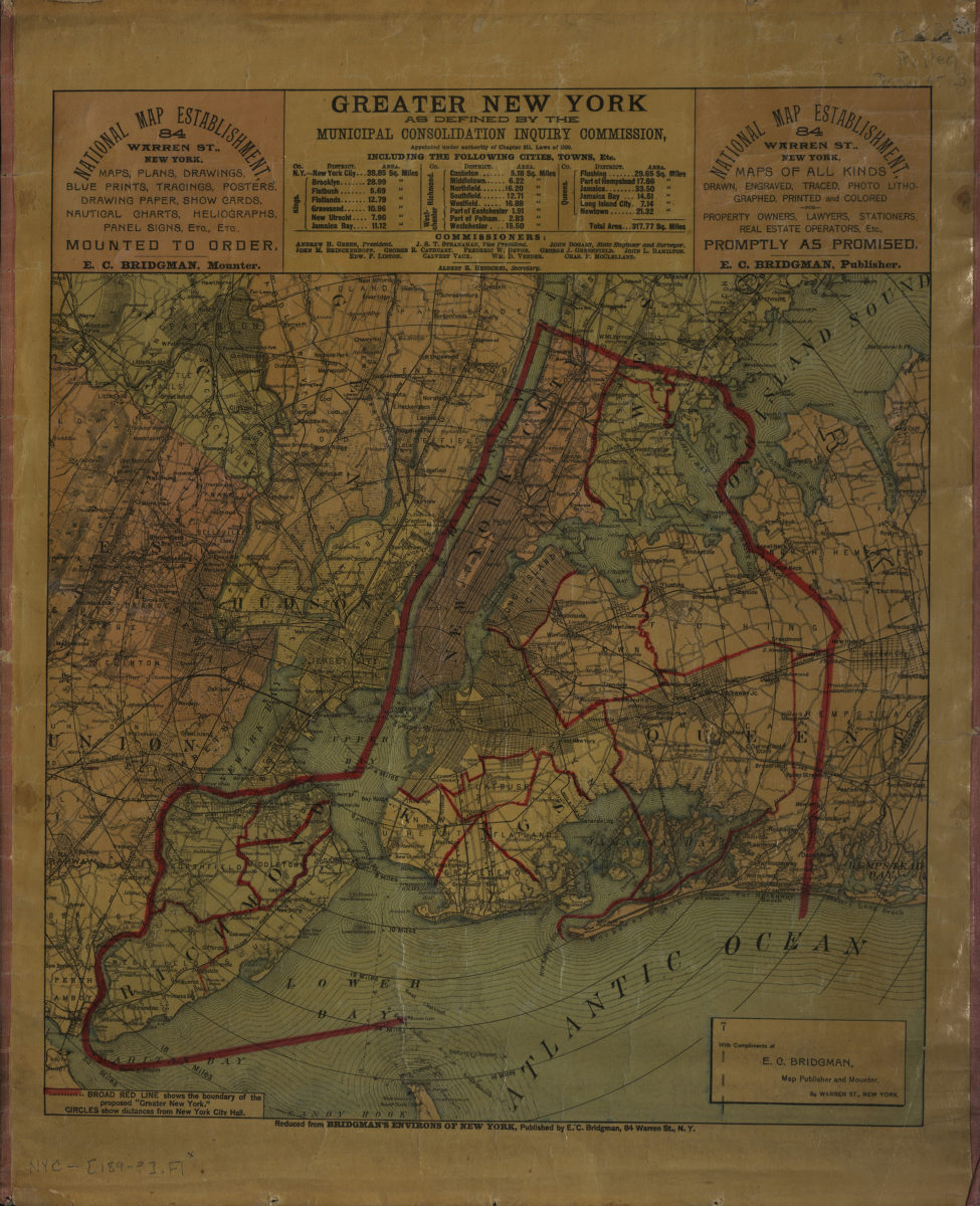
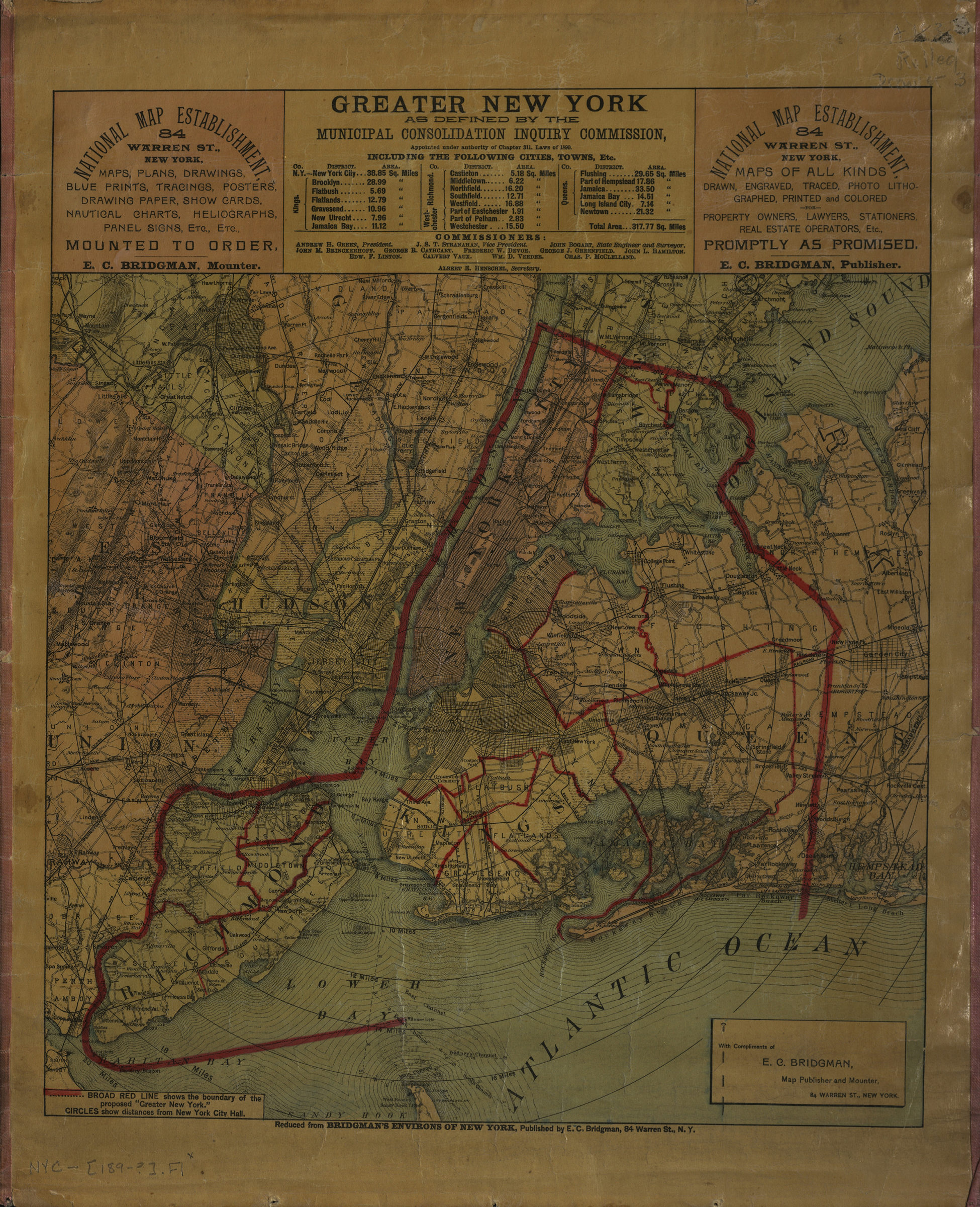
Covers New York City as well as portions of the following counties: Nassau, Westchester, Hudson, Bergen, Passaic, Essex, Union, and Middlesex. Shows counties, distances from New York City Hall, and the boundary of the proposed Greater New York (outlined in red). Relief shown by hachures. Title devised by cataloger. “Reduced from Bridgman’s Environs of New York, published by E.C. Bridgman …” “With compliments of E.C. Bridgman, map publisher and mounter …” Includes text and advertisements. BHS copy has publisher’s stamp and 2 cent stamp on verso.
Map area shown
Genre
MapRelation
Full catalog recordSize
44 × 36 cmDownload
Low Resolution Image
Creator
Bridgman, E. C.,Publisher
Brooklyn Historical SocietyCitation
[Map of New York metropolitan area]; [189?], Map Collection, NYC-[189-?].Fl; Brooklyn Historical Society.Scale
Scale not givenLoading zoom image...