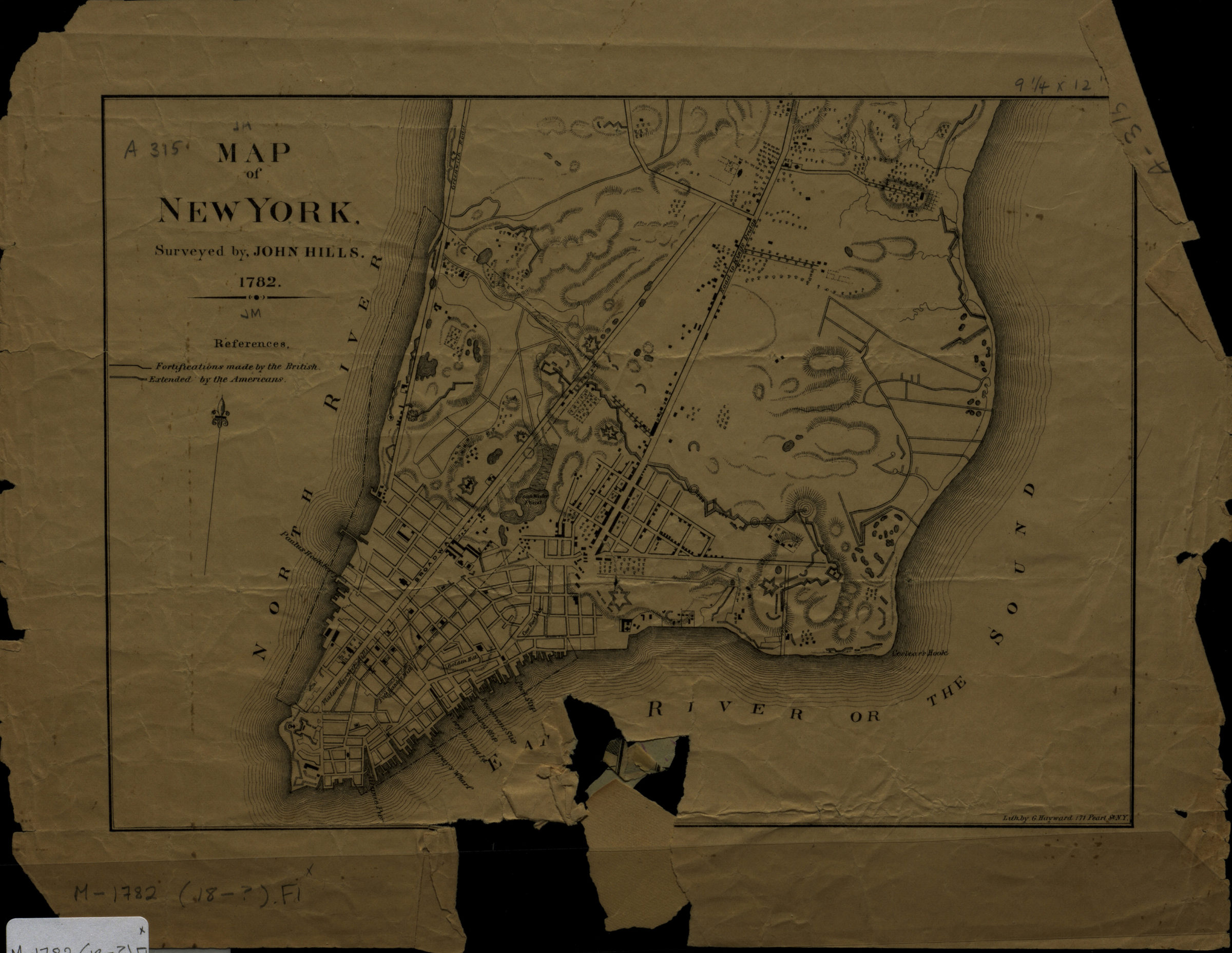
Map of New York: surveyed by John Hills [1890]
Map No. M-1782 (18--?).Fl
Facsimile covering lower Manhattan. Shows fortifications made by the British and extended by the Americans, streets, slips and piers. Relief shown by hachures. Includes key.
Map area shown
Genre
MapRelation
Full catalog recordSize
18 × 26 cmDownload
Low Resolution Image
Creator
Hills, John,Publisher
Brooklyn Historical SocietyCitation
Map of New York: surveyed by John Hills; [1890], Map Collection, M-1782 (18--?).Fl; Brooklyn Historical Society.Scale
Scale not givenLoading zoom image... 