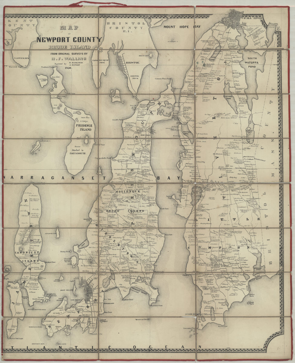
Map of Newport County: from original surveys: by H.F. Walling ; assisted by O. Harkness [and] J. Hanson 1850
Map No. RI-1850.Fd
Covers area north from Brenton’s Reef to Mount Hope Bay and east from Warwick Neck to Bristol County. Shows names of landowners. Relief shown by hachures. BHS copy missing portion of map neat line and border interrupted on left side. Left edge measures 6 cm. west from Canonicut Point.
Map area shown
Genre
Cadastral mapsRelation
Full catalog recordSize
76 × 62 cmDownload
Low Resolution Image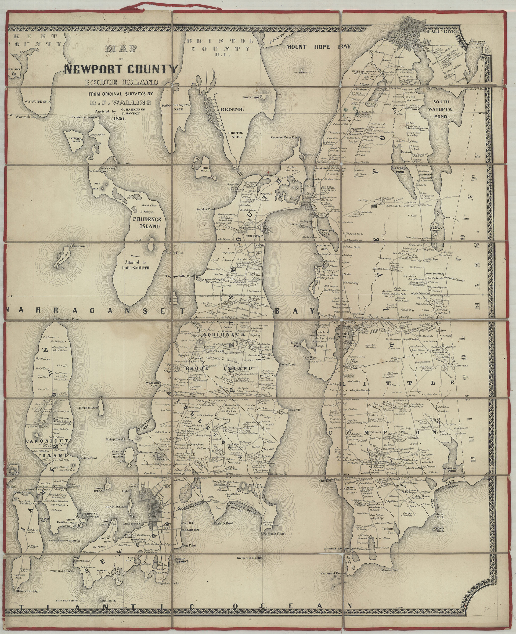
Creator
Walling, Henry Francis,Publisher
Brooklyn Historical SocietyCitation
Map of Newport County: from original surveys: by H.F. Walling ; assisted by O. Harkness [and] J. Hanson; 1850, Map Collection, RI-1850.Fd; Brooklyn Historical Society.Scale
Scale not givenLoading zoom image...