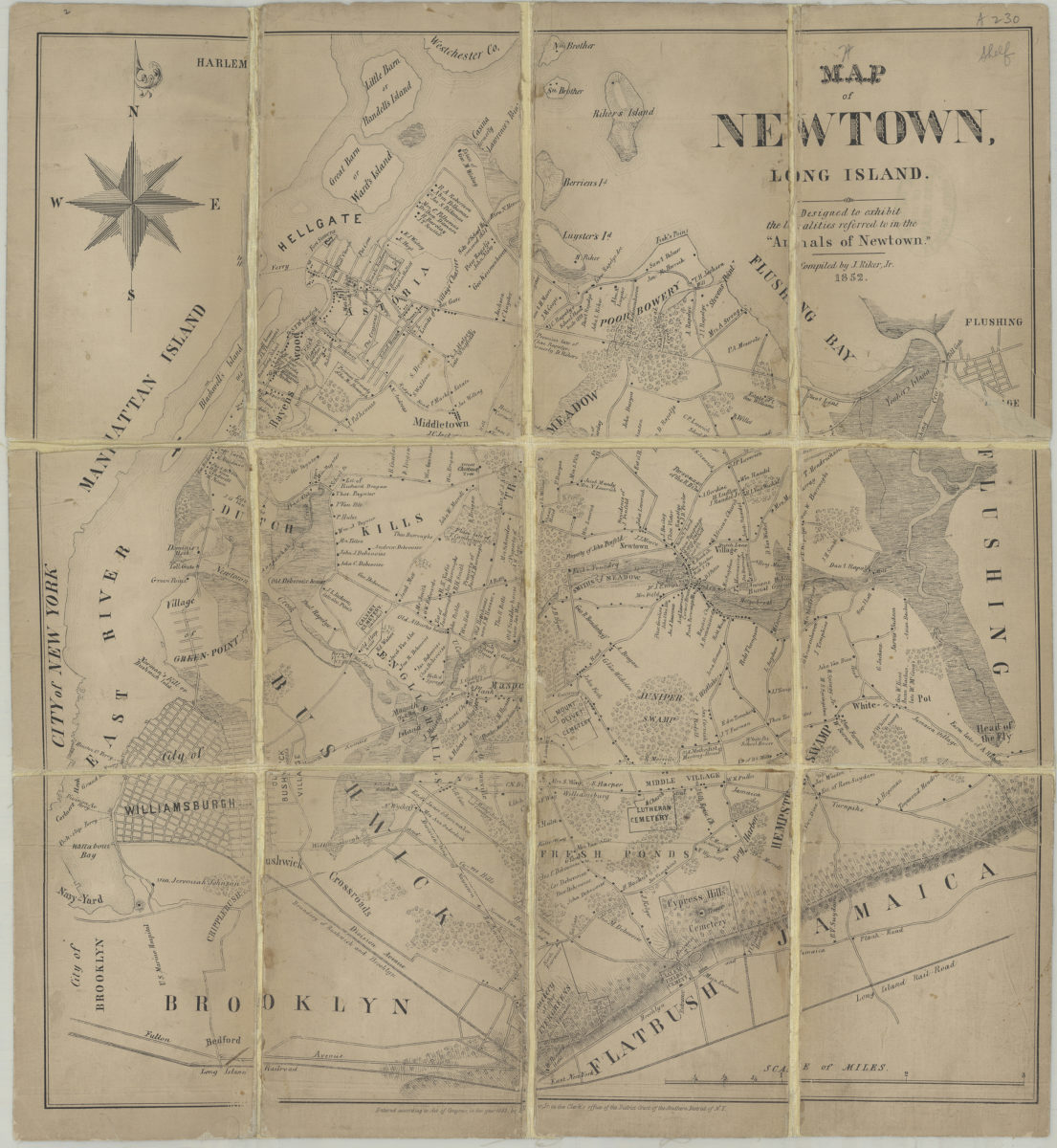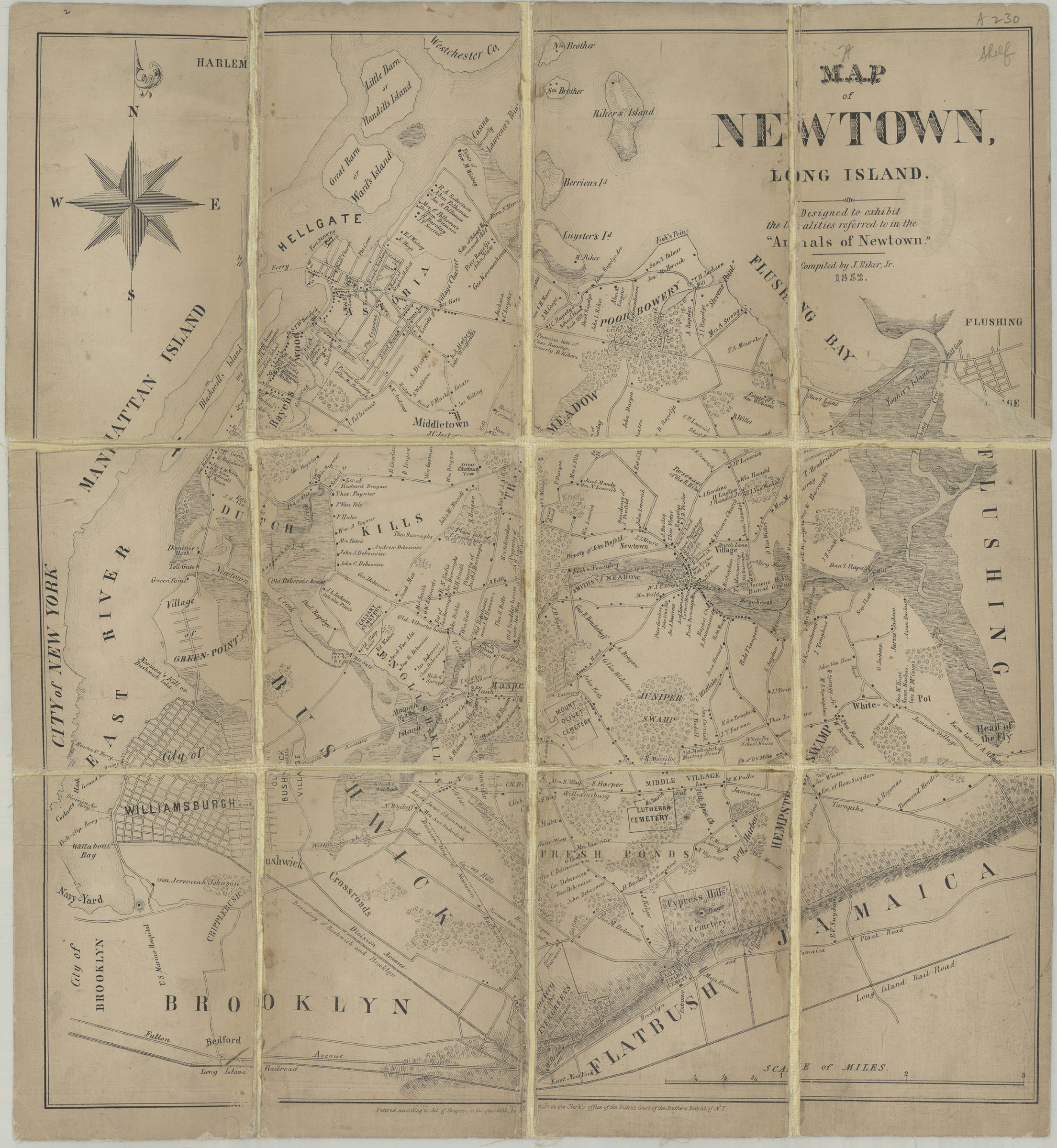
Map of Newtown, Long Island: designed to exhibit the [loc]alities referred to in the “Annals of Newtown”: compiled by J. Riker, Jr 1852
Covers area east from the East River to Flushing and north from the Cemetery of the Evergreens to Lawrence’s Point. Shows Williamsburgh, Bushwick, Green-Point, and a portion of Brooklyn. Also covers Rikers Island, North and South Brother Islands, Little Barn or Randells Island, Great Barn or Ward’s Island, Blackwell’s Island, and portions of Manhattan and Westchester Co. Shows names of property owners, cemeteries, schools, public buildings, swamps, and the Long Island Railroad. Relief shown by hachures. “Entered according to Act of Congress, in the year 1852 by [J. Riker?] Jr. in the Clerk’s office of the District Court of the Southern District of N.Y.” BHS copy imperfect missing portion of title and deposit statement. Portion of title inferred from: Map of Newtown, Long Island : designed to exhibit the localities referred to in the “Annals of Newtown” / compiled by J. Riker, Jr. [New York] : J. Riker, Jr., 1852. Portion of deposit statement conjectured by cataloger based on statement of responsibility.
Map area shown
Genre
Cadastral mapsRelation
Full catalog recordSize
48 × 44 cmDownload
Low Resolution Image
Creator
Riker, James,Publisher
Brooklyn Historical SocietyCitation
Map of Newtown, Long Island: designed to exhibit the [loc]alities referred to in the “Annals of Newtown”: compiled by J. Riker, Jr; 1852, Map Collection, Q-1852.Fl; Brooklyn Historical Society.Scale
Scale [ca. 1:47,520]