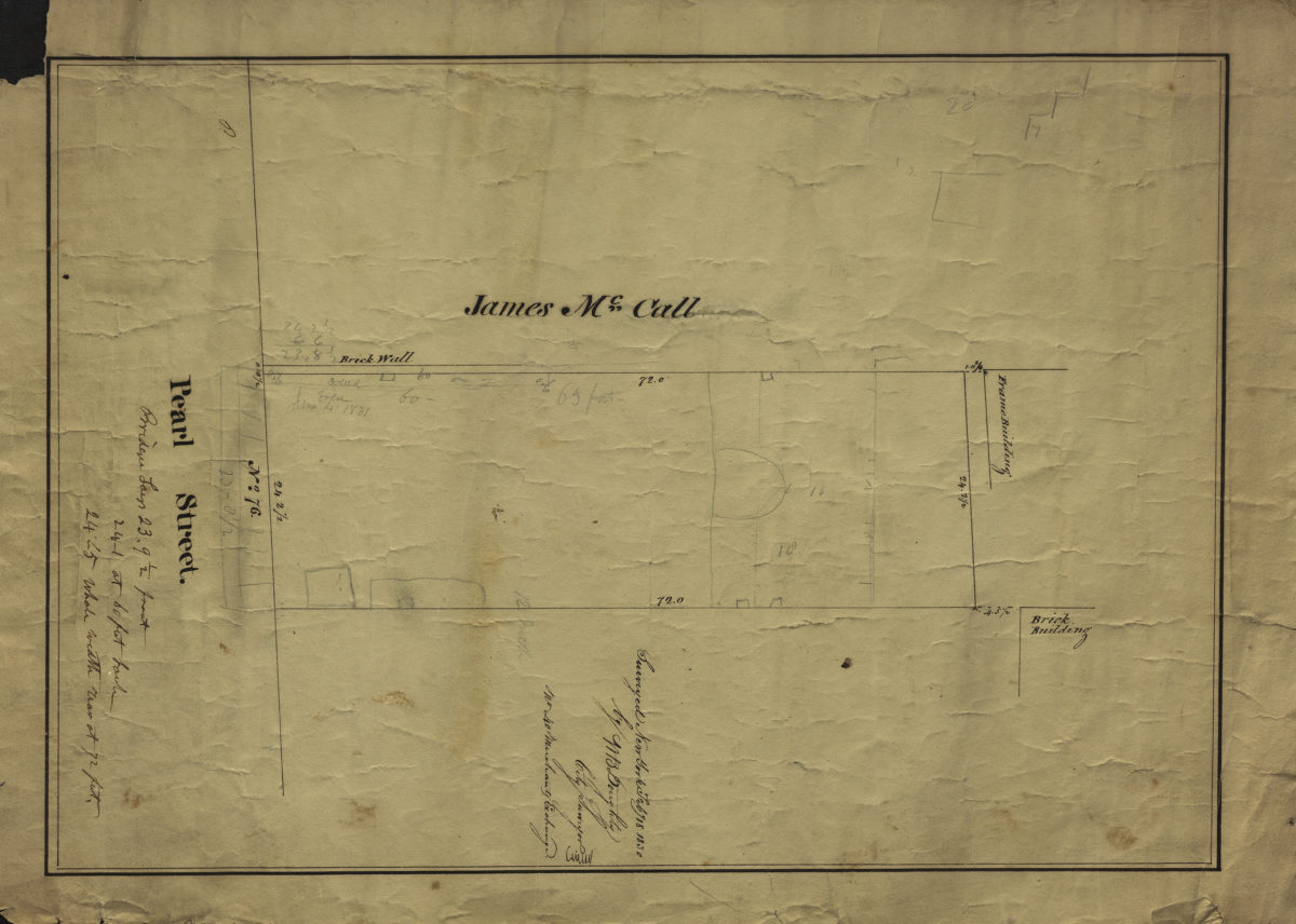
[Map of No. 76 Pearl St.]: surveyed … by M.B. Doughty, city surveyor February 18, 1830
Map No. B P-1830b.Fl
Cadastral map covering area in modern-day DUMBO. Shows property (including buildings and dimensions), and land of James McCall. Title devised by cataloger. Includes notes.
Map area shown
Relation
Full catalog recordSize
38 × 26 cmDownload
Low Resolution Image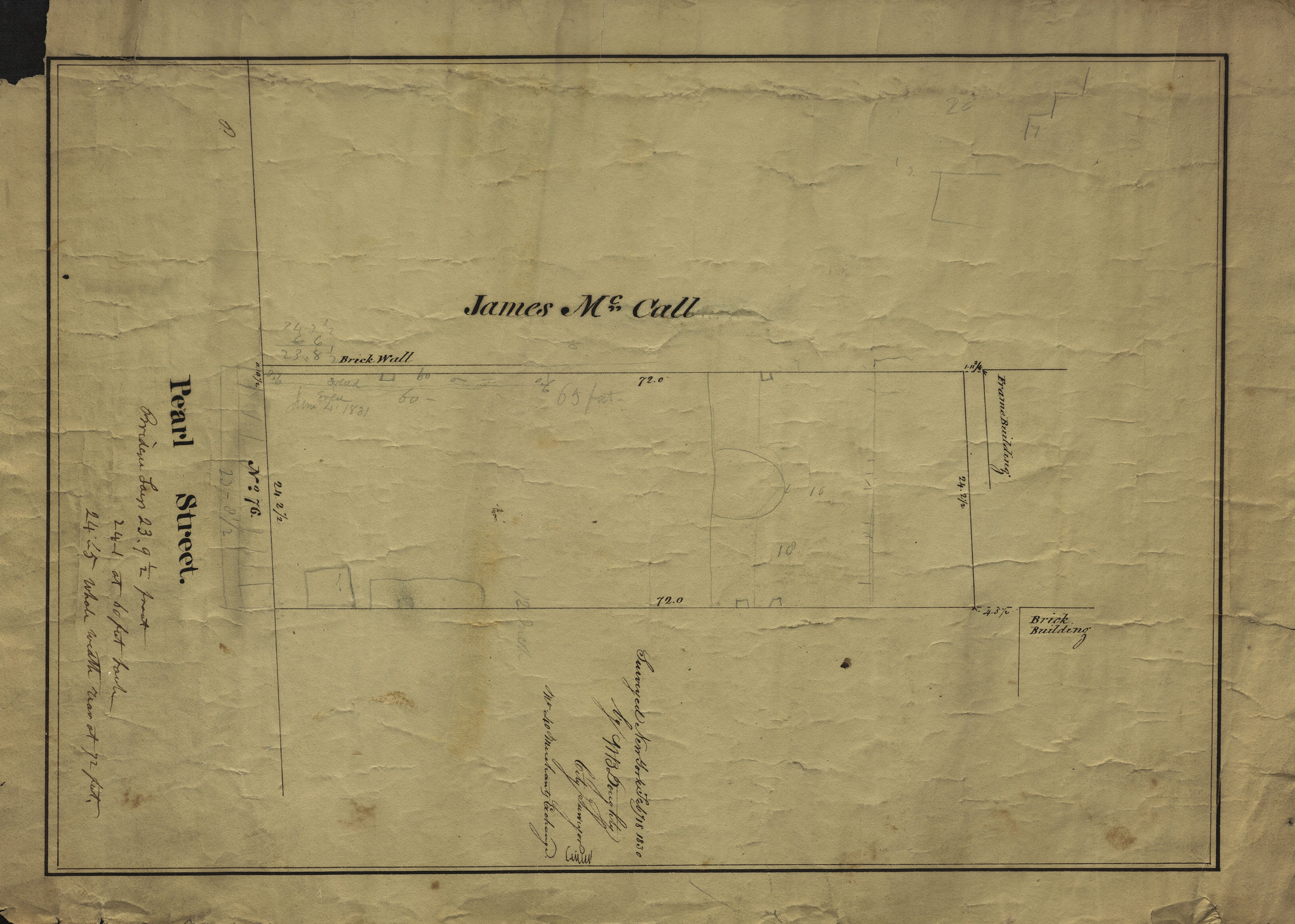
Creator
Doughty, M. B.,Publisher
Brooklyn Historical SocietyCitation
[Map of No. 76 Pearl St.]: surveyed … by M.B. Doughty, city surveyor; February 18, 1830, Map Collection, B P-1830b.Fl; Brooklyn Historical Society.Scale
Scale not givenLoading zoom image...