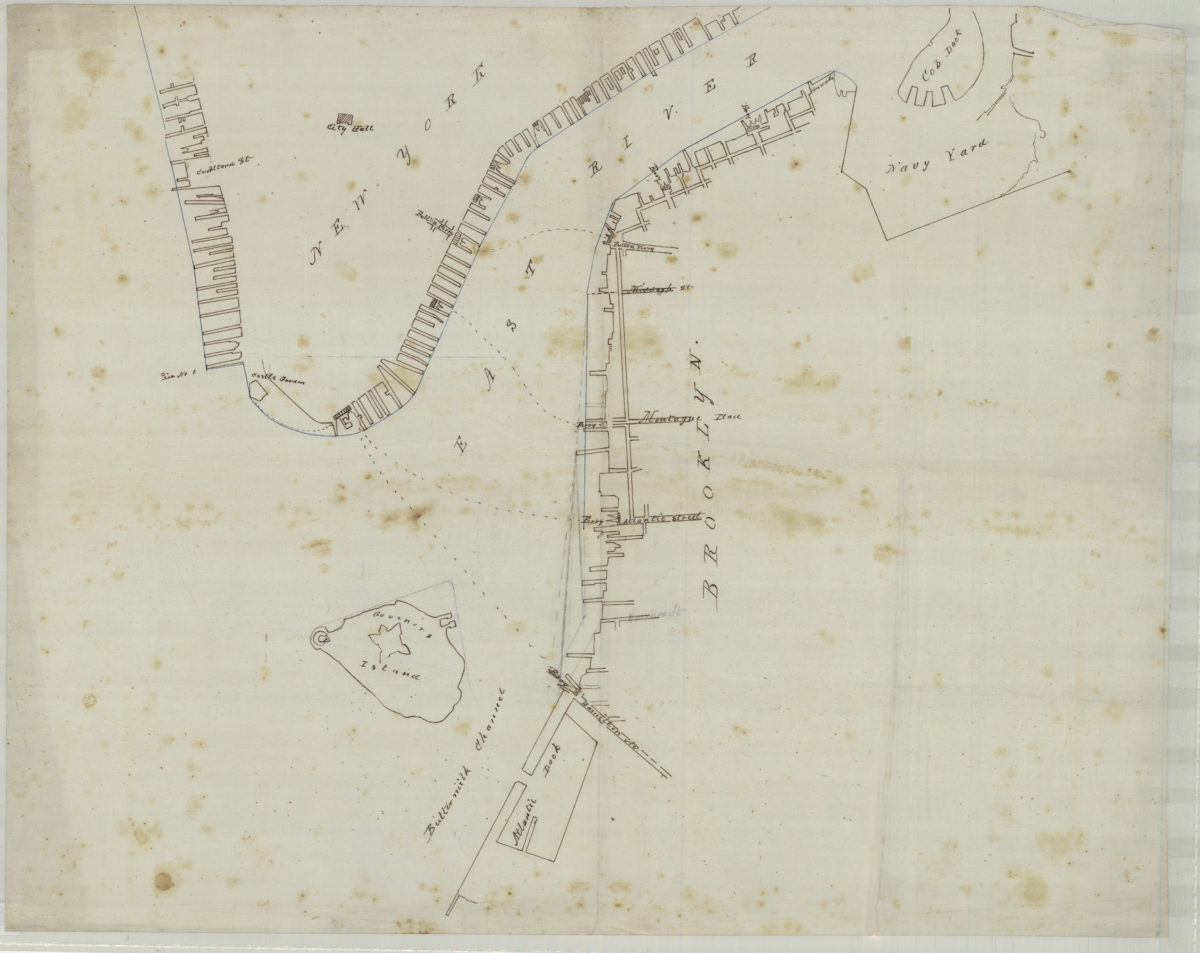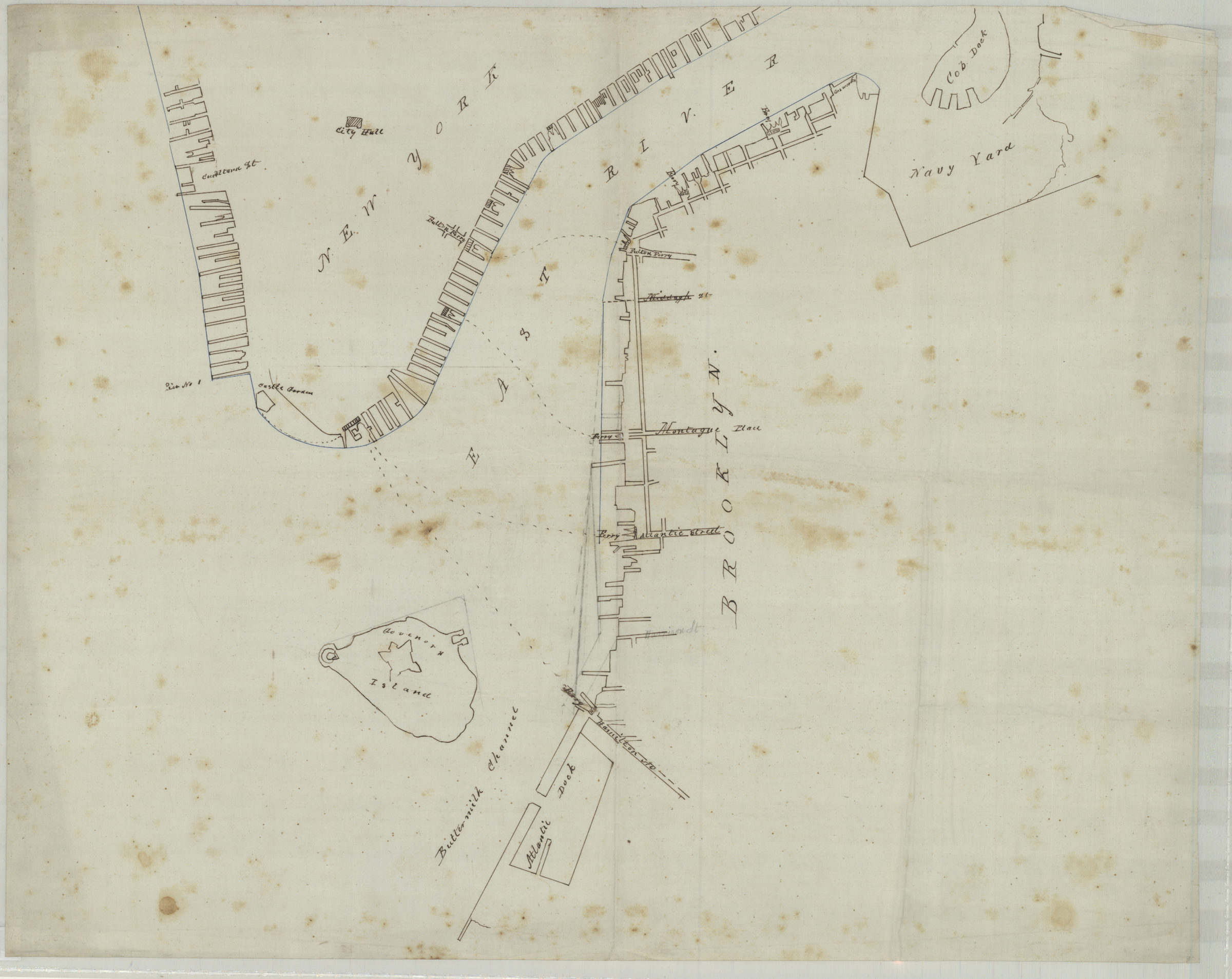
[Map of northwest Brooklyn and Lower Manhattan] [18??]
Map No. NYC-[18--?]c.Fl
Covers the Brooklyn coastline north from Atlantic Basin to the Navy Yard covers Manhattan north from the Battery to City Hall. Shows piers and ferry lines. Title devised by cataloger.
Map area shown
Genre
Manuscript mapsRelation
Full catalog recordSize
45 × 56 cmDownload
Low Resolution Image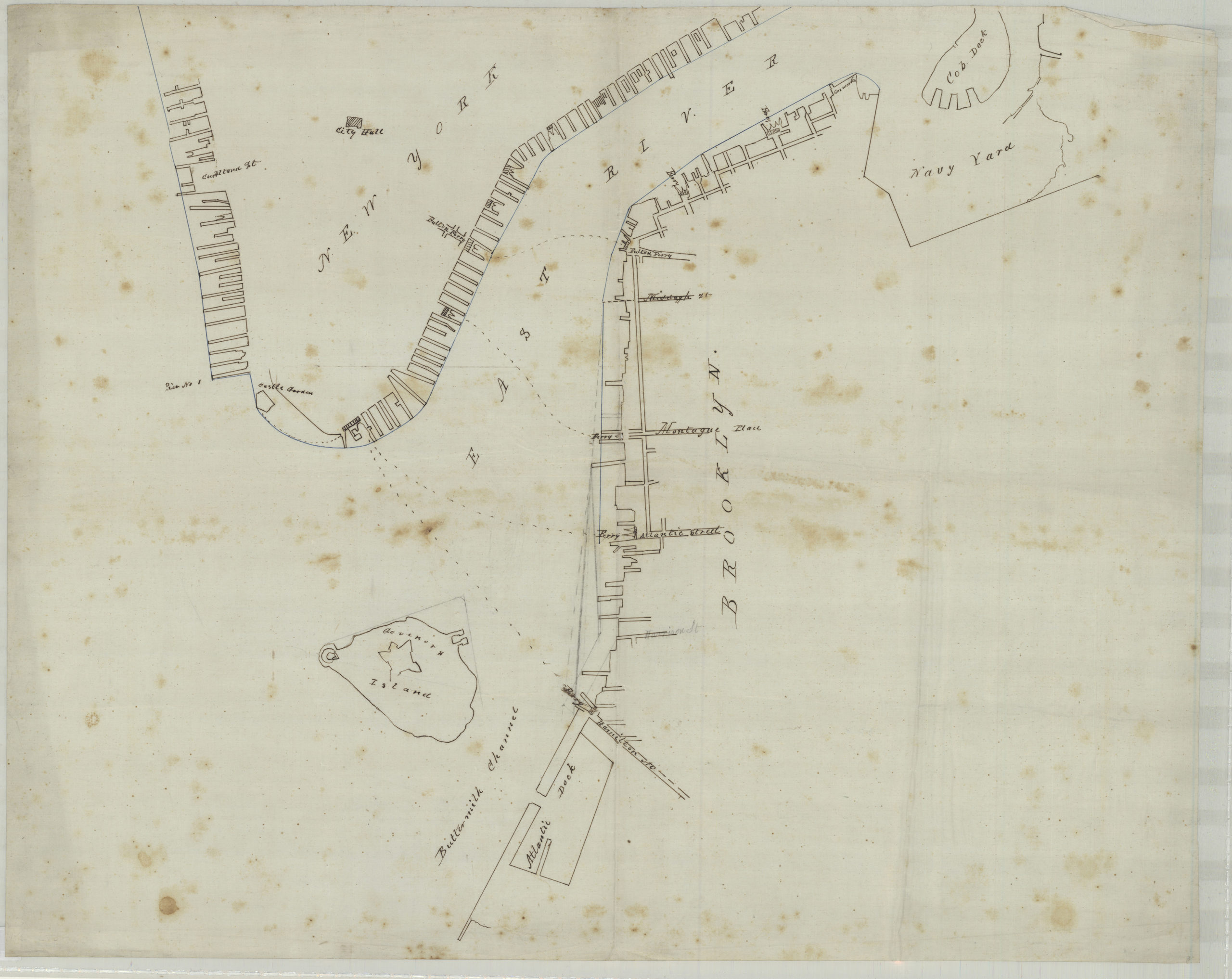
Creator
Publisher
Brooklyn Historical SocietyCitation
[Map of northwest Brooklyn and Lower Manhattan]; [18??], Map Collection, NYC-[18--?]c.Fl; Brooklyn Historical Society.Scale
Scale not givenLoading zoom image...