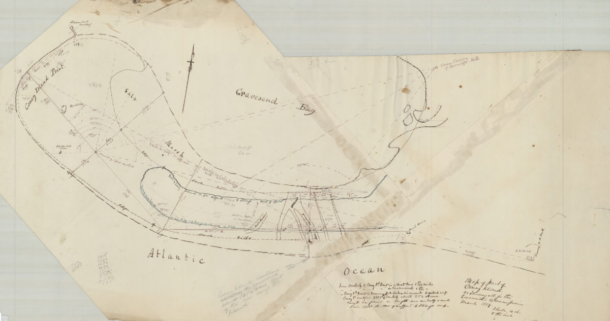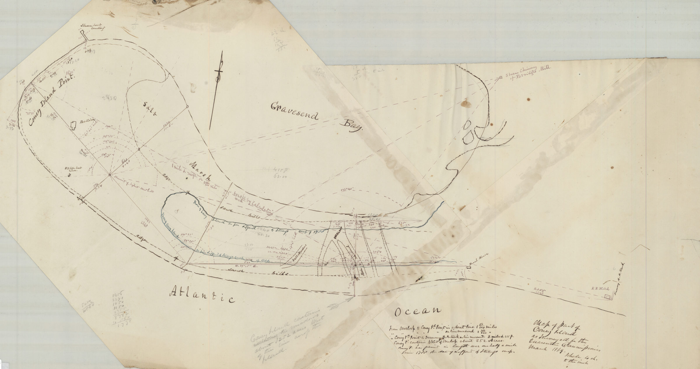
Map of part of Coney Island, as surveyed for the Quarantine Commission March 1869
Map No. Bergen-1869.Fl
Survey map covering modern-day Coney Island and Sea Gate. Shows salt meadows, sand hills, buildings, and Gravesend Bay. Likely attributed to T.G. Bergen, based on handwriting on piece. Irregularly shaped. Includes notes and calculations.
Map area shown
Genre
Manuscript mapsRelation
Full catalog recordSize
38 × 74 cmDownload
Low Resolution Image
Creator
Bergen, Teunis G.; Brooklyn (New York, N.Y.),Publisher
Brooklyn Historical SocietyCitation
Map of part of Coney Island, as surveyed for the Quarantine Commission; March 1869, Map Collection, Bergen-1869.Fl; Brooklyn Historical Society.Scale
Scale [1:4,752] 1 in to 6Loading zoom image...