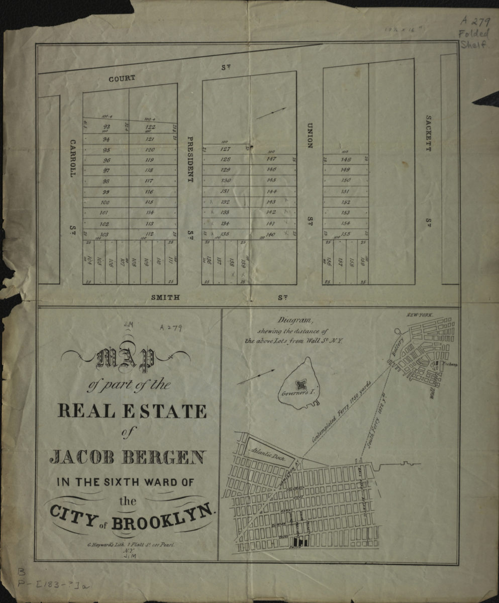
Map of part of the real estate of Jacob Bergen in the Sixth Ward of the city of Brooklyn [183?]
Map No. B P-[183-?]a.Fl
Cadastral map covering area north from Carroll St. to Sackett St. and east from Court St. to Smith St. (modern-day Carroll Gardens). Shows property (including lot numbers and dimensions). Oriented with north to the upper right. Includes “Diagram shewing the distance of the above Lots from Wall St., N.Y.”
Map area shown
Genre
Cadastral mapsRelation
Full catalog recordSize
42 × 35 cmDownload
Low Resolution Image
Creator
Hayward, George,Publisher
Brooklyn Historical SocietyCitation
Map of part of the real estate of Jacob Bergen in the Sixth Ward of the city of Brooklyn; [183?], Map Collection, B P-[183-?]a.Fl; Brooklyn Historical Society.Scale
Scale not givenLoading zoom image...