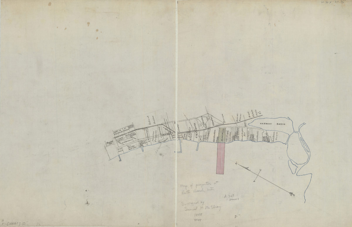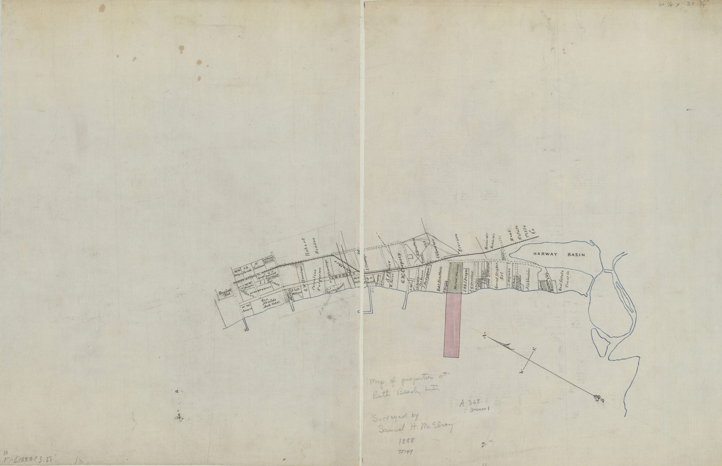
[Map of properties at Bath Beach] [1888]
Map No. B P-[1888?].Fl
Cadastral map showing lots and names of landowners. Title devised by cataloger. Oriented with north to the upper left. Likely attributed to Samuel H. McElroy, based on annotations on piece.
Map area shown
Relation
Full catalog recordSize
52 × 80 cmDownload
Low Resolution Image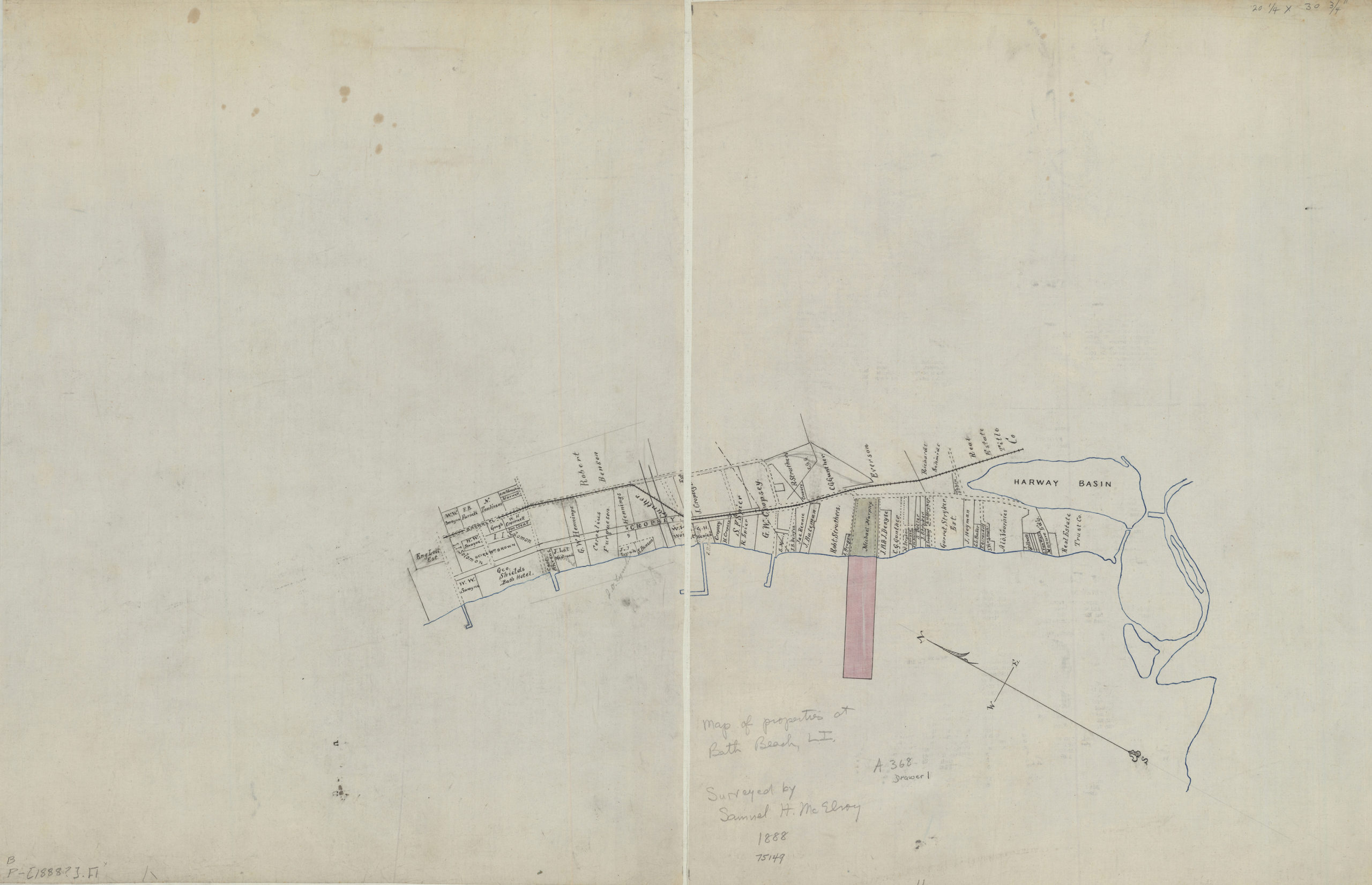
Creator
McElroy, Samuel,Publisher
Brooklyn Historical SocietyCitation
[Map of properties at Bath Beach]; [1888], Map Collection, B P-[1888?].Fl; Brooklyn Historical Society.Scale
Scale not givenLoading zoom image...