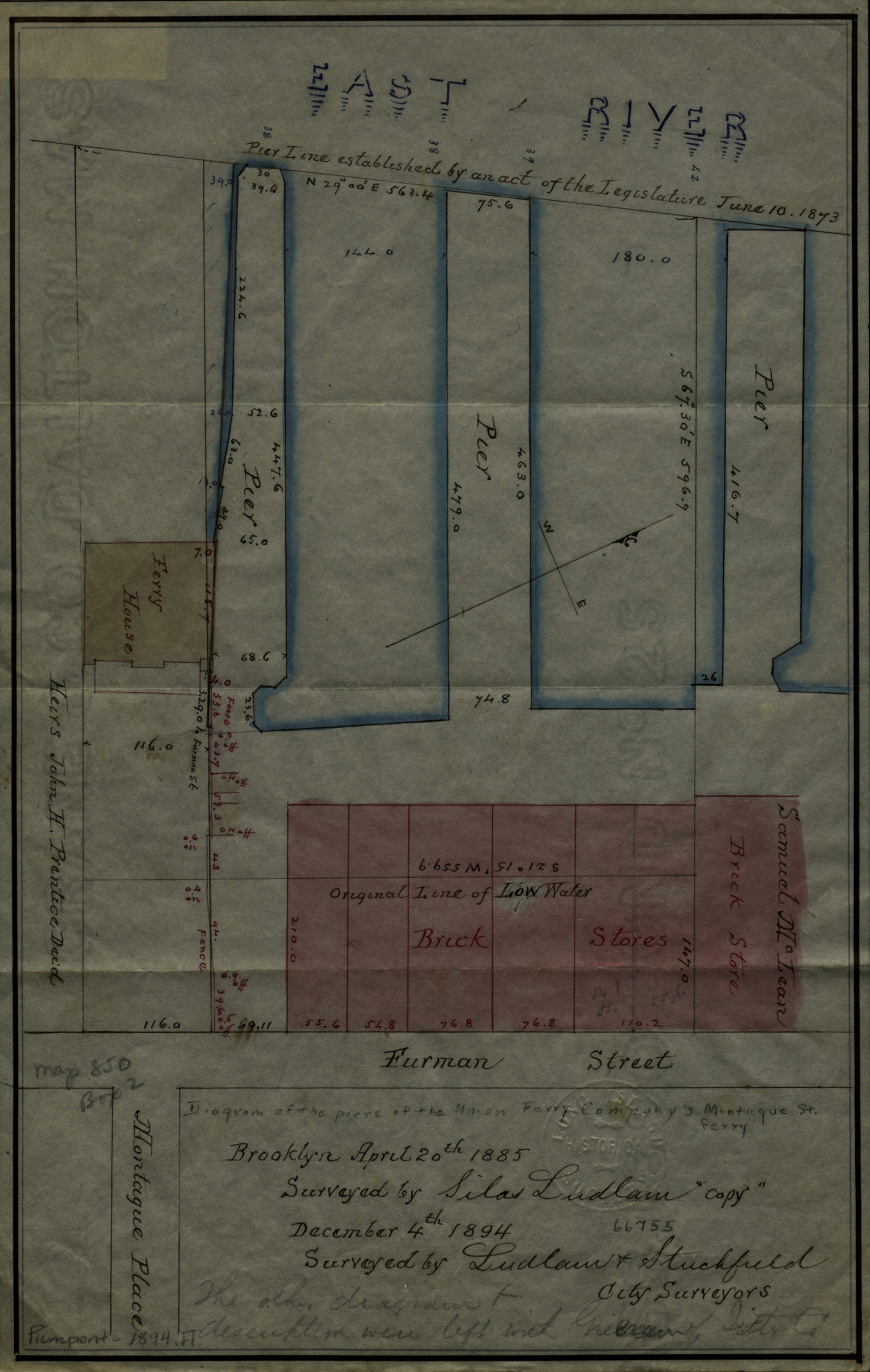
[Map of properties at Montague Pl. and Furman St.]: surveyed by Ludlam & Stuchfield, city surveyors December 4, 1894
Map No. Pierrepont-1894.Fl
Cadastral map covering area in modern-day Brooklyn Heights. Shows property (including lots and dimensions), names of landowners, piers, the Montague Ferry House, low water lines, and pier lines. Title devised by cataloger. Originally surveyed by Silas Ludlam on Apr. 20th, 1885. Oriented with north to the upper right.
Subjects
Places
Map area shown
Relation
Full catalog recordSize
31 × 20 cmDownload
Low Resolution Image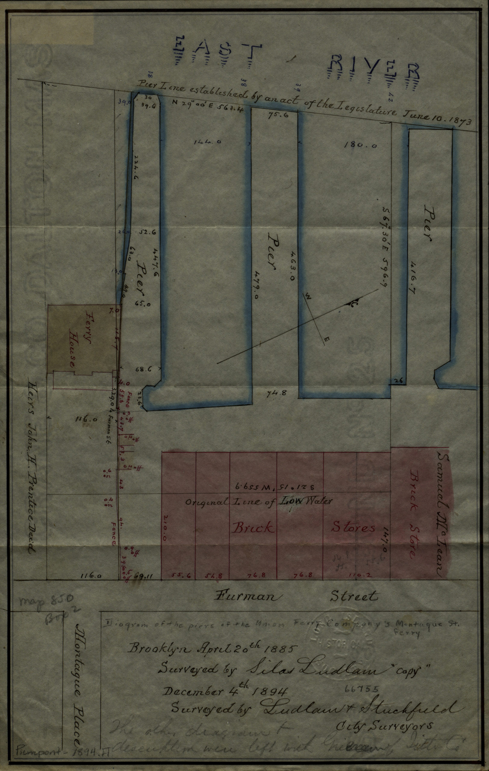
Creator
Ludlam, Silas,Publisher
Brooklyn Historical SocietyCitation
[Map of properties at Montague Pl. and Furman St.]: surveyed by Ludlam & Stuchfield, city surveyors; December 4, 1894, Map Collection, Pierrepont-1894.Fl; Brooklyn Historical Society.Scale
Scale not givenLoading zoom image... 