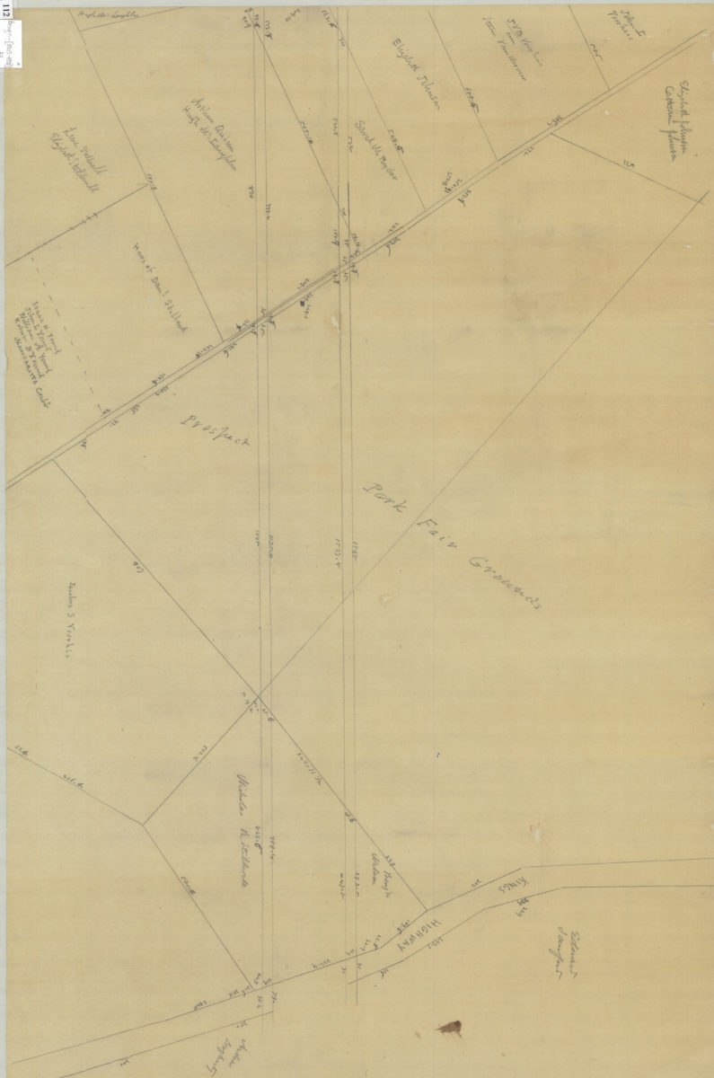
[Map of properties to the south of the Prospect Park Fair Grounds] [1865-1881]
Map No. Bergen-[1865-1881].Fl
Cadastral map showing property and landowners names in modern-day Gravesend. Title devised by cataloger. Attributed to Teunis G. Bergen, based on handwriting on piece. Pencil on tracing paper. Historical note: Prospect Park Fair Grounds, a harness racing track which operated from the late 1860’s to the late 1880’s, was located near Kings Highway and Avenue T in Gravesend.
Map area shown
Relation
Full catalog recordSize
53 × 79 cmDownload
Low Resolution Image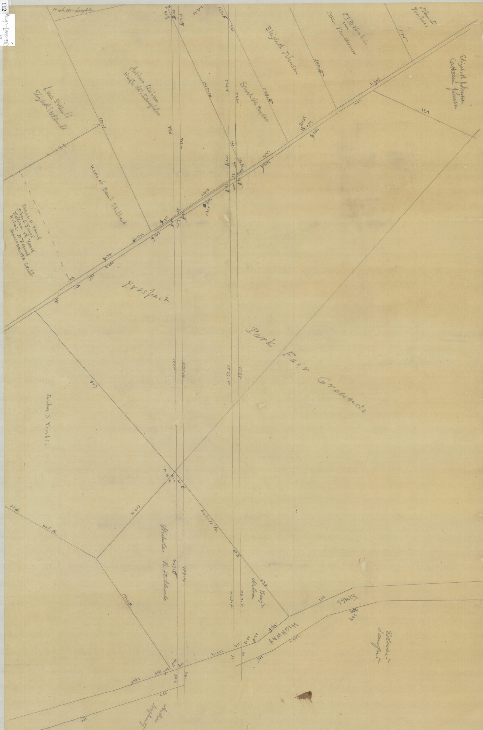
Creator
Bergen, Teunis G.,Publisher
Brooklyn Historical SocietyCitation
[Map of properties to the south of the Prospect Park Fair Grounds]; [1865-1881], Map Collection, Bergen-[1865-1881].Fl; Brooklyn Historical Society.Scale
Scale not givenLoading zoom image...