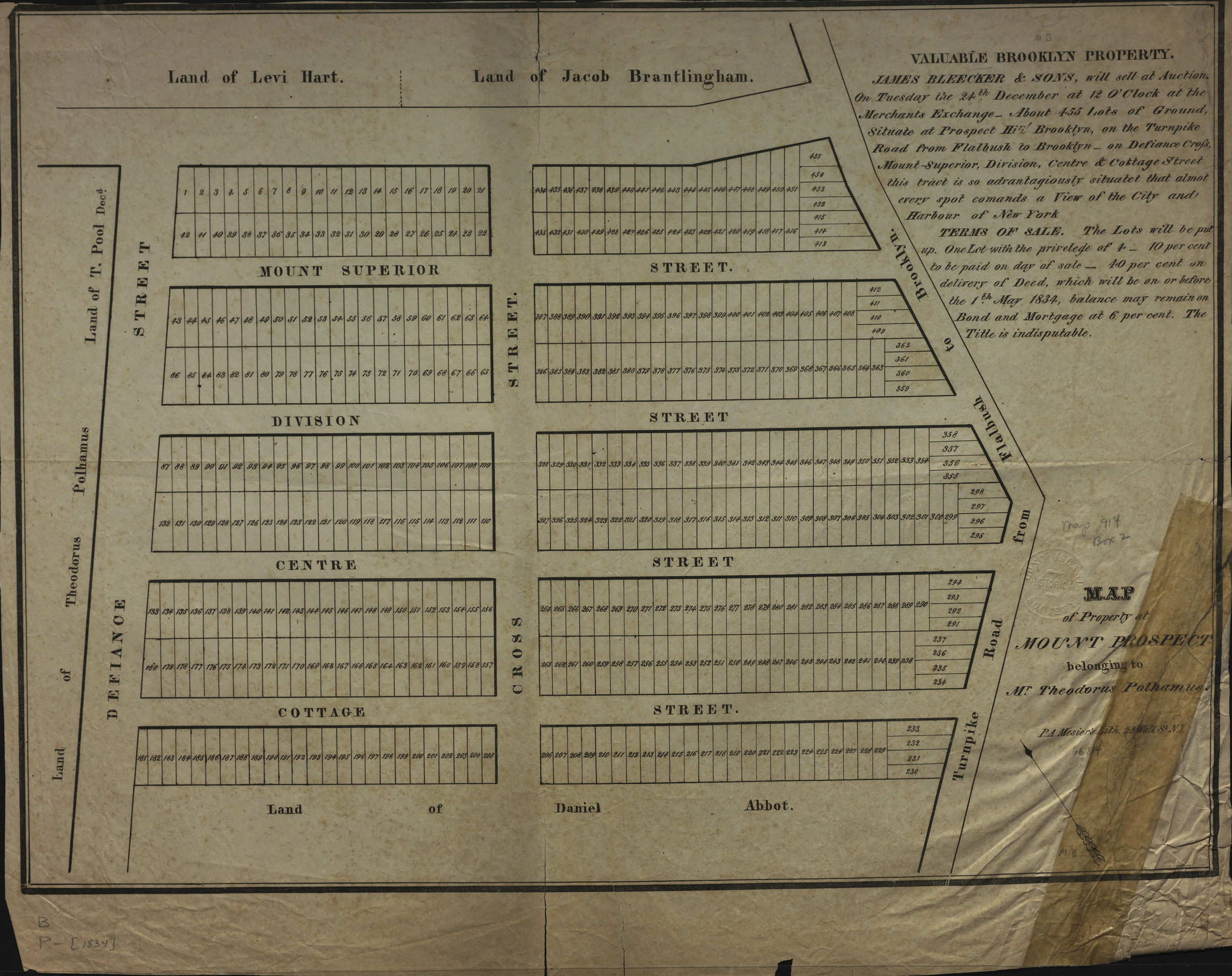
Map of property at Mount Prospect belonging to Mr. Theodorus Polhamus [1834]
Map No. B P-[1834].Fl
Cadastral map covering area north from Cottage St. to Mount Superior St. and east from Defiance St. to the Turnpike Road from Flatbush to Brooklyn (modern-day Prospect Heights). Shows property (including lot numbers) and names of property owners. Oriented with north to the upper left. Includes text.
Map area shown
Genre
Cadastral mapsRelation
Full catalog recordSize
37 × 51 cmDownload
Low Resolution Image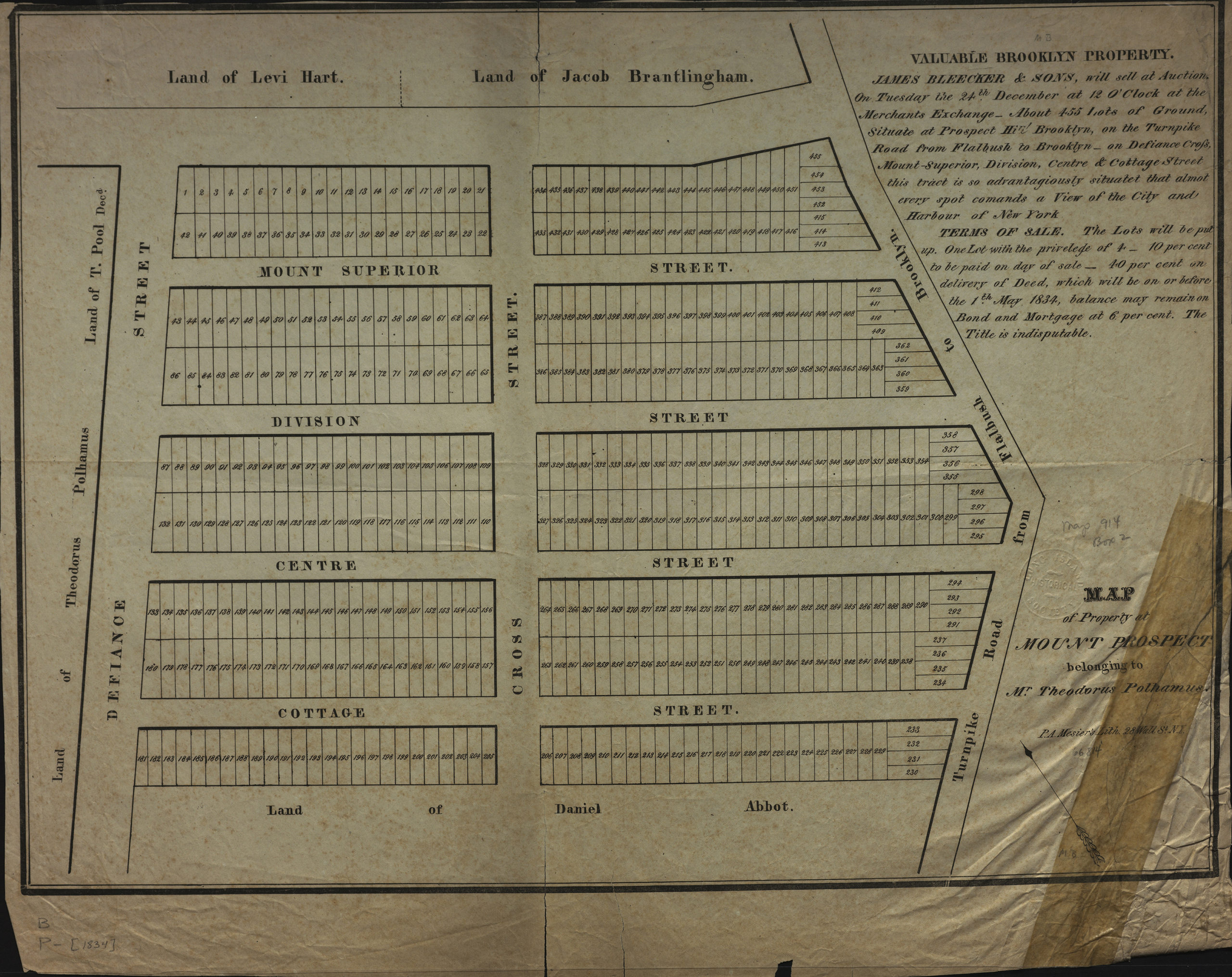
Creator
Mesier, Peter A.,Publisher
Brooklyn Historical SocietyCitation
Map of property at Mount Prospect belonging to Mr. Theodorus Polhamus; [1834], Map Collection, B P-[1834].Fl; Brooklyn Historical Society.Scale
Scale not givenLoading zoom image... 