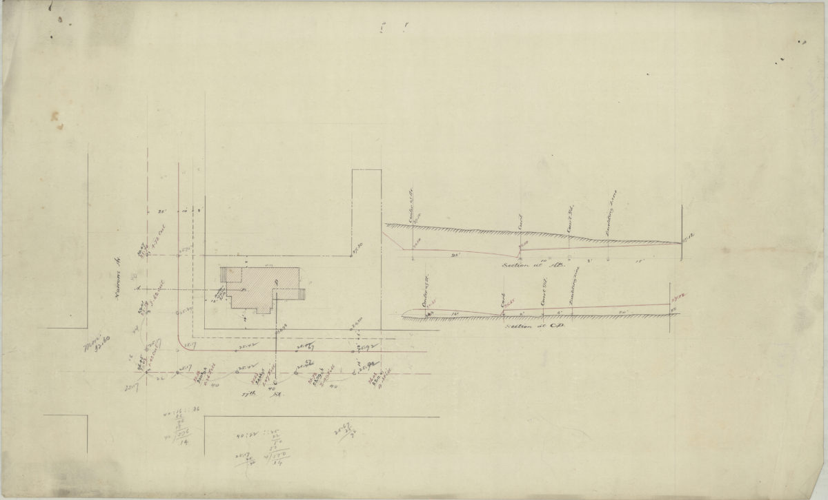
[Map of property at Narrows Ave. and 77th St.]. [1889]
Map No. Bergen-[1889?]a.Fl
Cadastral survey map covering area in modern-day Bay Ridge. Shows buildings and dimensions. Title devised by cataloger. Likely attributed to Van Brunt Bergen, based on handwriting on piece. Date of publication conjectured from watermark. Keyed to index no index present. Watermark: Crane & Co. Dalton Mass. 1889. Bond No. 29.
Map area shown
Relation
Full catalog recordSize
43 × 71 cmDownload
Low Resolution Image
Creator
Bergen, Van Brunt,Publisher
Brooklyn Historical SocietyCitation
[Map of property at Narrows Ave. and 77th St.].; [1889], Map Collection, Bergen-[1889?]a.Fl; Brooklyn Historical Society.Scale
Scale not givenLoading zoom image...