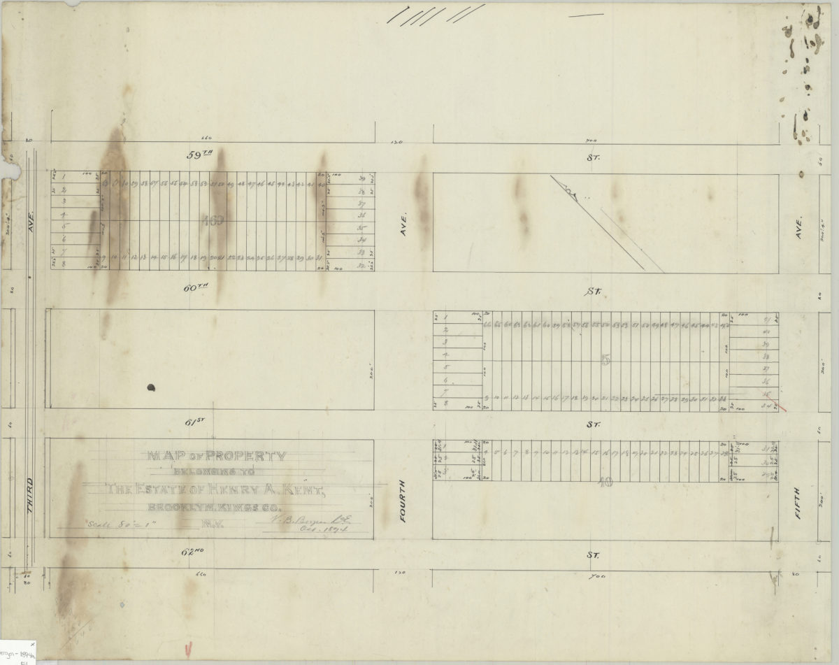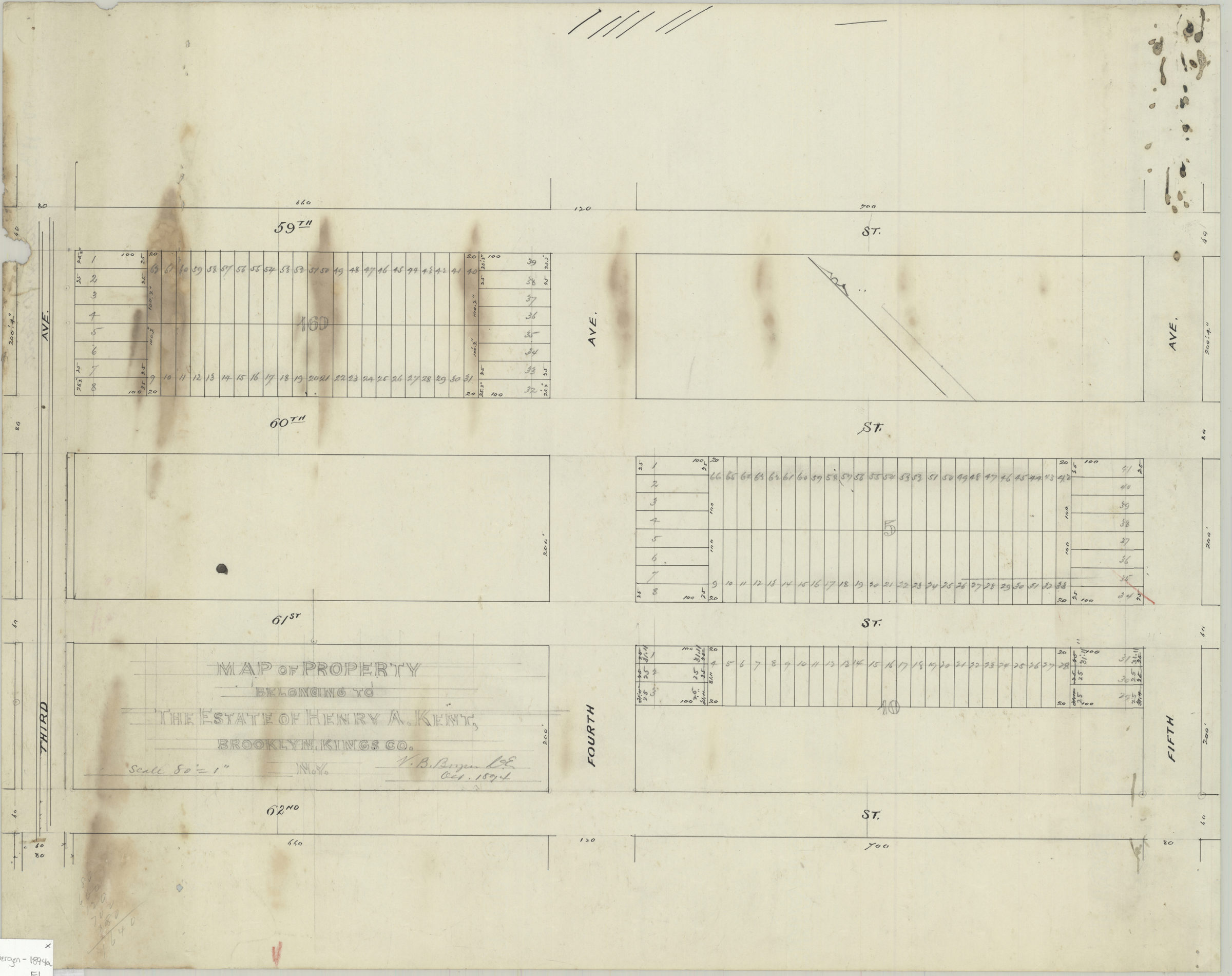
Map of property belonging to Henry A. Kent, Brooklyn, Kings Co., N.Y.: V.B. Bergen, C.E. October 1894
Map No. Bergen-1894a.Fl
Cadastral map covering area bounded by 59th Street, Fifth Avenue, 62nd Street, and Third Avenue in modern-day Sunset Park. Shows streets, property, and lots (including dimensions). Oriented with north to the upper left. Includes calculations. Watermark: Crane & Co., Dalton, Mass., 1892.
Map area shown
Relation
Full catalog recordSize
42 × 53 cmDownload
Low Resolution Image
Creator
Bergen, Van Brunt,Publisher
Brooklyn Historical SocietyCitation
Map of property belonging to Henry A. Kent, Brooklyn, Kings Co., N.Y.: V.B. Bergen, C.E.; October 1894, Map Collection, Bergen-1894a.Fl; Brooklyn Historical Society.Scale
Scale [1:960] 1 in to 80Loading zoom image...