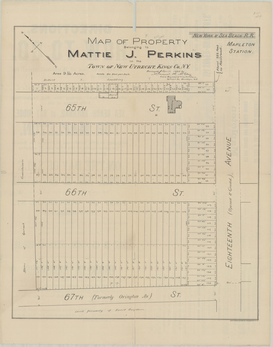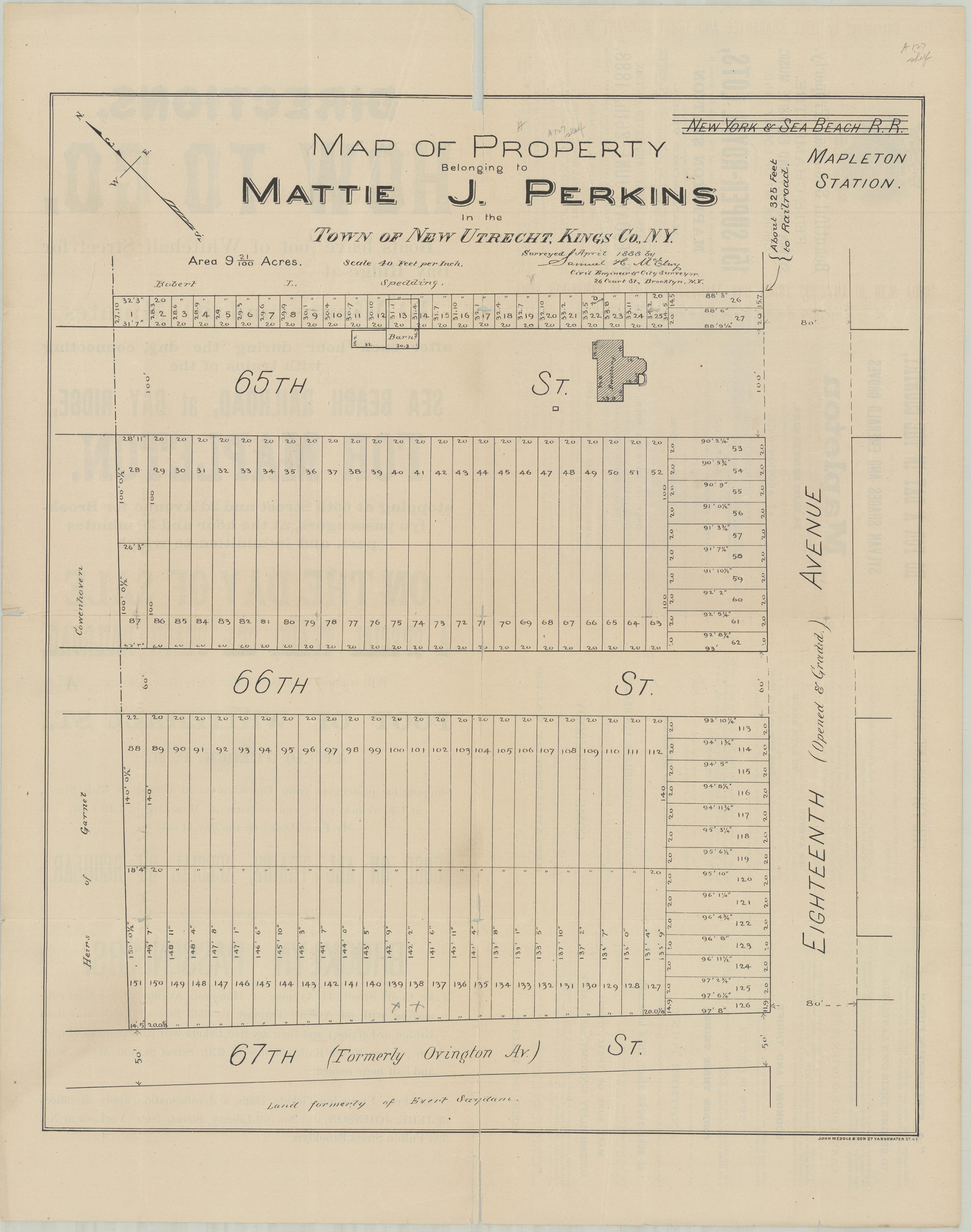
Map of property belonging to Mattie J. Perkins in the town of New Utrecht, Kings Co., N.Y.: surveyed April 1888 by Samuel H. McElroy, city engineer & city surveyor, 26 Court St., Brooklyn, N.Y. [1888]
Map No. B P-[1888].Fl
Cadastral map covering the intersections of 18th Ave. with 65th St., 66th St., and 67th St. (modern-day Dyker Heights). Shows property (including lot numbers and dimensions), the New York & Sea Beach R.R., the Mapleton Station, and distances to the railroad. Oriented with north to the upper left. On verso: Text and ill. BHS has 2 copies.
Map area shown
Genre
Cadastral mapsRelation
Full catalog recordSize
61 × 51 cmDownload
Low Resolution Image
Creator
McElroy, Samuel,Publisher
Brooklyn Historical SocietyCitation
Map of property belonging to Mattie J. Perkins in the town of New Utrecht, Kings Co., N.Y.: surveyed April 1888 by Samuel H. McElroy, city engineer & city surveyor, 26 Court St., Brooklyn, N.Y.; [1888], Map Collection, B P-[1888].Fl; Brooklyn Historical Society.Scale
Scale [1:480] 1 in to 40Loading zoom image...